Satellite communications
To achieve the objective of enabling space-based services, ESA has identified operational areas where satcoms could help.
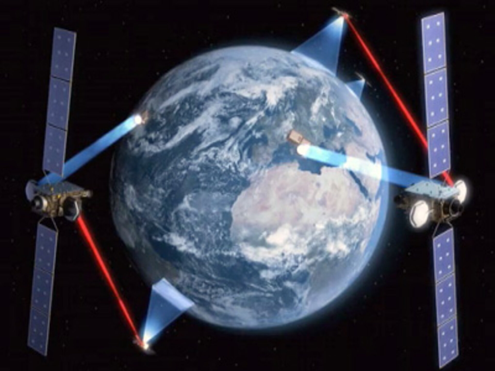
The European Data Relay System (EDRS), being developed under ARTES 7, is an independent, European satellite system designed to reduce time delays in the transmission of large quantities of data. Data relay satellites are placed in geostationary orbit to relay information to and from non-geostationary satellites, spacecraft, other vehicles and fixed Earth stations, which otherwise are not able to be in touch permanently with each other. To add to Europe’s independence, EDRS will fill the gap of a European telecom network that is fast, reliable and seamless. It will make on-demand data available at the right place and at the right time.
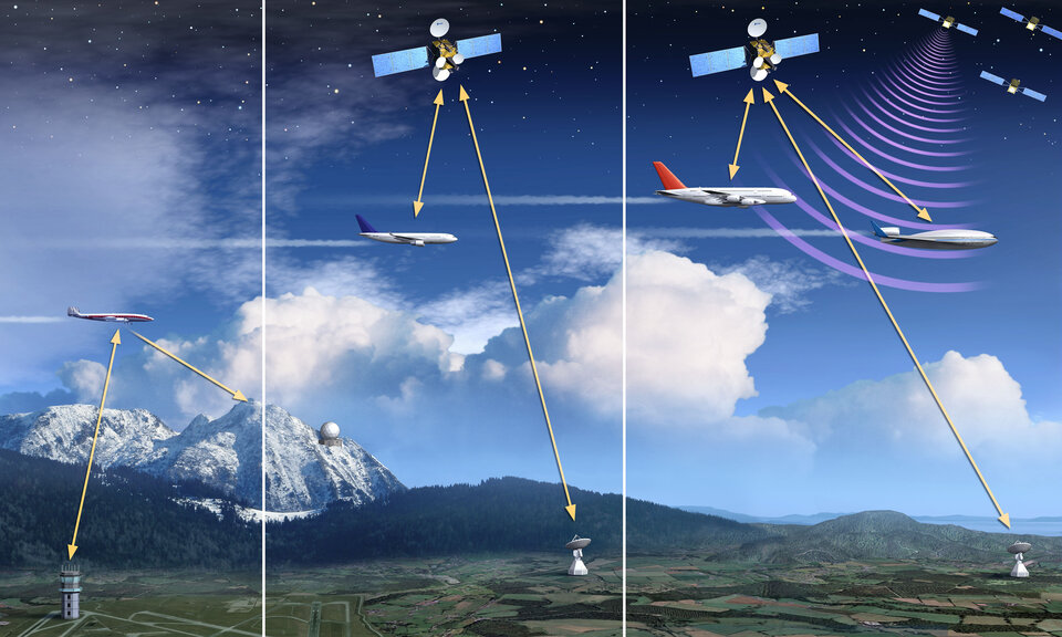
Iris, element 10 of the ARTES programme, aims to develop a new air-ground communication system for air traffic management. It is the satellite-based solution for the Single European Sky ATM Research (SESAR) programme. By 2020 it will contribute to the modernisation of air traffic management by providing digital data links to cockpit crews in continental and oceanic airspace.
Proposal to the Ministerial Council
GlobeNET programme
GlobeNET, proposed as a complement to ARTES element 7, entails the development of a Global Data Relay Network, built to enhance EDRS currently under development, and to serve a wider base of user communities. In order for EDRS to become a genuinely world standard, an extension of its functionality is necessary.
The programme focuses on: the development and launch of additional node(s) to ensure a GEO–GEO link to download from anywhere-to-anywhere on a global scale; system security and additional features to address new user communities; and an enhanced Laser Communication Terminal development and qualification.
GlobeNET will be implemented in partnership with the selected service partner and in synchronisation with the EU’s decisions on GMES funding. As a result, only the definition phase will be initiated at this year’s Council. The development phase will be proposed at the Council at Ministerial Level in 2014.
Iris programme
The Iris (ARTES 10 Phase 2.1) proposal consists of the continuation of the programme approved in 2008. It aims to finalise the system design and development of the technical specifications of the communication standard and achieve their verification in full synchronisation with SESAR and SES (Single European Sky) policy implementation. In addition, the development of precursor services in partnership with the sole European service provider in this domain is proposed with the objective to set up a certified service provider.
The Iris programme will be implemented in synchronisation with the decisions of SESAR and the EC. At this Ministerial Council, it is proposed to develop testbeds with a continuation foreseen at the next Council at Ministerial level. In parallel, it is proposed to introduce a precursor service (Sub-element 1), which aims to be operational in 2017.
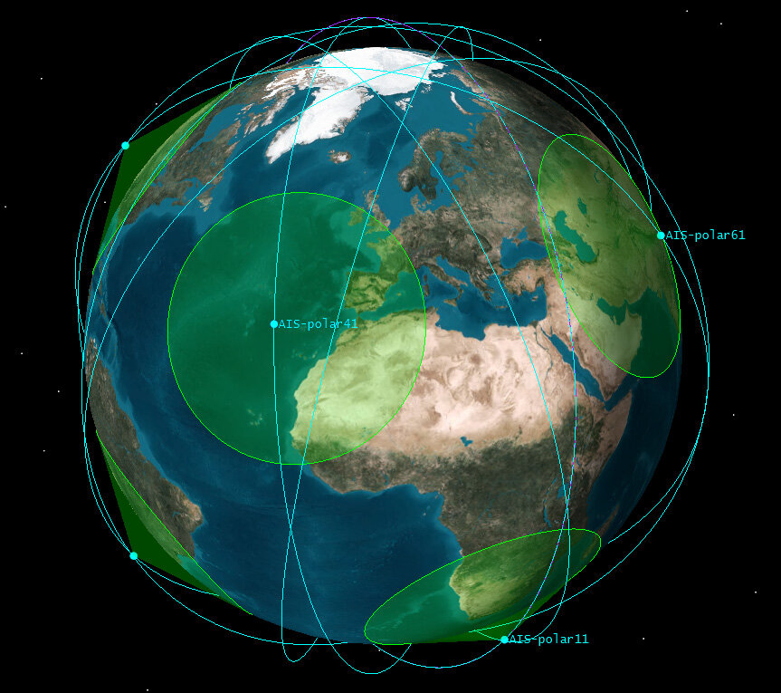
Satellite-Automatic Identification System (SAT-AIS)
The Automatic Identification System (AIS) is a short-range coastal tracking system currently used on ships to provide identification and position information to vessels and shore stations.
The objective of the SAT-AIS (ARTES 21 Continuation) programme is to define in cooperation with the European Maritime Safety Agency (EMSA) a sustainable space-based system that shall be capable of providing AIS data on a global scale, in line with the user requirements, taking into account the existing and planned private initiatives for the benefit of European institutional users.