

Galileo satellites help rescue Vendée Globe yachtsman
A sailor in the Vendée Globe solo round-the-world yacht race faced disaster in the Southern Ocean as raging waves pounded his vessel apart. But he was saved thanks to the search and rescue antennas aboard Europe’s Galileo satellites, part of the international Cospas-Sarsat rescue system.
Skipper Kevin Escoffier later recounted his Monday afternoon ordeal: “You see the images of shipwrecks? It was like that, but worse. In four seconds the boat nosedived, the bow folded at 90 degrees. I put my head down in the cockpit, a wave was coming. I had time to send one text before the wave fried the electronics. It was completely crazy. It folded the boat in two.”
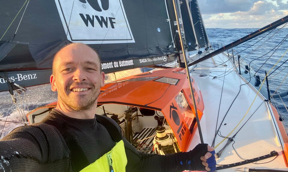
In a few minutes he had taken to his life raft: “I would have liked to stay a little longer on board but I could see that everything was going very quickly and then I took a break and went into the water with the raft. At that time, I was not at all reassured… You are in a raft with 35 knots of wind. No, it is not reassuring.”
For the next 11 hours Kevin Escoffier was adrift in fierce winds and surging waves. But he was not entirely alone. Once his raft hit the water it automatically activated its rescue beacon, transmitting a 406 MHz SOS signal for automatic pickup by participating satellites, courtesy of the Cospas-Sarsat satellite-based emergency detecting and locating system.

The only system that can independently locate a beacon anywhere on Earth’s surface, Cospas-Sarsat has helped save thousands of people since it was first established in 1982. Originally the system operated through transponders hosted aboard either low-Earth orbit or geostationary satellites. In the last decade Galileo joined Cospas-Sarsat – supported by the European Commission, the system’s owner – driving a significant increase in performance.
Because they have such a high orbital altitude, at 23 222 km up, while still moving steadily through the sky, Galileo satellites combine broad views of Earth with the ability to facilitate quick determination of the position of a distress signal through a combination of delay and Doppler ranging.
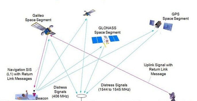
At 13:48:51 UTC on Monday the Cospas-Sarsat system’s French Mission Control Centre (FMCC) based in Toulouse and operated by French space agency CNES received the first alert via the search and rescue transponders of a trio of Galileo satellites, picked up the Search and Rescue (SAR)/Galileo Medium Earth Orbit Local User Terminal (MEOLUT) in Cyprus. This is one of three MEOLUTS, put in place as part of Europe’s Galileo programme and European contribution to the Cospas-Sarsat system.
The next step was to localise the signal’s origin, which was achieved under two minutes later at 13:51.07 UTC, pinning down its source within the South African Mission Control Centre Service Area (ASMCC), which extends from southern Africa down to the Antarctic coast – to a location around 1000 km south of Cape of Good Hope.

The alert was immediately forwarded on to the Australian Mission Control Centre (AUMCC) in Canberra, Australia, whose data distribution region includes South Africa.
At the same time, the alert was also forwarded to France’s CROSS Gris-Nez centre – a national point of contact for Cospas-Sarsat incidents – which immediately notified Vendée Globe Race Direction in Les Sables d’Olonne. The team were able to call on rival racer Jean Le Cam, the competitor closest to the stricken sailor, to look for him.
As Race Director Jacques Caraës explained: “When we saw that the EPIRB (Emergency Position Indicating Radio Beacon) position was lining up with the drift prediction track we sent Jean to that point.”
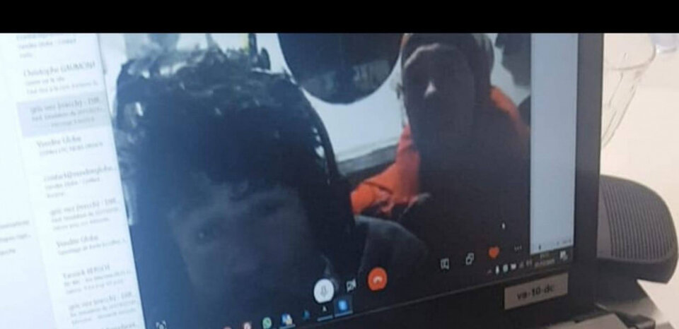
After repeated attempts, Le Cam was finally able to take Escoffier safely aboard at 0118hrs UTC on Tuesday morning. In the meantime the race organisers used the beacon signals as the basis of a wider search effort, calling in other skippers to help. Further signals were received at the FMCC in Toulouse from 14:10:34 UTC on Monday afternoon and on a regular basis after that, serving to track the gradually drifting signal source.
European satellite navigation
Galileo is Europe's global navigation satellite system. It provides accurate and reliable positioning and timing information for autonomous and connected cars, railways, aviation and other sectors. Galileo has been operational since December 2016, when it started offering initial services to public authorities, businesses and citizens.
With 26 satellites in orbit and their supporting ground infrastructure, Galileo is currently offering three Initial Services after an extensive testing period. Its search and rescue service contributes to the international distress beacon locating organisation Cospsas-Sarsat. Galileo's data helps to locate beacons and rescue people in distress in every kind of environment.
ESA acts as the system architect for Galileo and EGNOS infrastructure. It manages its design, development, procurement, deployment and validation on the EU’s behalf. ESA will maintain this role throughout the life of the systems, also providing technical support to the European GNSS Agency (GSA), which was designated by the Commission to exploit the system and provide Galileo and EGNOS services.
Established in 2004, GSA is responsible for managing a range of activities relating to Galileo and EGNOS. This includes preparing for the successful commercialisation and exploitation of the two systems; supporting the utilisation and marketing of GNSS activities; and ensuring the security of the systems, notably through the establishment and operation of the Galileo Security Monitoring Centres.
Both entities are working in close cooperation with the European Commission, the programme owner.