How does Galileo help other space missions?
In 2023 satnav receivers are everywhere: in our phones, our cars, and drones, in fixed infrastructure, aboard boats, trains and aircraft. They are also in space: more than 95% of all the satellites in low-Earth orbit carry satnav receivers to calculate their position. The additional signals from Europe’s Galileo satellites are providing a big boost to the coverage, availability, redundancy, and accuracy of spaceborne receivers, in turn enlarging the possible scope of future missions, and extending the useful range of satnav much further out into space – to the Moon and beyond.

Galileo boosting satellite positioning precision
The first generation of spaceborne satnav receivers typically made use only of the American GPS system, and sometimes the Russian Glonass. But today the high-quality signals from Europe’s Galileo are increasingly employed alongside GPS, sharpening orbital positioning levels considerably.
“For the vast majority of satellites in low-Earth orbit, their positioning requirements are relaxed, in the order of tens of metres, achieved in real time on-board the satellite with a standard Global Navigation Satellite System, GNSS, receiver,” explains Werner Enderle, heading ESA’s Navigation Support Office at ESA’s Mission Control Centre ESOC in Darmstadt, Germany, tasked with providing independent precise orbit determination for European space missions.
Then there are the satellites with much tighter requirements, such as Earth observation radar missions, where more precise knowledge of the satellite’s position in space enhances the accuracy of the results, because then you can derive the exact distance between the satellite and the ground. There are also upcoming constellation, formation flying, and orbital rendezvous missions planned where accurate knowledge of relative positions will be crucial.
“What we can say, based on the Precise Orbit Determination we are routinely achieving down to a scale of a few centimetres, is that POD accuracy is no longer the limiting factor that it once was in space missions.”
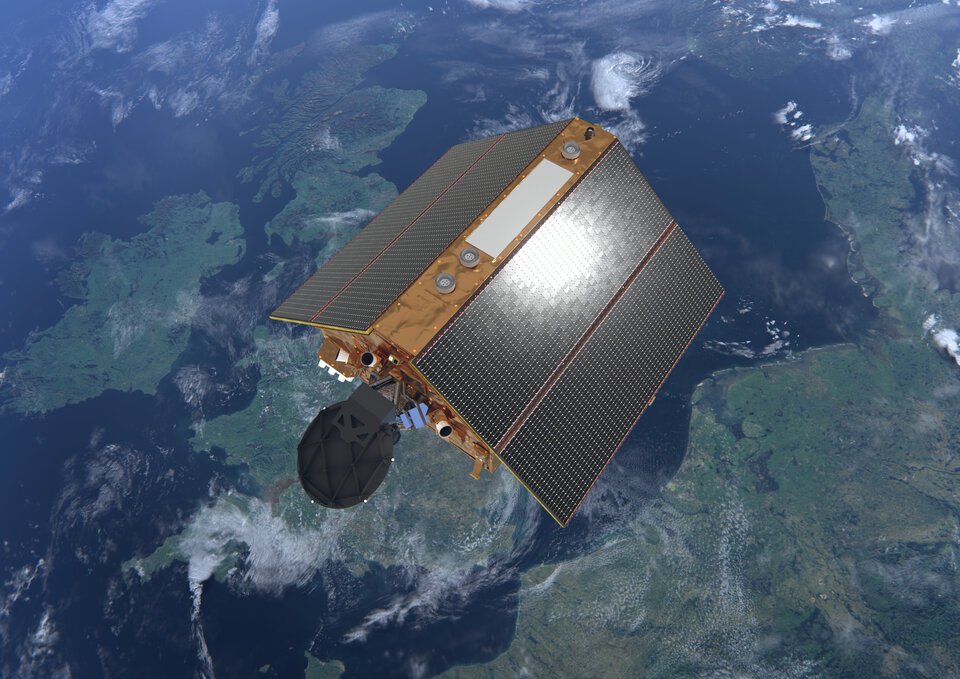
For instance, Copernicus Sentinel-6 measures sea-surface height by bouncing radar pulses down and back, deriving the distance to the ocean surface to 1-2 cm. But to attain the necessary level of accuracy, the satellite’s position in space must be known as precisely as possible.
Accordingly, Copernicus Sentinel-6 was one of the first missions to fly a new joint Galileo-GPS capable receiver, with high-quality Galileo dual frequency signals improving its overall positioning capability.
“The results were excellent, based on the final positioning processing we perform here down on the ground. What we’re finding is that there’s a big advantage to combining Galileo and GPS, especially the two frequency bands E1 and L5a, coupled with the obvious fact of much better coverage and availability – meaning there are twice as many satellites to acquire signals from. So, there are more spaceborne receivers on the way, designed to benefit from Galileo’s really outstanding performance.”
The Navigation Support Office has been bringing this proven advantage to the attention of ESA mission teams. For instance, Proba-3 is an ambitious precision formation flying mission due to be launched in 2024, involving two satellites which will manoeuvre at a fixed distance of 140 m from each other so that one can blank out the Sun for the other, allowing sustained study of our parent star’s fiery outer atmosphere, or corona. This will require millimetre scale positioning precision – as if the pair were a single rigid spacecraft.

The mission will use a variety of positioning methods, including optical, radio and laser links, but GNSS will be an important element. Werner adds: “So in this case we advised the Proba-3 team to switch to a GPS/Galileo-capable receiver, because that will give us completely new positioning and POD possibilities.
“What we can say, based on the Precise Orbit Determination we are routinely achieving down to a scale of a few centimetres, is that POD accuracy is no longer the limiting factor that it once was in space missions.”
Extending into higher orbital regimes
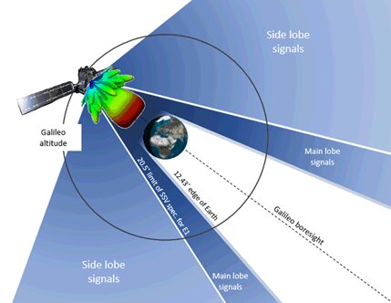
The other argument for adopting Galileo signals is that of coverage. As missions make use of higher orbital regimes, then the maximum possible signals will be necessary. Above the orbits of the GPS and Galileo constellations themselves, planet Earth can block the bulk of the signals – which are, after all, focused onto Earth.
Instead, higher-orbit missions need to make use of side lobe signals, spillovers from the main signal like sidelight from a flashlight beam, which requires added processing, as does the progressive weakening of these signals with distance, which will eventually become barely distinguishable from noise.
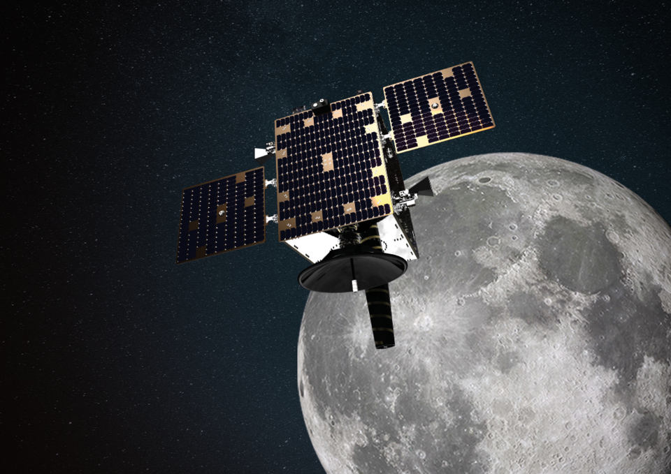
Geostationary satellites are already making use of such high-altitude GNSS signals. A more ambitious test comes next year, with the launch of the ESA-supported Lunar Pathfinder into lunar orbit, intended as a communication satellite for future Moon missions. The spacecraft will incorporate a specially designed GPS/Galileo-capable receiver to demonstrate for the first time ever the feasibility of positioning fixes from 400 000 km away, complemented with a NASA-developed laser retroreflector employed to cross-check performance.
“Then as a next step will come ESA’s Moonlight satellites in lunar orbit, delivering a dedicated lunar infrastructure for providing telecommunications and navigation services for Moon missions,” explains Werner. “The Navigation Support Office is involved with defining the necessary lunar reference frame and the associated timescale that will be needed to realise this vision.”

Navigation Support Office: into its second decade
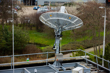
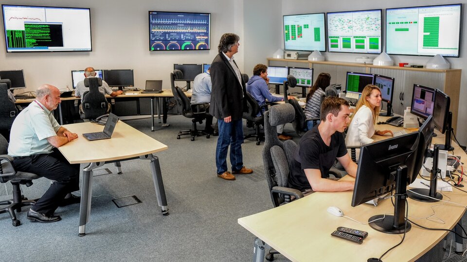
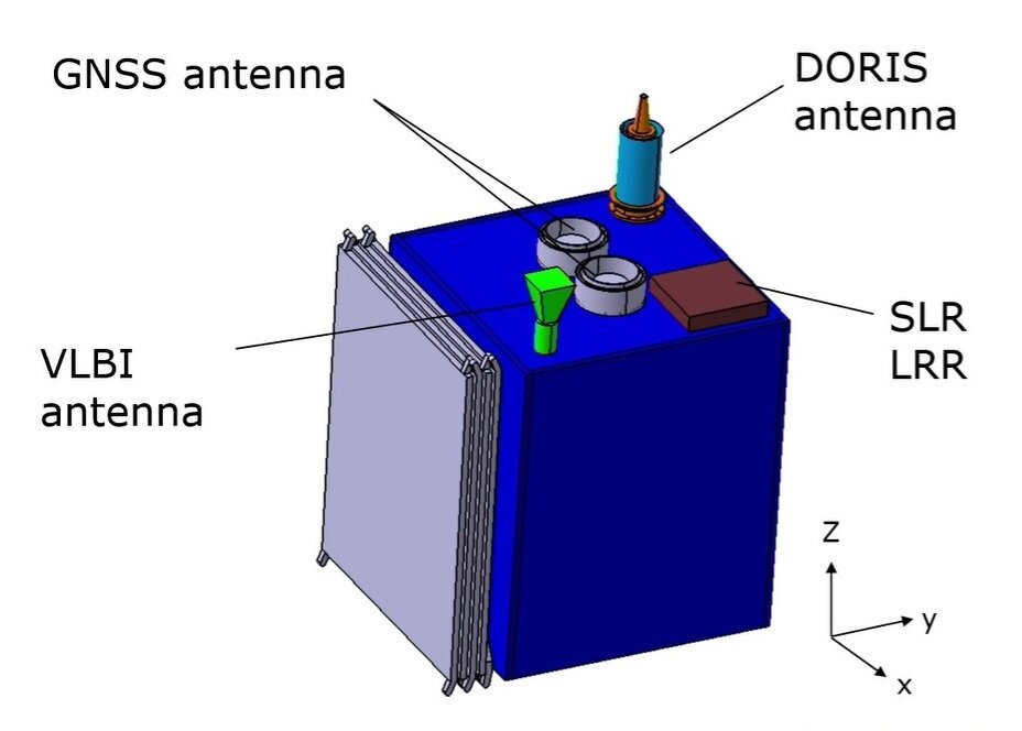
The Navigation Support Office has been operating since 2006, spun off from ESOC’s Flight Dynamics division. The foundation of its POD services are the GNSS constellations around Earth, not only Galileo but GPS, Glonass, Beidou and the Indian and Japanese satellites. To derive the positions of European missions, the positions and the clock rates of the satnav satellites used to measure them must first be determined to a high degree of accuracy, down to a few centimetres on an ongoing basis, with observations, obtained every second via a dedicated worldwide real time network of sensor stations – the Office oversees the ESA GNSS Observation Network.
Among its other activities, the Office represents ESA in international GNSS, scientific and geodetic-related forums, and maintains the ‘Galileo geodetic reference frame’ – the reference system for the three-dimensional Earth, essential for accurate positioning, navigation, and timing, as well as contributing to the International Terrestrial Reference Frame – the globally agreed equivalent system.
The next challenge
If today’s POD performance is good, Werner adds that it is going to get even better: “Our next challenge is coming in the shape of the new FutureNAV mission GENESIS. GENESIS aims to generate an updated International Terrestrial Reference Frame with an order of magnitude improvement in accuracy. Accurate sub-centimetre POD and clock measurements will be essential to make this happen, while our colleagues from ESA’s Navigation Science Office will be archiving and distributing the data from this groundbreaking mission.”
About Galileo
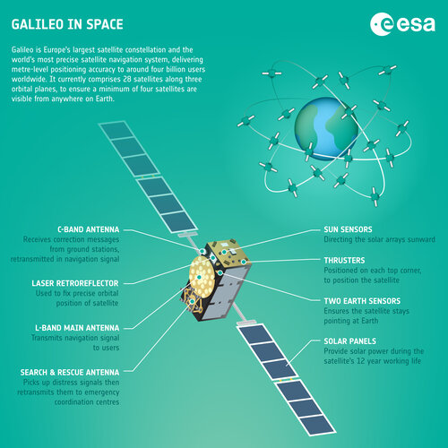
Galileo is currently the world’s most precise satellite navigation system, now serving more than four billion users around the globe. All smartphones sold in the European Single Market are now guaranteed Galileo-enabled. In addition, Galileo is making a difference across the fields of rail and maritime transportation, agriculture, financial timing services and rescue operations.
Galileo is a flagship programmes of the EU Space Programme, managed and funded by the European Union. Since its inception, ESA has been leading the design and development of the space and ground systems, as well as procuring launches. EUSPA (the EU Agency for the Space Programme) acts as the service provider of Galileo, overseeing the market and application needs and closing the loop with users.
For more info about Galileo: https://www.usegalileo.eu