Tracking valuable and dangerous goods in transit
A new technique for monitoring goods in transit is being demonstrated in Rome on 23 May. The system called EGNOS TRAN enables enhanced satellite positioning data to be received on handheld devices.
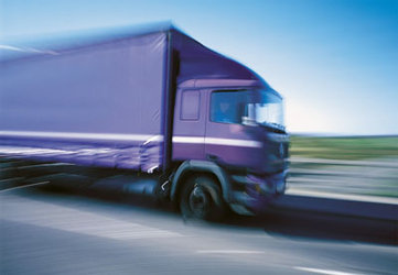
Fleet owners, transport customers and local authorities can use the system to accurately track and continuously monitor the movement of dangerous or valuable goods in real time. Direct communication between transport vehicles and the fleet management service centre means that custom-tailored alarms and notifications are launched in the case of deviation from scheduled routes or anomalous events.
The EGNOS TRAN (European Geostationary Navigation Overlay Service - Terrestrial Regional Augmentation Networks) technique is funded by ESA and has been developed in cooperation with Telespazio. It works by allowing users direct access to EGNOS signals that contain information on the reliability and accuracy of the positioning signals sent out by GPS and GLONASS.
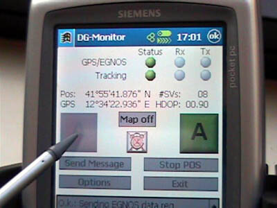
The low elevation of EGNOS satellites means their signal cannot be received in certain conditions such as urban areas, difficult terrain and northern altitudes. A terrestrial link to the satellite signal is therefore achieved through the use of a GPRS (General Packet Radio Service) wireless connection to broadcast the EGNOS message. The terrestrial data link overcomes the need for a direct line-of-sight connection between the transmitter and receiver sometimes hampered by topographic elements.
In addition to the safe transport sector, EGNOS TRAN is also used in personal safety, GIS (Geographical Information Systems) applications and air traffic control. The technique used for civil aviation safety was demonstrated last month at Kiruna airport in Sweden.
The event on 23 May is set to take place in the urban environment of Rome. The live demonstration will show users the benefits of the integration of EGNOS and GPRS for dangerous goods monitoring applications such as geofencing and route deviation alarms in a scenario involving transport vehicles and a fleet management service centre.
Anyone from the transport industry wishing to participate at this event should contact ESA.