

Guiding fishing fleets
The size and number of fish landed from traditional European fisheries has undergone a dramatic decline in the last quarter of a century, even as demand for fishing products continues to rise.
Ensuring sustainability
To ensure the sustainability of fisheries and aquaculture in the waters around our continent, the Common Fisheries Policy for Europe has put tough quotas on traditionally fished species. In their place, the fishing industry is being encouraged to harvest less exploited and more abundant species and move further offshore.
Hard-earned knowledge of fishing grounds and experience at sea becomes less relevant with this push into more distant waters. In a highly competitive industry, fishing captains need all the help they can get to locate fish quickly and economically while remaining within the protective limits and regulations.
Wide-area information gathering
Satellite instruments can simultaneously gather information across a wide area on important variables such as sea temperature, ocean colour and currents and wind and wave conditions. With the correct scientific interpretation the combination of these variables can highlight areas most likely to prove richest in fish.
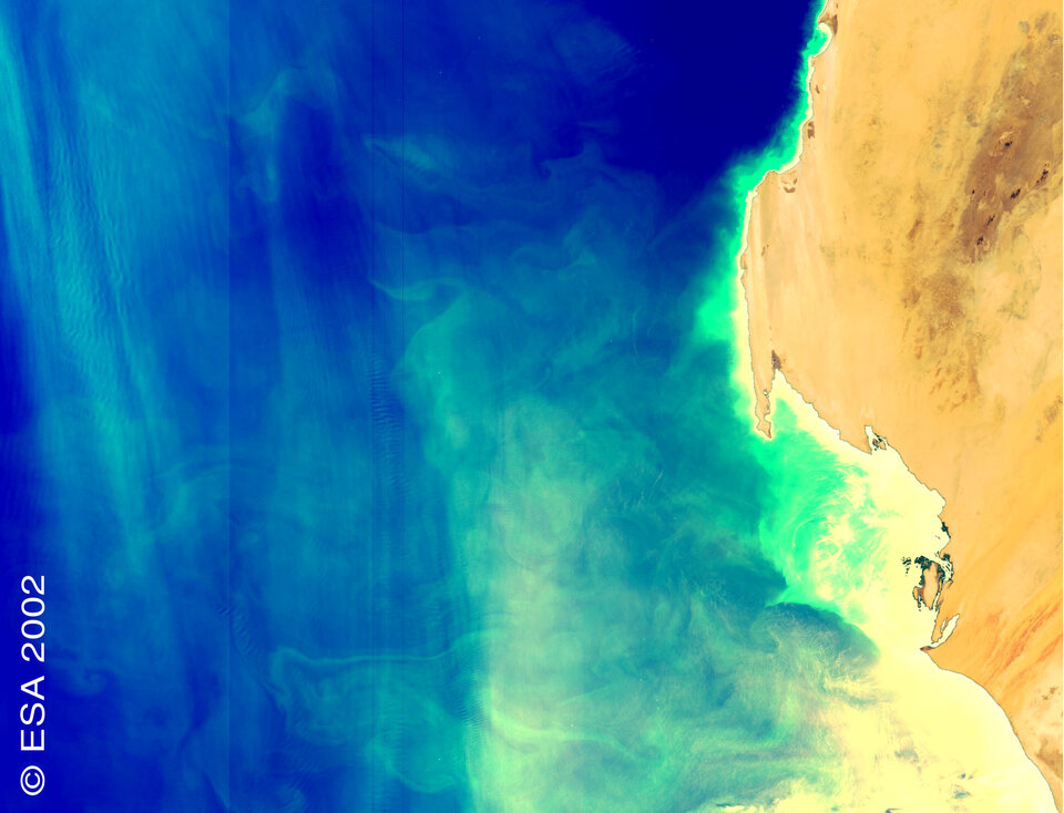
Sea surface temperature maps can identify the location of warm and cold fronts marking the boundaries of water masses of different temperatures. Upwelling zones - typically found at ocean fronts where cold nutrient rich water reaches the surface - often cause the rapid growth of algae, known as phytoplankton blooms.
This bloom is the first stage of the marine food chain sustaining a population of feeding fish. Phytoplankton blooms produce chlorophyll that can be directly detected from space using ocean colour sensors such as the Medium Resolution Imaging Spectrometer (MERIS) on Envisat.
Tracking currents
And by charting variations in ocean height, orbital altimeter-derived data can identify ocean currents and eddies: smaller fish species tend to move with currents and wind drift, creating a high level of biological activity within a localised area.
Earth observation-based information products from services currently operational can be transmitted directly via satellite to vessels while at sea, so their captains have the information at hand to more effectively plan their operations at sea.
Protecting fisheries
Wide-area Earth observation also has the potential to detect unauthorized marine incursions into exclusive economic zones, helping to deter unregulated and illegal fishing from taking place. Ships are corner reflectors for radar signals, showing up as tell-tale bright points in the background grey of a marine radar image.

