Copernicus Masters wants your ideas
Submit your ideas to this year’s competition on how Earth observation data can benefit business and society. Entries will be accepted in all nine categories starting tomorrow.
The Copernicus Masters – previously known as the GMES Masters – rewards the best ideas for services, business cases and applications based on satellite Earth observation data. With a prize pool of € 350 000 in cash prizes, technical support, data packages and business incubation, it aims to foster product development and entrepreneurship in Europe.
Started in 2011 by ESA, the Bavarian Ministry of Economic Affairs, the DLR German Aerospace Center, Anwendungszentrum Oberpfaffenhofen and T-Systems GmbH, the competition is supported by the European Commission, European Space Imaging GmbH, Astrium GEO-Information Services, BMW Group and GEO magazine.
Participants in the competition can choose from a total of nine Challenges covering topics such as environmental monitoring, cloud computing and mobile services, as well as the innovative use of radar and very high-resolution satellite imagery.
The ESA App Challenge will award the best application idea that uses Earth observation data from European missions on mobile phones.
A €10 000 cash prize will be awarded to the winner of this category, along with the chance to have the idea further developed in one of the seven ESA Business Incubation Centres, valued at €60 000.
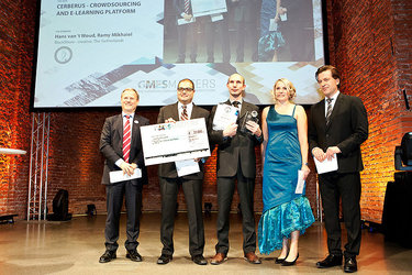
Last year’s winning team from the Norwegian company AnsuR Technologies AS won the prize with the ASIGN app. It uses crowdsourcing to support personnel deployed in disaster areas by encouraging users to take pictures of the situation on the ground. These images then supplement remote satellite data.
ASIGN was used to aid relief efforts during the 2011 floods in Thailand.
Other categories in the Copernicus Masters competition include the Best Service Challenge, which aims to increase awareness of existing Earth monitoring services and their benefits, and the Ideas Challenge for the innovative commercial use of Copernicus data.
The European Space Imaging High-Res Challenge invites people to create new and viable applications using very high-resolution satellite data.
Contestants in the GEO Illustration Challenge are asked to illustrate humankind’s footprint on our planet – from past to current developments – in vivid, artistic ways based on satellite imagery. ESA is teaming up with DLR, European Space Imaging and Astrium GEO-Information Services to provide free satellite data to the contestants of this category.
Submissions for the GEO Illustration Challenge ‘Traces of Humankind’ are being accepted until 30 June. All other challenges are open from 1 June to 15 September.
For a complete list of Challenges and more information on the competition, visit the Copernicus Masters website.
‘Copernicus’ is the new name for the Global Monitoring for Environment and Security (GMES) programme.