Monitoring water quality down under
Former Copernicus Masters competition winner EOMAP has launched a new web-based application that provides daily maps of Australia’s coastal water quality.
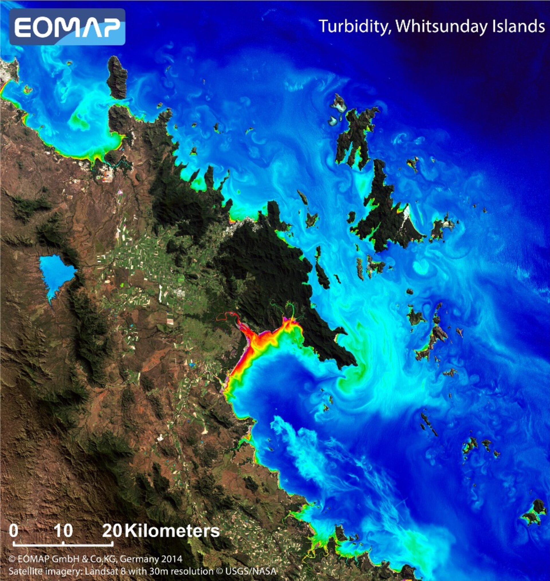
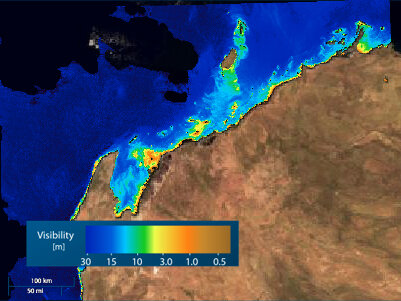
The free app, called eoApp Australia, enables anyone with a web browser to view various water quality parameters in two important areas of Australia: Abbot Point with an adjoining section of the Great Barrier Reef, as well as Barrow Island with the nearby Ningaloo Reef.
The data products include maps of turbidity – cloudiness caused by particles in the water – and visibility. These are important parameters for monitoring sediment plumes from dredging and dumping activities, as well as land run-off.
"Anyone can access the eoApp and look at the data online," explained Karin Schenk, head of EOMAP’s Water Quality Group.
"We also offer the option of professional, customised versions of the eoApp to scientists and managers in conjunction with a subscription to these data product feeds."
The German company EOMAP is not new to aquatic remote sensing applications. In 2011 the company won the Copernicus Masters ESA App Challenge for its idea for AquaMap – a near-realtime water quality service on mobile phones.
The Copernicus Masters competition seeks applications for business and society based on Earth observation data, while fostering creative product development and entrepreneurship in Europe.
Last year, EOMAP’s satellite service for mapping global seafloor topography also won the competition’s T-Systems Cloud Computing Challenge. Seafloor topography of the Great Barrier Reef has also been included in the new eoApp Australia.