Science meets Sentinel-3
With the first of the Sentinel satellites being readied for launch next spring, scientists are looking ahead to the third mission in the series to ensure the highest quality data possible.
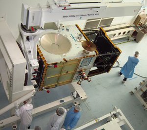
The main objectives of the Sentinel-3 mission are to measure sea-surface topography, sea- and land-surface temperature and ocean- and land-surface colour.
To achieve this, the satellites will carry a suite of advanced instruments, including a precision radar altimeter, an infrared radiometer and a wide-swath ocean and land-colour radiometer.
This information will be used to support Copernicus services related to the marine environment, such as ocean current forecasting, sea-water pollution monitoring and wave information for maritime safety. The data will also be used for Copernicus land services, such as fire detection and land-cover mapping.
Sentinel-3 data are essential to our understanding of our planet, as well as the interaction between the ocean/land surface and the atmosphere, increasing our knowledge of the evolution of Earth’s climate.

Last week, the first Sentinel-3 Validation Team workshop was held at ESA’s centre for Earth observation in Frascati, Italy.
The team is taking up the challenge of validating Sentinel-3 data, to verify their performance once the mission is in orbit. The accuracy of this information is essential to Copernicus services and their underpinning scientific community.
Validation activities are currently led by over 100 Principal Investigators, with an additional 400 co-investigators, from across Europe and the world.
In 2009, a validation campaign using airborne instruments was conducted over parts of southern Europe. The project called for scientists on the ground and at sea to take ground-truth measurements while aircraft carrying the sensitive hyperspectral instruments passed overhead and satellites acquired data simultaneously from space.
With about 150 participants, the workshop demonstrated the high interest of both the scientific and user communities in the topics of validation, sea- and land-surface temperature, ocean colour, vegetation monitoring and oceanography. The range of activities planned during the verification and validation campaign of Sentinel-3 is technically extensive, with a strong international component.

The four-day event was organised in partnership with Eumetsat, which will operate the satellites and generate all marine data products.
While the workshop was a significant step in the mission’s validation programme, the team now faces the challenge of securing a long-term reference measurement infrastructure required to validate all Sentinel missions during operations.
ESA is developing the Sentinels missions to meet the needs of Europe’s Copernicus programme.
Data from the Sentinel missions will be available for Copernicus services and to the scientific community for research. The European Delegated Act on Copernicus data and information policy recently entered into force, guaranteeing free and open access to environmental data from the whole Copernicus programme, including the Sentinels.