
Satellites yield insight into not so permanent permafrost
Ice is without doubt one of the first casualties of climate change, but the effects of our warming world are not only limited to ice melting on Earth’s surface. Ground that has been frozen for thousands of years is also thawing, adding to the climate crisis and causing immediate problems for local communities.
In Earth’s cold regions, much of the sub-surface ground is frozen. Permafrost is frozen soil, rock or sediment – sometimes hundreds of metres thick. To be classified as permafrost, the ground has to have been frozen for at least two years, but much of the sub-surface ground in the polar regions has remained frozen since the last ice age.
Permafrost holds carbon-based remains of vegetation and animals that froze before decomposition could set in. Scientists estimate that the world’s permafrost holds almost double the amount of carbon than is currently in the atmosphere.
When permafrost warms and thaws, it releases methane and carbon dioxide, adding these greenhouse gases to the atmosphere and making global warming even worse.
With permafrost covering about a quarter of the northern hemisphere, extensive thawing could trigger a feedback loop that could potentially turn the Arctic from a carbon sink into a carbon source.

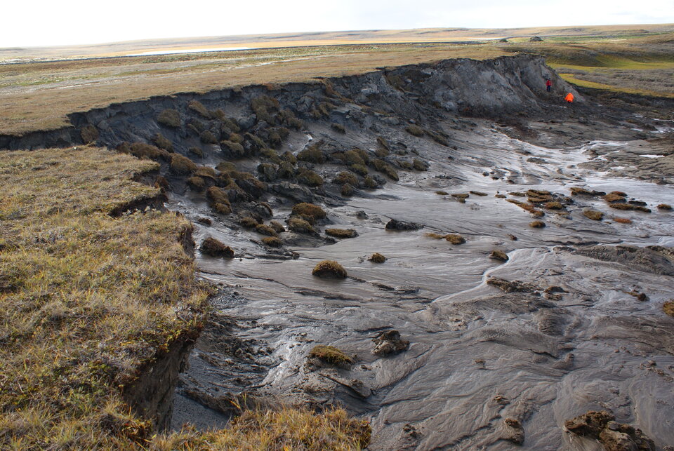
Thawing permafrost isn't just releasing more greenhouse gases into air – it's also changing the landscape and destabilising the ground, and so causing real practical problems for society.
Over 30 million people live in the permafrost zone, in towns that were built on firm ground. As the ground softens, the infrastructure that Arctic communities rely on is becoming increasingly unstable.
Determined by temperature, permafrost is an essential climate variable. Through ESA’s Climate Change Initiative, temperature data that have been collected over years are gathered to determine trends and to understand more about how permafrost fits into the climate system.
Traditionally, direct temperature observations are made through boreholes. However, the measurement network is rather sparse because of the obvious remoteness and logistical issues in the Arctic.
Therefore, other types of information that reflect change are needed to fill the vast gaps across the Arctic and other mountain regions.
Discussed at this week’s Living Planet Symposium, satellites are an important part of monitoring permafrost, albeit indirectly, from space.
Annett Bartsch, the founder and managing director of b.geos, explained, “We can’t monitor permafrost as such from space. Although it’s a bit complicated, we can, however, use a lot of different types of satellite data along with in situ measurements and modelling to put together a picture of what is happening.
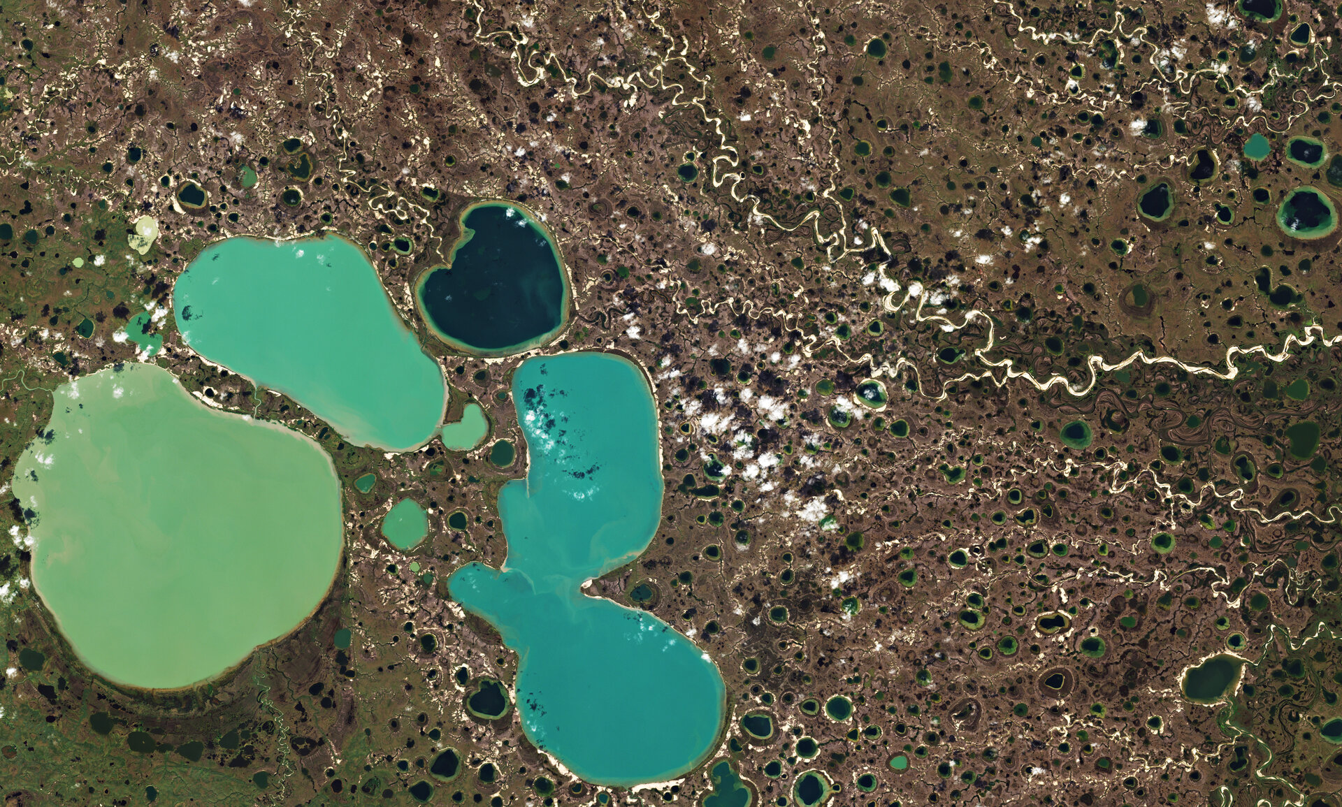
“Through an ESA project called Glob Permafrost, we use images captured by the Copernicus Sentinel-2 mission, for example, which give us a camera-like view of how the land surface is slumping and eroding because of thawing permafrost. The Copernicus Sentinel-1 radar mission, on the other hand gives us valuable information on widespread changes in topography.
“Missions carrying thermal sensors such as Copernicus Sentinel-3 can provide information about the changes in the temperature of Earth’s surface.
“And, we can use information on snow conditions and land cover as a proxy for soil properties. Both snow and soil regulate heat transfer, so they determine the actual impact of increasing air temperature on the frozen soil beneath.”

Research that uses satellite data has resulted in the first global map of permafrost at a spatial resolution of 1 km, and was published recently in Earth Science Reviews.
The dataset contains information on the average mean annual ground temperature for 2000 to 2016. Dr Bartsch, noted, “We are now also looking at changes over time as part of ESA’s Climate Change Initiative.”
Other advances are also being made through the GlobPermafrost project; notably the Permafrost Information System, which consists of a database as well as a visualisation platform of satellite-derived information relevant for permafrost monitoring. It includes the permafrost map and land-cover change information, ground subsidence, rock glaciers and information on lake properties for key regions.
With the damage that thawing permafrost can unleash on the climate system and on the local environments, it is no surprise that this is a hot topic. Scientists are drawing on all resources at hand to understand and monitor the situation, which, in turn, arms decision-makers with the information they need to take action.


