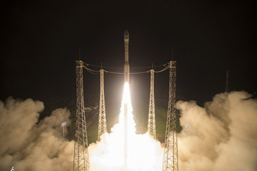
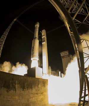
Sentinel-2B poised for liftoff
With liftoff just few days away, the next Sentinel satellite for the Copernicus environmental monitoring programme is positioned in the launch tower at Europe’s Spaceport in Kourou, French Guiana.
Carrying a multispectral camera to image Earth’s changing land and vegetation, Sentinel-2B is set for launch on 7 March at 01:49 GMT (02:49 CET; 22:49 local time on 6 March).
It will join its twin, Sentinel-2A, which has been in orbit since June 2015. With them circling on opposite sides of Earth and each providing 290 km-wide coverage, the time it takes to image the globe will be cut in half to five days, and to just three days over Europe.
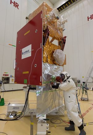
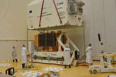
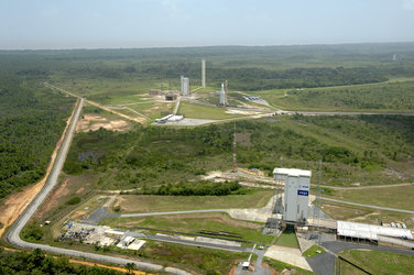
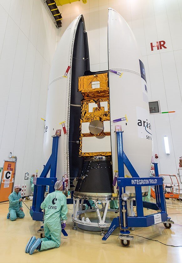
The satellite was shipped to Kourou in early January, where it has been tested, fuelled, encapsulated in its Vega rocket fairing, rolled out to the launch pad and hoisted into the tower.
The upper stage of the rocket has also been fuelled and the teams are now preparing for countdown.


Access the video
Today, Arianespace, the Sentinel-2 team in Kourou and ESA’s mission control in Darmstadt, Germany, are performing a full rehearsal.
Paolo Laberinti, ESA’s Sentinel-2 launch campaign manager, said, “It’s been a very intense couple of months for the ESA and the Airbus Defences and Space team here in Kourou, but thoroughly checking and preparing the satellite for liftoff has gone very well and we are really looking forward to saying a fond farewell to our baby when it lifts off on Monday night.”
Francois Spoto, ESA’s Sentinel-2 project manager, added, “We’re were very proud to see the Sentinel-2A launch two years ago and now it’s almost time for Sentinel-2B to join its twin.
“The mission is not just down to us though, it is thanks to the close collaboration we have with the European Commission, an industrial consortium of about 60 companies led by Airbus Defence and Space, France’s CNES space agency and the Copernicus service providers – and I’m sure everyone is as excited as we are.”
As for all the Sentinel missions, Sentinel-2 has been built for the Copernicus programme, this time focusing largely on Earth’s vegetation.
Ensuring land is used sustainably while meeting the food and wood demands of a growing global population is one of today’s biggest challenges. The Copernicus land service provides information to help respond to global issues such as this, as well as local areas that are prone to specific challenges.
The state-of-the-art Sentinel-2 mission provides not only information to improve agricultural practices and map changes in land cover, but it also helps to monitor the world’s forests and to detect pollution in lakes and coastal waters.
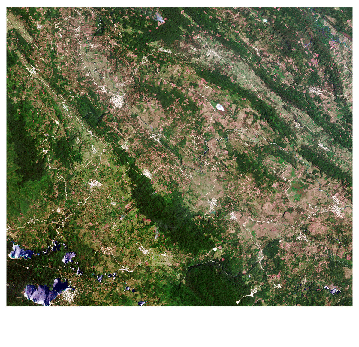
In addition, images of floods, volcanic eruptions and landslides can contribute to disaster mapping and help humanitarian relief efforts.
Many of these applications rely on satellite images that are repeated very quickly – especially in the growing season. Once Sentinel-2B has been commissioned, users will have images of all Earth’s land surfaces, large islands, and inland and coastal waters between latitudes 84°S and 84°N every five days.
The Copernicus programme is led by the EU and the EC while ESA coordinates the Copernicus space component.