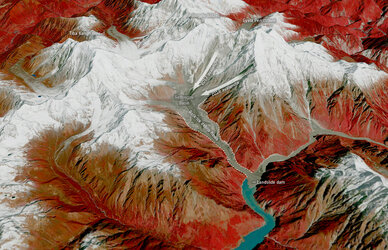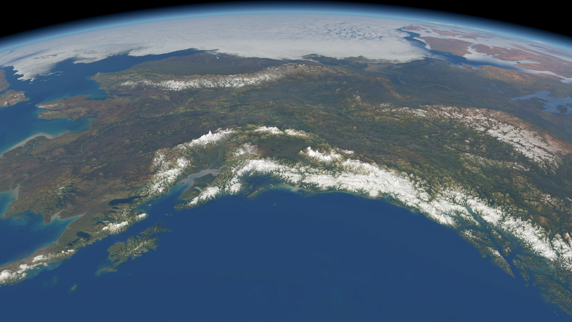
CryoSat reveals ice loss from glaciers in Alaska and Asia
As our climate warms, ice melting from glaciers around the world is one of main causes of sea-level rise. As well as being a major contributor to this worrying trend, the loss of glacier ice also poses a direct threat to hundreds of millions of people relying on glacier runoff for drinking water and irrigation. With monitoring mountain glaciers clearly important for these reasons and more, new research, based on information from ESA’s CryoSat mission, shows how much ice has been lost from mountain glaciers in the Gulf Alaska and in High Mountain Asia since 2010.
Monitoring glaciers globally is a challenge because of their sheer number, size, remoteness and rugged terrain they occupy. Various satellite instruments offer key data to monitor change, but one type of spaceborne sensor – the radar altimeter – has seen limited use over mountain glaciers.
Traditionally, satellite radar altimeters are used to monitor changes in the height of the sea surface and changes in the height of the huge ice sheets that cover Antarctica and Greenland. They work by measuring the time it takes for a radar pulse transmitted from the satellite to reflect from Earth’s surface and return to the satellite. Knowing the exact position of the satellite in space, this measure of time is used to calculate the height of the surface below.
However, the footprint of this type of instrument is generally too coarse to monitor mountain glaciers. ESA’s CryoSat pushes the boundaries of radar altimetry and a particular way of processing its data – swath processing – make it possible to map glaciers in fine detail.

Access the video
A paper published recently in The Cryosphere describes how scientists used CryoSat to investigate ice loss in the Gulf of Alaska and High Mountain Asia.
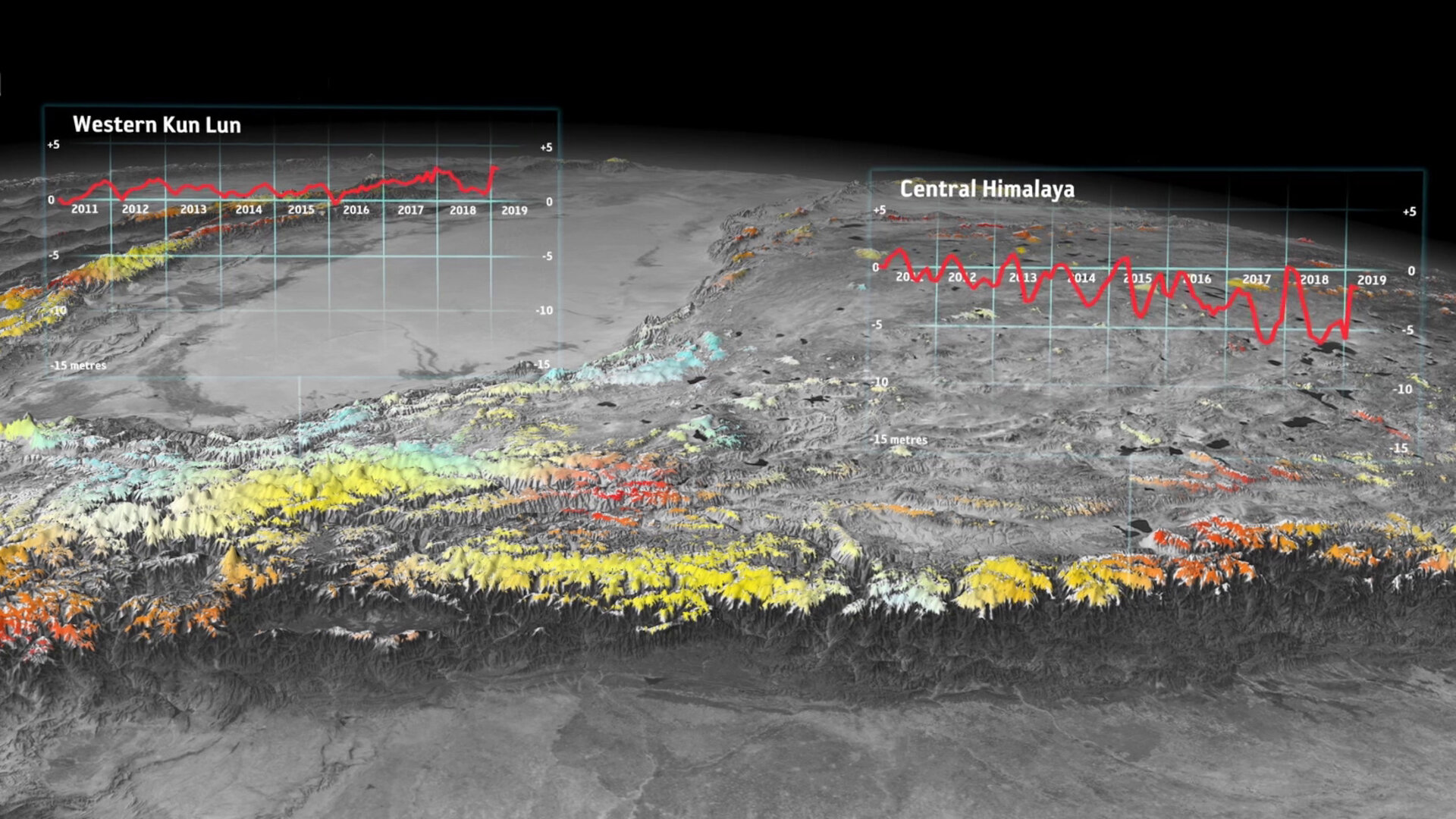
They found that between 2010 and 2019, the Gulf of Alaska lost 76 Gt of ice per year while High Mountain Asia lost 28 Gt of ice per year. These losses are equivalent to adding 0.21 mm and 0.05 mm to sea level rise per year, respectively.
Livia Jakob, from Earthwave, explains, “One of the unique properties of this dataset is that we can look at ice trends at exceptionally high resolution in space and time. This enabled us to discover changes in trends, such as the increased ice loss from 2013 onwards in parts of the Gulf of Alaska, which is linked to climatic changes.”
The study, which was carried out through ESA’s Science for Society programme, also shows that almost all regions have lost ice, with the exception of the Karakoram-Kunlun area in High Mountain Asia, a phenomenon known was the ‘Karakoram anomaly’.

Noel Gourmelen, from the University of Edinburgh, said, “It is astonishing to think that over last decade alone, both regions have lost 5% of their volume of ice. What CryoSat has accomplished also is astonishing. While glaciers were a secondary objective of the mission, few would have thought possible to use radar altimetry in regions with extremely complex topography like High Mountain Asia and the Gulf of Alaska.
“But thanks to a brilliant altimeter design, dedicated support from ESA, and many years of research by the community, interferometric radar altimeters are now part of the toolset to monitor glacier change globally.”
This research, as well as that published in a related paper covering the entire Arctic region apart from Greenland, demonstrates that this unique high-resolution radar altimetry dataset can provide crucial information to better quantify and understand glacier changes on a global scale. This also opens up possibilities to monitor glaciers globally with satellites such as the planned CRISTAL mission, part of the expansion of Europe’s Copernicus programme.