Expanding our knowledge of Arctic Ocean bathymetry
Our knowledge of the depth and shape of the Arctic Ocean floor – its bathymetry – is insufficient. Owing to year-round sea-ice coverage and the cost of research in this remote region, much of the Arctic Ocean’s bathymetry has remained a mystery, until now.
Bathymetry maps are crucial for studying ocean dynamics, currents and tides, as well as for ship safety. Several campaigns to map seafloor bathymetry through ship soundings have been proposed, but only small fractions of the Arctic Ocean have ever been covered.
Scientists from DTU Space, Denmark’s national space research institute, have published a paper that reveals the first Arctic bathymetry map using marine gravity.
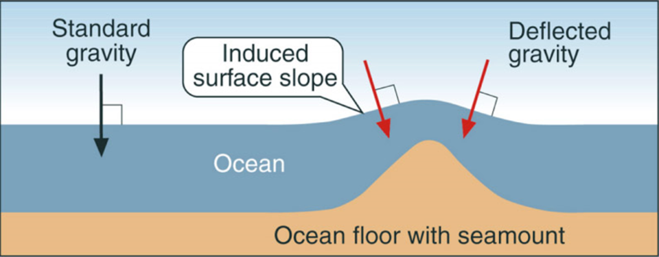
The surface of the ocean is not flat. Because of gravitational pull, the height of the ocean surface mimics the rise and fall of the ocean floor. Areas of greater mass such as underwater mountains have a higher gravity and therefore attract more water creating a rise in the sea surface.
Fine-tuning the relationship between bathymetry and gravity in the Arctic Ocean has enabled scientists to calculate sea—floor bathymetry from satellite gravity measurements.
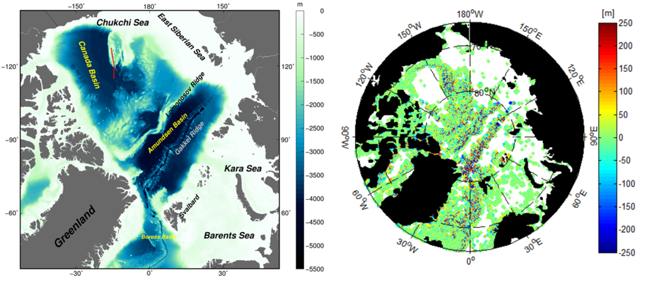
By using ERS-1 and ERS-2, Envisat and seven years’ of CryoSat data, an altimetric gravity model has been developed by DTU Space. This has been combined with the existing IBCAO bathymetry map to create a new and improved hybrid bathymetry map of the Arctic Ocean.
CryoSat was originally launched to measure sea-ice thickness, but data from the Earth-observing satellite have been exploited for other studies. Carrying a radar altimeter, the satellite can sense the gravity field at the ocean surface, so that seafloor characteristics are revealed – allowing it to map the global marine gravity field at a high spatial resolution.
“The existing IBCAO bathymetry map of the Arctic Ocean is based purely on ship soundings and assisted by digital depth contours. Combining the IBCAO bathymetry with altimetry-derived marine gravity has resulted in a more accurate bathymetry map of the Arctic,” says Ole Baltazar Andersen from DTU Space.
He continues, “The true value in the satellite data lies in the fact that it can help fill in data gaps between ship soundings, giving us a more complete picture of the Arctic bathymetry.”
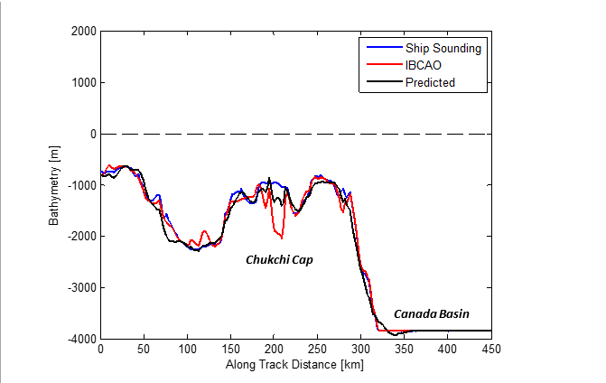
The value of the hybrid bathymetry has also been validated using recent independent ship sounding surveys accessed through the NOAA’s National Center for Environmental Information (NCEI). Over the Chukchi Cap in the Canadian Arctic, the hybrid bathymetry could improve the existing IBCAO model derived from sparse ship tracks in the region.
“This mapping shows our satellites’ capability of providing us with new data, especially in more difficult areas such as the unknown Arctic waters,” says Jérôme Benveniste, senior advisor at ESA.
Josef Aschbacher, ESA’s director of Earth observation programmes, added, “And this is yet another piece of the jigsaw that adds to our understanding of the planet – and critically this kind of information can be used for maritime safety therefore benefiting society.”