

Earth from Space: Delta’s edge
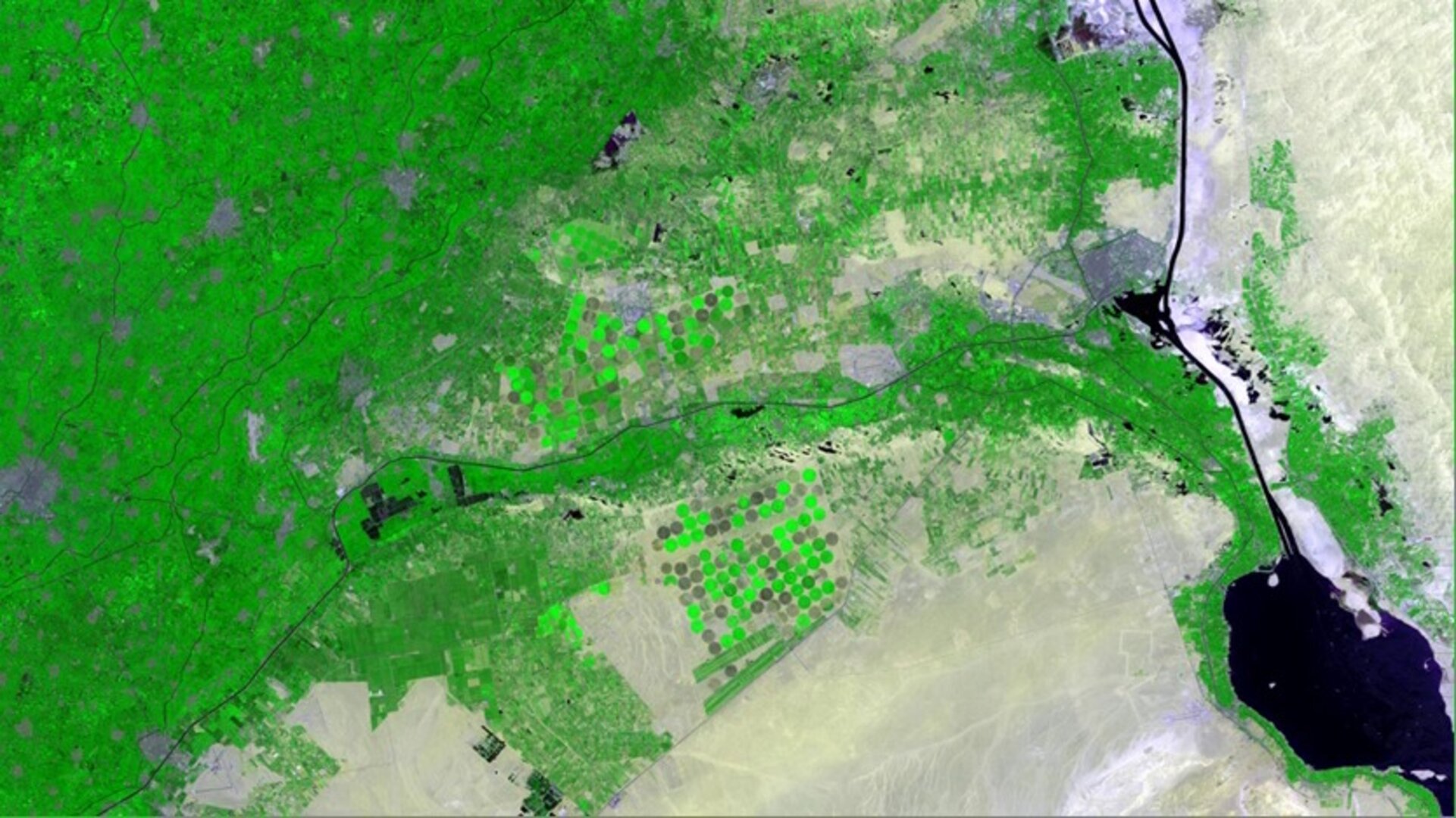
This animation shows before-and-after satellite images over two harvest seasons in 2012 in the eastern Nile Delta.
Located in northern Egypt, the delta is where the Nile River splits and empties into the Mediterranean Sea. Important crops grown in this rich agricultural area include cotton, rice and sugar cane.
Owing to the reflection of infrared light, vegetation appears bright green in the two images acquired before harvest. But once the crops were reaped, the overall colour dulls with the drop in vegetation.
Not every crop is harvested twice a year or at the same time. In the lower-central portion of the image, for example, the circles of crops do not necessarily follow the overall pattern. The crops grow in circles here due to central-pivot irrigation system, where the long water pipe rotates around a well at the centre.
The grey spots that are visible throughout the time series are towns and other inhabited areas.
The arid and desert areas in the right and lower portions of the images also remain constant throughout the year since there is little to no vegetation here – and no agriculture.
The upper portion of the images also shows unchanging dark areas, but we can see the lines of division resembling agricultural structures. These areas could be covered by water – such as rice paddies – or the vegetation could be covered for protection.
Other geographical features include the Great Bitter Lake in the lower-right corner. The Suez Canal connects this saltwater lake to the Mediterranean Sea (north).
These images were acquired by the Landsat-7 satellite.
This animation is featured on the Earth from Space video programme.

