
Earth from Space: Probing Mesopotamia
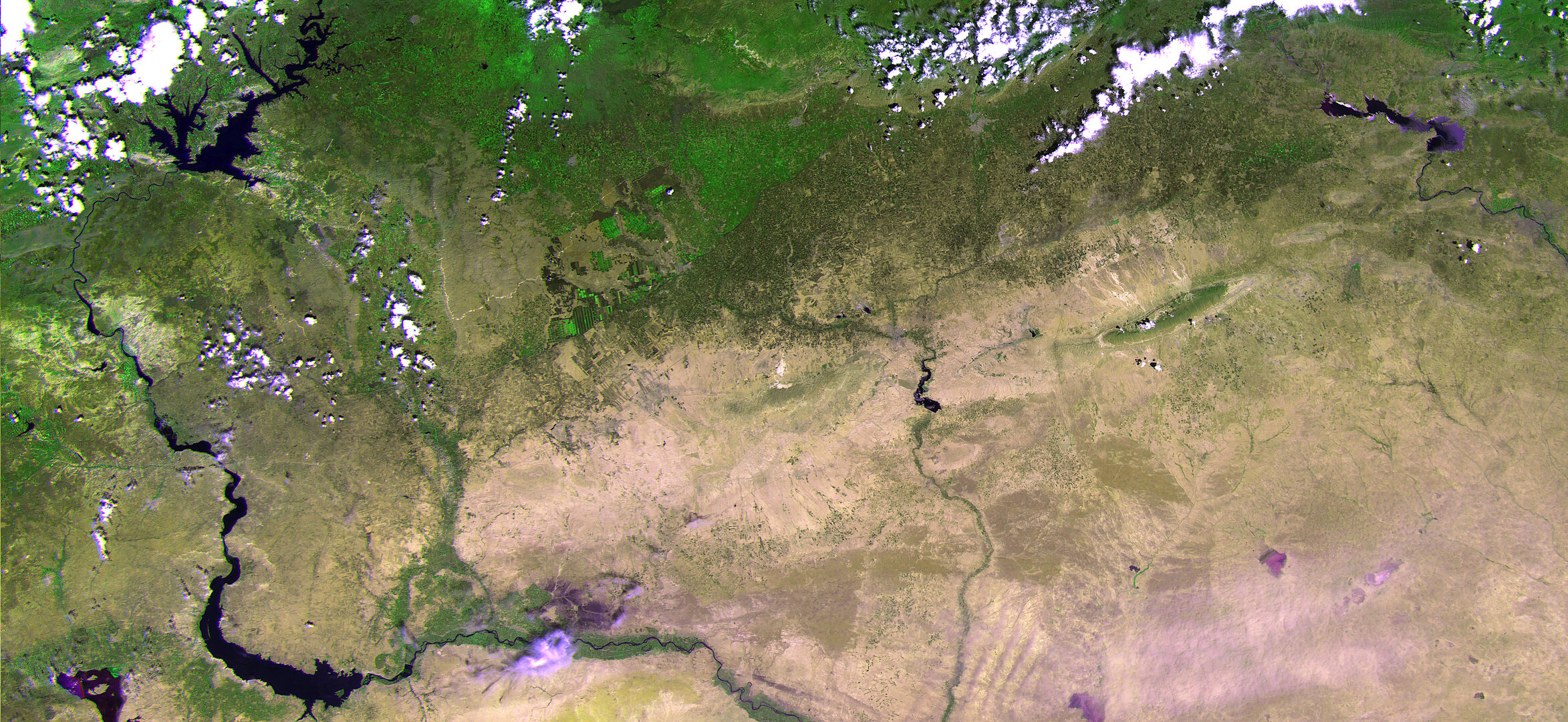
The recently launched Proba-V miniaturised satellite captured this image over the border region of northern Syria, southeastern Turkey and northern Iraq on 28 May.
The area pictured is about 500 km across, with large reservoir lakes along the Euphrates River visible on the left, and another along the Tigris River on the right.
Reservoirs and rivers secure water supply in the very dry region. They also form the basis for what is visible in different shades of green along the river water’s edges and irrigated agricultural plots to provide food and income to the population.
In the central-right portion of the image, we can see Iraq’s Sinjar mountains. Members of the Yazidi religious group believe that this is where Noah’s Ark came to rest after the biblical flood.
Proba-V will map land cover and vegetation growth across the entire planet every two days with its Vegetation imager.
In this image, the contrast between the green areas – some with agricultural plots – and the sparsely vegetated areas is evident. It demonstrates Proba-V’s ability to see slight differences in vegetation cover. Vegetation intensity and health can help in crop yield predictions and to map interannual changes in vegetation cover.
The camera will also be used for day-by-day tracking of extreme weather, alerting authorities to crop failures, monitoring inland water resources and tracing the steady spread of deserts and deforestation.
This ‘raw’ image from Proba-V has not yet been corrected.
The satellite is currently in its commissioning phase, which includes a careful cross-calibration of the Vegetation imager with its predecessor on France’s Spot-5 satellite, to ensure data compatibility.
This image is featured on the Earth from Space video programme.

