
Earth from Space: Sahara’s end
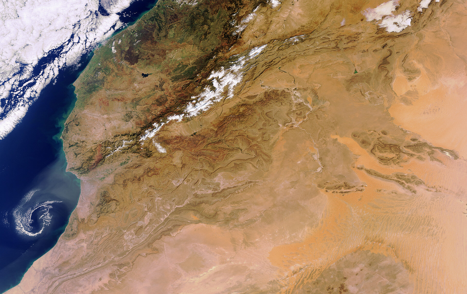
This Envisat image shows part of central Morocco from the Atlantic Ocean to the west, over the Atlas mountains and into arid parts of Algeria further inland.
The snow-capped High Atlas mountain range divides Morocco from the Sahara desert’s climatic influences in Algeria. Northwest of the mountains, the area experiences a more Mediterranean-like climate, with dry and hot summers and moderate winters with a fair amount of rain.
Several peaks in the mountain range exceed 4000 m and experience regular snowfall, allowing winter sports to be played well into the spring. The melting snow provides sufficient water supplies in the drier seasons.
To the south are the lower, Anti-Atlas mountains. Here the land is mostly dry and barren as the mountains belong to the Saharan climate zone.
Further inland we can see the sands of western Algeria’s desert lands. Located at approximately 30ºN latitude and at the edge of the Sahara desert, these areas experience high temperatures and little rainfall.
The Sahara is constantly expanding southward, rendering large areas of land barren. One of the many benefits of Earth observation satellites is the possibility to monitor changes like desertification, or the degradation of land, caused by human activities or climate change.
This image was acquired on 5 December 2011 by the MERIS instrument on ESA’s Envisat satellite.
The Image of the Week is featured on ESA Web-TV, broadcast online every Friday at 10:00 CET.

