
Earth from Space: The Strait of Messina
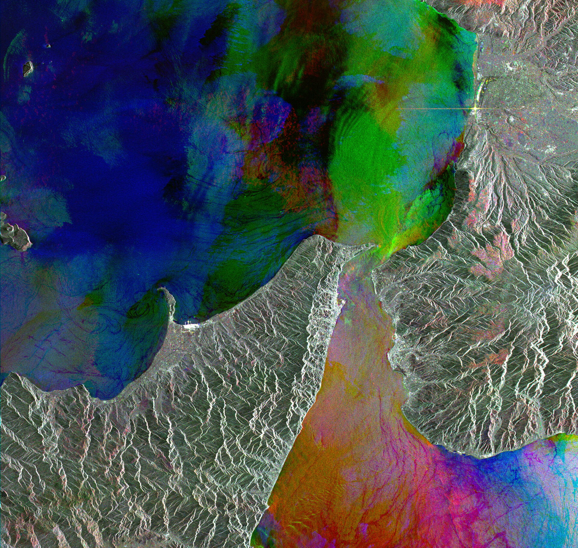
The Strait of Messina – the narrow section of water separating the Italian Peninsula (seen on the right) from Sicily – is featured in this multi-colour ERS-2 composite image.
Located in the Mediterranean Sea, the Strait joins the Tyrrhenian Sea in the north with the Ionian Sea in the south and has a reputation for its hydrological peculiarities – namely whirlpools, strong currents and internal waves.
Throughout history the Strait has received a lot of attention because of its dangerous waters. In Greek mythology, a six-headed monster named Scylla lived on the Italian Peninsula and would pull sailors up and devour them if they came within her grasp, while an all-consuming whirlpool called Charybdis, on the Sicilian side, would suck passersby to their deaths.
In Homer’s Odyssey, Odysseus and his crew confronted the two monsters while navigating through the Strait. Emphasizing the dangers of the narrow Strait – 32 kilometres long and from 3 to 16 kilometres wide – it was only possible to avoid one of the monsters by sailing closely to the other. Odysseus navigated his ship through safely, but Scylla managed to catch and devour six of his men.
Currently, the Strait is at the centre of a much-debated topic over whether a bridge should be built to connect Sicily to the peninsula. If built, it would be the longest suspension bridge in the world (3.7 kilometres).
Opponents say the bridge will damage the unique ecosystem of the area. According to the World Wide Fund for Nature (WWF), the area around the Strait borders one of the three most important European migration routes for many birds, with some 34,000 birds (comprised of 32 different species) passing through the area in just two months.
The main towns of the Strait are Messina, on the Sicilian side, and Reggio-Calabria on the peninsula side. The two mountain ranges seen in the image are the Monti Peloritani, in Sicily, and the Aspromonte, in Calabria.
Messina and Reggio di Calabria were both founded in the late 8th Century B.C. by the Greeks. Because of their strategic port locations, both cities have suffered numerous foreign invasions. The area was also hit by two major earthquakes in 1783 and 1908; the latter nearly destroyed the entire city of Messina.
The image is composed of three ERS-2 SAR PRI (Precision Radar Image) images acquired on different dates with different colours assigned to each date: red for 13 February 2002; green for 11 August 2004; blue for 5 May 1999.
The image covers a width of 100 kilometres and has a 12.5 metre pixel sampling.

