
Satellite captures images of sandstorm
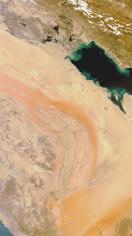
ESA’s Envisat satellite has captured images of a sandstorm over Saudi Arabia, Qatar, Bahrain and southern Iraq and Iran.
The animation shows two cloud-free images of the region: the first captured on 10 March and the second on 18 March.

The latest image shows how sand has swept over the Persian Gulf States in recent days, extending some 1500 km north to south.
Over the past few days, strong winds have whipped up dust and sand, causing low visibility and grounding flights across the region.
In some areas of Saudi Arabia, schools have been closed and hundreds of people are suffering from respiratory problems. The storm has also caused a sharp decline in temperatures.
The storm has even disrupted traffic further south in the United Arab Emirates, Kuwait, Oman and Yemen.
These images were captured by Envisat’s MERIS instrument. This month, Envisat celebrated ten years in orbit.

