GOCE delivers on its promise
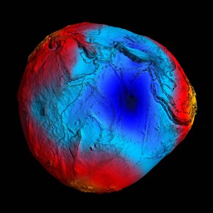
ESA’s GOCE satellite has reached its ambitious goal of mapping Earth's gravity with unprecedented precision. In two short years, the sophisticated satellite has collected the measurements needed to record the 'geoid' reference shape of our planet.
"GOCE is one of ESA’s most innovative missions. The number of 'firsts' it embodies led to many challenges for our scientists, engineers and more than 40 companies involved in building the satellite," said Volker Liebig, Director of ESA's Earth Observation Programmes.
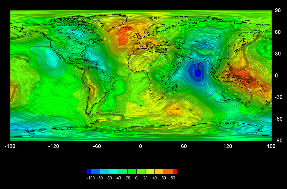
"I am happy to announce that their hard work and dedication have paid off. The satellite has recorded the measurements necessary to enable us to produce a high-resolution map of the 'geoid' that is far more accurate and has a much higher spatial resolution then any other dataset of this kind."

The geoid is the shape of an imaginary global ocean dictated by gravity in the absence of tides and currents. It is a crucial reference for accurately measuring ocean circulation, sea-level change and ice dynamics – all affected by climate change.
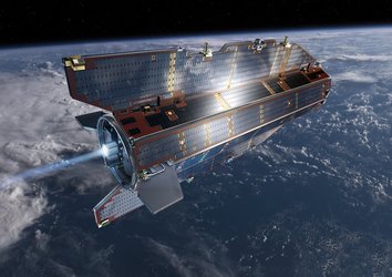
The planned mission of the Gravity field and steady-state Ocean Circulation Explorer (GOCE) satellite, launched in March 2009, included two six-month measurement periods. On 2 March it completed its 12th month of gravity-field mapping.
In the coming weeks, these data will be calibrated and processed for scientists to create a unique model of the geoid.
Although GOCE has completed its planned mission, the low solar activity during the last two years led to a lower fuel consumption than anticipated.
Based on this fuel saving, the good health of the satellite and the excellent quality of its data, ESA decided in November 2010 to extend the mission until the end of 2012.
"By nearly doubling the mission’s lifetime, GOCE data will provide an even better gravity field map and geoid products," said GOCE Mission Manager Rune Floberghagen.
"Once the gravity models are completed, they will be made available to all users, free of charge in line with ESA's data policy."
The new GOCE products and the science derived from these products will be presented and discussed at the Fourth International GOCE User Workshop held at the Technische Universität München in Munich, Germany, on 31 March–1 April.
Media representatives will be invited to attend the event. For more details, please see the programme at http://www.goce2011.org.