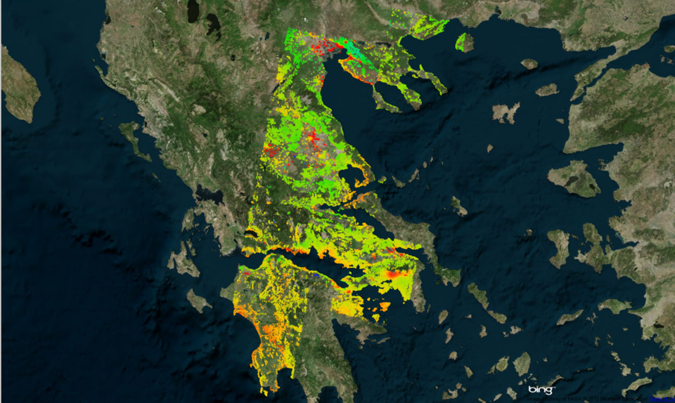
Greece’s ups and downs
A new data processor is creating maps of land deformation from satellite radar data over larger areas and with higher precision than ever before. These maps can be used to detect and monitor geological hazards.
The land beneath our feet is not always stable. In some areas, the ground is sinking through mining, earthquakes and natural gas extraction, among other factors. There are also areas that are rising from, for example, expanding volcanoes or the collision between tectonic plates.
Measuring these changes is not always easy, especially across vast areas or in places that are not easily accessible. Radars on satellites, however, can map these changes on a global scale and with millimetre-precision.
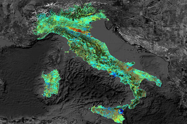
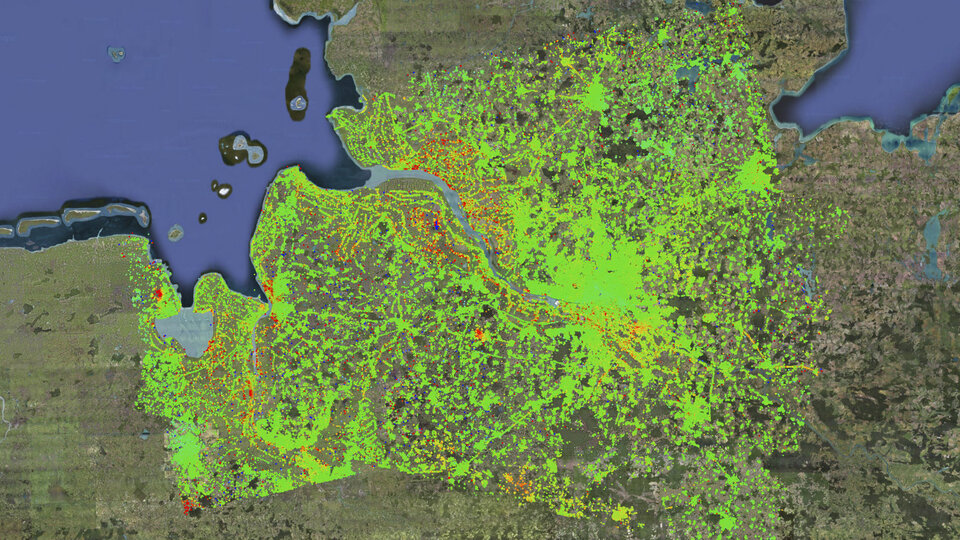
A new Wide Area Processor, or WAP, has now been developed to process the full radar data over a specific area automatically and then mosaic adjacent ‘datastacks’ with uniform quality, yielding country-sized maps of land deformation with unprecedented accuracy.
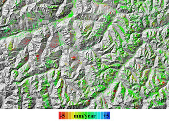
To do this, the WAP applies the remote sensing technique ‘persistent scatterer interferometry’. Persistent scatterers are stable objects that reflect radar well, such as metal structures and buildings, and are continuously present as the satellite orbits Earth. By measuring the point scatterers within the resolution cell of each radar image and combining images acquired over time, millimetre terrain deformations can be estimated.
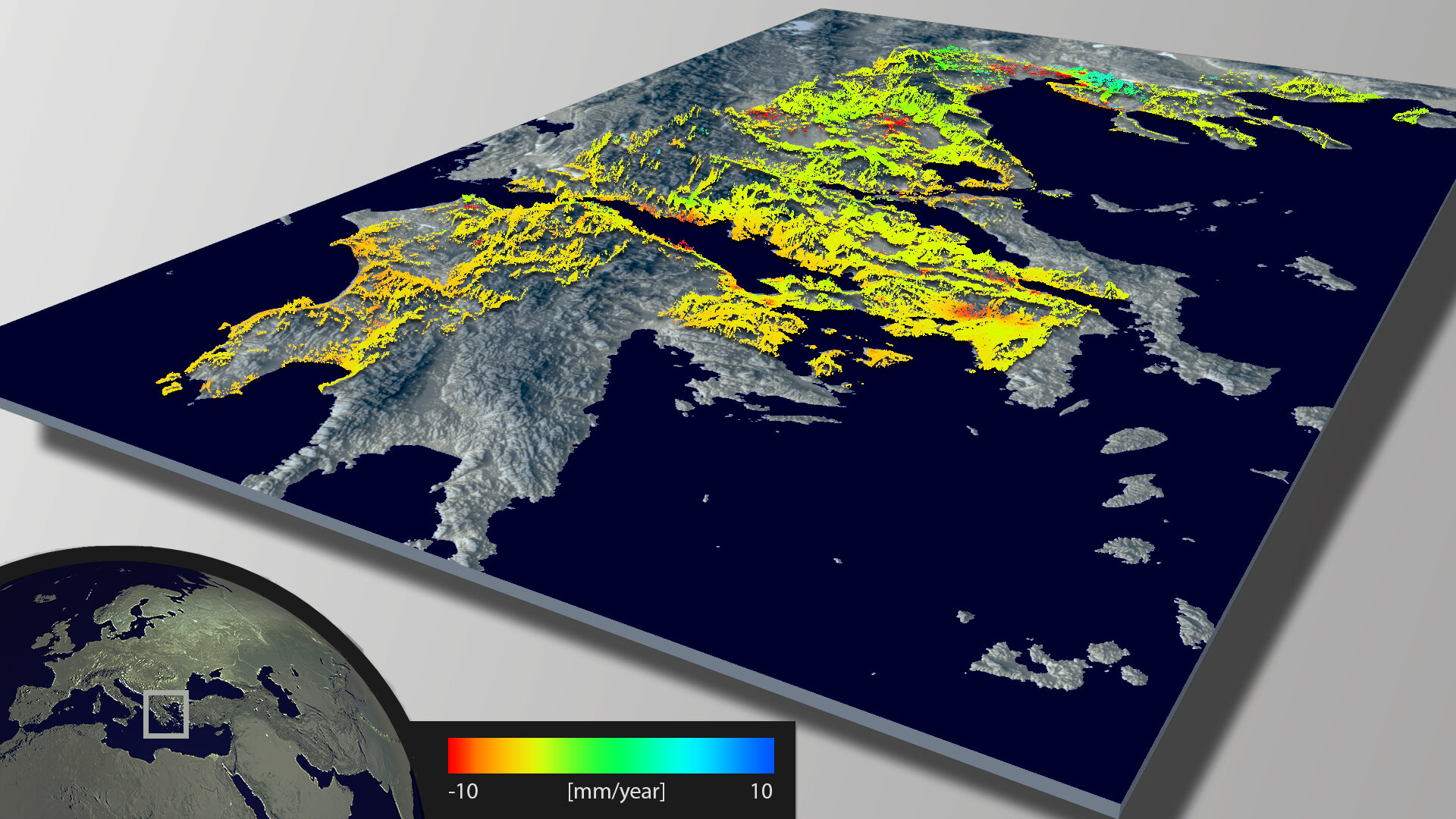
In one of its first trials, the WAP identified over a million persistent scatterers over half of Greece’s mainland. In rural areas, there was an average of 10 scatterers per sq km, while urban areas, like Athens, saw up to 200 scatterers per sq km.
Using about 360 gigabytes of raw radar data from the ERS-1 and -2 satellites, the WAP mapped terrain deformation over more than ten years, finding that some areas are sinking by about 10 mm per year.
High subsidence was detected in Athens, Larissa and around the Gulf of Corinth among other places. Both subsidence and uplift were detected in and around the city of Thessaloniki.
The next step is to apply WAP to an entire continent. The data already exist thanks to ERS-1 and -2’s decade’s worth of acquisitions starting from the early 1990s, but the processing of this huge amount of data takes time.
In addition, WAP is designed to process data from different sensors, so information from Envisat, ALOS, TerraSAR-X and the future Sentinel-1 can also be used.
The Sentinels are being developed under Europe’s Global Monitoring for Environment and Security (GMES) programme. Sentinel-1, a two-satellite mission with the first to be launched this year, will ensure the continuity of C-band synthetic aperture radar data.
With a 250 km swath and short revisit time, the mission will provide consistent observations of regions prone to geohazards. WAP capabilities with these data will allow the delivery of geo-information required for monitoring seismic hazards, volcanoes, coastal lowland subsidence, flood defence and hydro-geological hazards, including landslides.
The new WAP was developed by the DLR German Aerospace Center within the framework of the ESA GSE Terrafirma project.