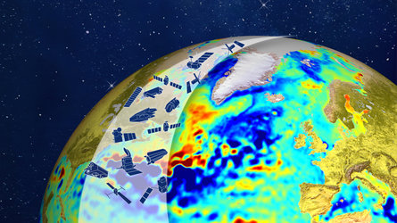
Live: 25 years of radar altimetry
Live from the Azores, follow the opening session of an event where world-class scientists meet to discuss the latest developments in our understanding of Earth’s surface variations observed by altimetry. Radar altimeters record the surface topography along the satellite’s ground track. They precisely measure a satellite’s height above water, land or ice by timing the interval between the transmission and reception of very short radar pulses.
Programme overview (all times in CEST)
10:55: Welcome addresses by representatives from ESA, CNES, Azores Regional Government and Portuguese Government
11:40: Early Development of Satellite Altimetry
12:00: Achievements of TOPEX/Poseidon and Jason Series
12:20: Assessment of the Global Mean Sea Level Budget with Altimetry
12:30: 25-Year Record of Global Mean Sea Level Change
12:40: Global Ocean Circulation from Satellite Altimetry
13:00: Satellite Altimetry and the Copernicus Marine Service
13:20: Progresses of Altimetry for Marine Ecology
13:40: The Ocean Mean Dynamic Topography
13:50: 25 Years of Progress in Sea Floor Mapping
14:00: Coastal Altimetry
14:20: CryoSat-2 for Inland Water Applications
14:40: Polar Altimetry
14:50: The Younger, Thinner, Faster Arctic Sea Ice Cover
A detailed programme is available on the symposium website.