WMO celebrates 52 years
Today is World Meteorological Day, an important date in the calendar of the World Meteorological Organization, better known as the WMO. Exactly 52 years ago the World Meteorological Convention came into force, bringing into existence the WMO, a United Nations specialised agency.
The weather is not just the subject of polite conversation, it affects our moods, the quality and the cost of the food we eat, our leisure activities and - for many of us - our livelihoods. As the atmosphere has no national or regional boundaries an authoritative international organisation is needed to provide a scientific voice, acting in the interests of us all, on the weather and the Earth’s climate.
When the WMO first began operating, weather forecasts tended to be rather hit and miss affairs, more often renowned for their failures than for their accurate predictions. Over the years, however, the accuracy of weather reports has improved enormously, greatly aided by powerful computers and the use of weather satellites, the first of which was launched in 1960.
This is where the WMO comes in. Since its inception it has fostered international treaties and conventions concerning the climate, and facilitated the rapid exchange of information, the standardisation of meteorological recordings and data, and the publication of observations and statistics.
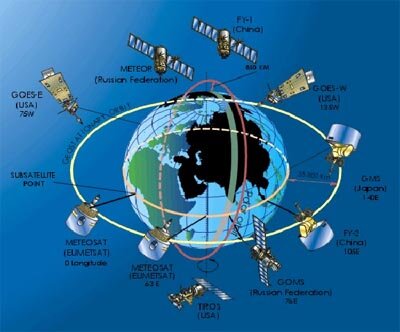
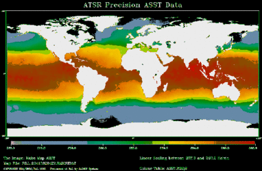
Now the WMO community can rely on data from four polar orbiting and five geostationary satellites. This is in addition to approximately 10 000 land observation and 7000 ship stations, and 300 moored and drifting buoys carrying automatic weather stations.
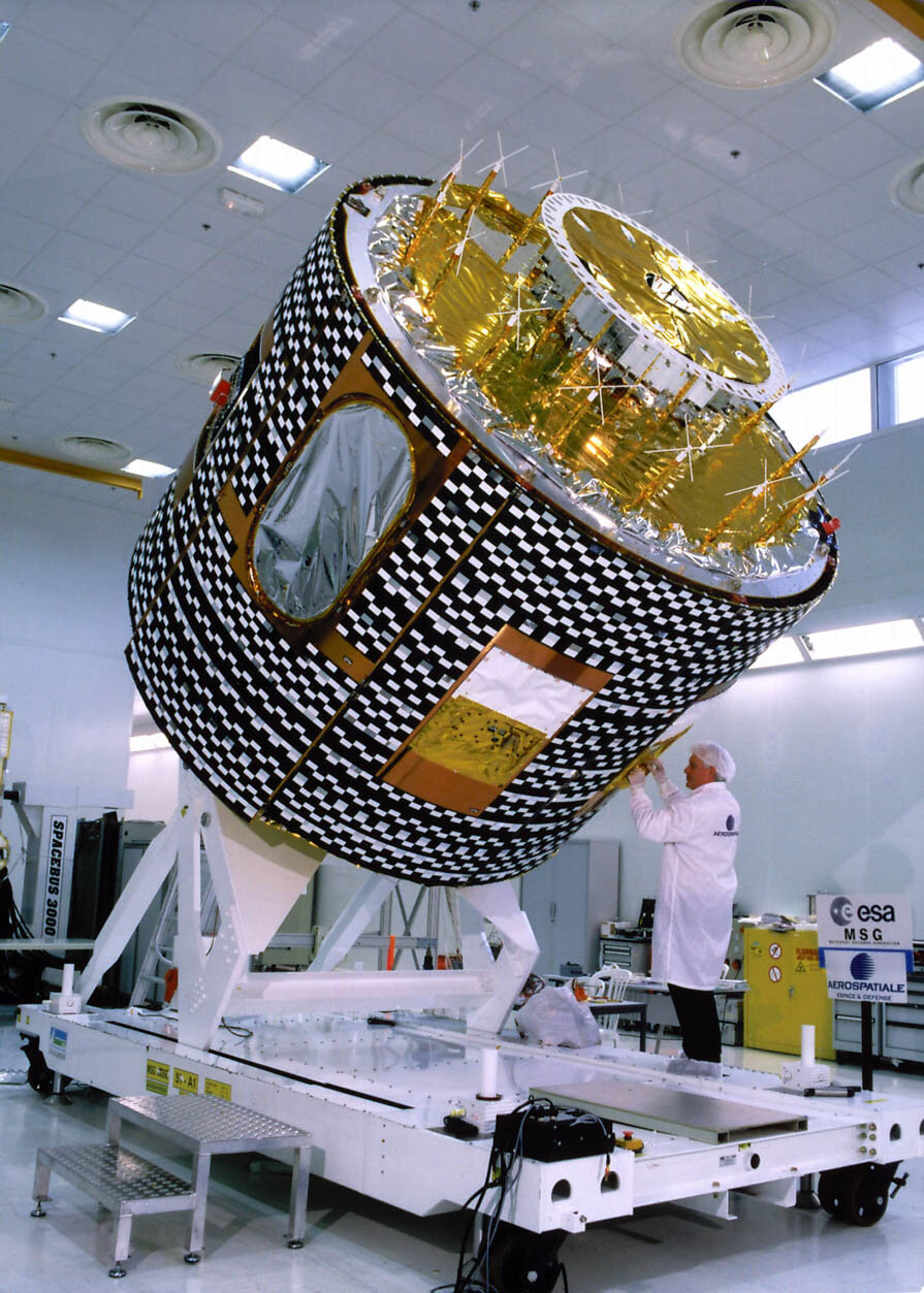
Within the near future there will be another weather satellite in orbit. The first Meteosat Second Generation satellite, MSG-1, is due to be launched shortly from Europe’s spaceport in French Guiana, onboard an Ariane launcher. MSG is the result of a cooperation programme between ESA and Eumetsat, the European Organisation for the Exploitation of Meteorological Satellites, based in Germany. ESA’s role in this partnership is to design and develop MSG-1, and to procure MSG-2 and -3 on behalf of Eumetsat.
Once in its geostationary orbit at an altitude of 36 000 km, MSG will be one of the world’s most sophisticated meteorological satellites and will use the most advanced technology available. The two main instruments on board will be the MSG camera SEVIRI - the Spinning Enhanced Visible and Infra-red Imager and GERB - the Geostationary Earth Radiation Budget.
Every 15 minutes SEVIRI will build up images of the Earth’s surface and cloud cover in 12 different wavelengths. This marks a big improvement when compared to the three different wavelengths every 30 minutes provided by Meteosat, the current European system that has been in operation for almost 25 years.
GERB will be able to measure the amount of radiation that arrives on the Earth from the Sun and the amount leaving as heat, and scattered and reflected solar radiation. Other benefits will be provided by MSG’s powerful communications package that will receive and transmit data between the ground station and users, and by a transponder for search and rescue operations at sea. All this equipment will help to make meteorology a more exact science and provide a valuable contribution to the ongoing debate on climate change.
A more mundane but more noticeable advantage will be the high quality of the images on our TV weather reports. MSG will provide clearer pictures of the Earth, and smoother and more realistic images of cloud formations. However, a much more exciting prospect for the WMO is the possibility of having a continuous supply of improved data available for its World Weather Watch and World Climate Programmes.