Antarctic DOMEX experiment contributes to SMOS mission preparations
As part of ESA's calibration and validation programme for the Earth Explorer Soil Moisture and Ocean Salinity (SMOS) mission, data collected during the Antarctic DOMEX field campaign have confirmed that this cold and remote wilderness is well suited for extended calibration activities relating to space-borne radiometer missions.
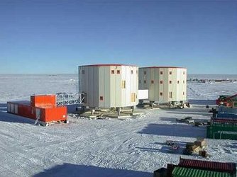
The purpose of the DOMEX experiment was to acquire the first combined, in-situ microwave emission measurements using C- and L-band radiometers. The campaign took place at the Italian-French Concordia Station located on the polar plateau of East Antarctica – known as DOME-C, which is around 1000 km from the coast and 3,280 metres above sea level where, in winter, temperatures can reach -60° C. The month-long campaign was carried out last Austral summer by an Italian team led by Giovanni Macelloni from the Italian Institute for Applied Physics (IFAC-CNR) and Anselmo Cagnati from the Italian Regional Agency for Environmental Prevention and Protection in Vento (CVA-ARPAV). It was supported by ESA within the framework of the SMOS calibration and validation preparatory activities and by the Italian Programme of National Research in Antarctica (PNRA).

The SMOS mission, due for launch in 2007, will provide global maps of soil moisture and ocean salinity. Soil moisture data are urgently required for hydrological studies and data on ocean salinity are vital for improving our understanding of ocean circulation patterns. Together these data will contribute to furthering our knowledge of the Earth's water cycle, and will improve climate, weather and extreme-event forecasting. To achieve this, SMOS has been designed to measure microwave radiation emitted from the Earth's surface at L-band (1.4 GHz). In order to estimate soil moisture and ocean salinity from SMOS data, digital counts, provided by instrument output, need to be related to radiometric units, i.e. calibrated.
Calibration of passive microwave and space-borne sensor data can be performed both with the monitoring of the instrument performance and with the collection of data from extremely stable natural targets. The Antarctic plateau, thanks to its size, structure, spatial homogeneity and thermal stability, was thought to be particularly suited to this kind of calibration exercise.
Microwave data from this region at frequencies ranging from 6.8 GHz up to about 90 GHz have been, and still are being, collected by means of the SMMR (Scanning Multi-channel Microwave Radiometer), SSMI/I (Special Sensor Microwave Imager) and AMSR-E (Advanced Microwave Scanning Radiometer for EOS) satellite sensors. Results from these sensors confirm the high temporal stability of microwave emissions in this area. However, there remains a significant lack of information at frequencies below 6 GHz.
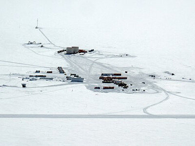
The location for the Concordia Station was originally selected for glaciological purposes. Its 3,300 metres of undisturbed ice layers have yielded a 740,000-year paleo-climatic reconstruction as part of the European Project for Ice Coring in Antarctica (EPICA). This extraordinary natural laboratory attracts scientists from all over the world and the base is now a reference point for astronomical, seismological and atmospheric research.
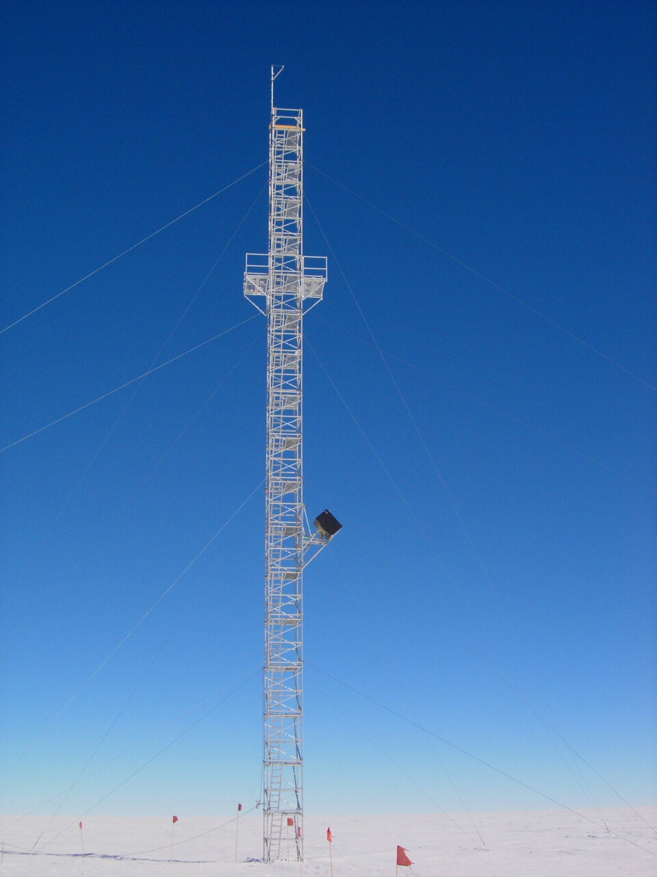
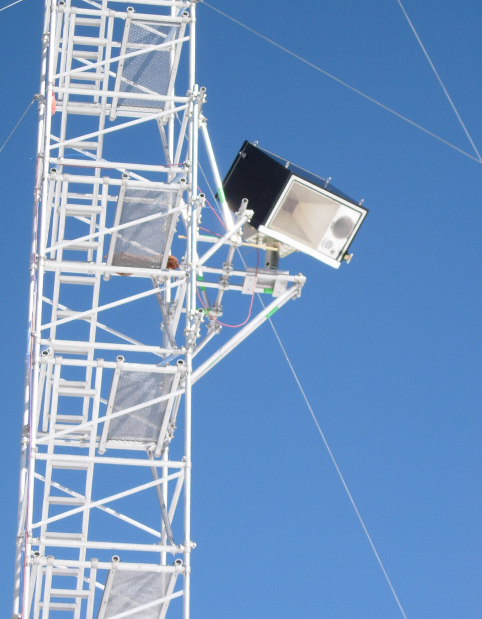
During the DOMEX experiment, microwave radiometers at 1.4 and 6.8 GHz designed and developed at the IFAC laboratories and used in recent years for studies on agricultural and mountainous areas, were adapted for the extreme Antarctic conditions. The instrument package was installed on a mechanical platform and fixed to a 32 m pre-existing observation tower used for the calibration of optical space-borne sensors. The platform was mounted on the observation tower at a height of about 13 m above the surface of the ice. The instrument package provided thermal control, and an autonomous sampling capability, making it possible to perform angular scans and regular cold sky calibrations. Data were collected continuously 24 hours per day for 20 days, at various incidence and azimuth angle combinations. The area observed by the radiometers is part of a protected area where the snow is pristine and undisturbed by human activity.
The physical characteristics of the snow were also monitored during DOMEX. Several snow pits were manually excavated in an area of 2 km x 2 km (down to a maximum depth of 4 m) and conventional measurements of snow parameters (grain shape and size, snow density, temperature and hardness) were carried out along vertical profiles. The dielectric constant of the snow was measured using an electromagnetic probe (at L-band). In addition, the temperature profile of the first 10 m of the snow pack was measured continuously by using 10 probes embedded in the snow.

The results of DOMEX confirmed the stability of the microwave emission on a monthly time-scale, while snow measurements emphasised the spatial uniformity of the area. A comparison of the C-band measurements, taken at an incidence angle of 55 degrees, with satellite data from the AMSR-E showed a very close agreement between the two measured brightness temperatures.
The possibility of using this area as an extended calibration target for future space-borne radiometer missions is confirmed. However, it will be important to extend the time interval of measurements to a minimum of the entire summer period, and to evaluate the spatial uniformity over a larger area to confirm that these conclusions are robust throughout all seasons. In order to investigate these aspects, a new experimental campaign is currently being planned within the framework of the SMOS Calibration and Validation Programme.