SMOS joins forces with top weather forecasting system
As of yesterday, 11 June 2019, measurements from ESA’s SMOS mission are being fully integrated into ECMWF’s forecasting system, allowing for a more accurate description of water content in soil.
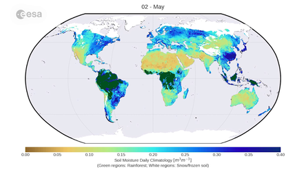
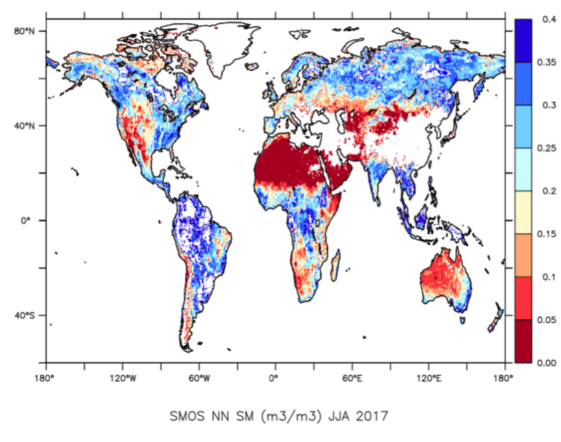
Since its launch in 2009, ESA’s Soil Moisture and Ocean Salinity (SMOS) mission has been providing global observations of emissions from Earth’s surface, particularly soil moisture and ocean salinity – two important variables in the water cycle.
Accurate weather forecasts are paramount for both commercial and leisure activities. The European Centre for Medium-Range Weather Forecasts (ECMWF) is the leading agency to provide global accurate weather forecasts. Its Integrated Forecasting System (IFS), a gigantic numerical weather prediction model, provides weather predictions 24 hours a day, seven days a week.
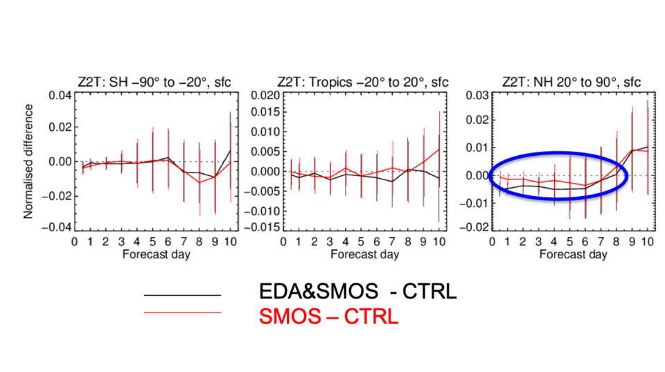
Patricia de Rosnay, the Coupled Assimilation team leader at ECMWF comments that, “When using SMOS measurements in our operational forecasting system, we get a better description of the spatial distribution of the water in the soil.
“These are important measurements to understand the complex interactions between the land surface and the atmosphere, which is crucial for our forecasting system.”
The weather is a complex process and a good prediction largely depends on the knowledge of Earth’s atmosphere provided through a variety of observations from satellites, in situ data, balloons, buoys and other observing systems.
These data need to be available fast in order to be beneficial for predictions. Producing geophysical soil-moisture measurements takes around eight hours after sensing.
A clever technique used to accelerate the production of these data is machine learning, for example using an artificial ‘neural network’, which computes values of soil moisture from the satellite within seconds. It was adapted by CESBIO and LERMA to generate the information needed for operational forecasts.
“Machine learning techniques are computationally efficient and are very fast tools to process large datasets quickly. Using neural networks was the key for the integration of SMOS measurements in time for the weather forecast,” says Nemesio Rodriguez-Fernandez from CESBIO, and who designed and trained the neural network prior to the operational integration done by ECMWF.
Using measurements from an Earth explorer satellite in 24/7 operations is a major achievement. So far, only SMOS measurements over land are being used to support general weather forecasts. Considering SMOS provides information in all weather conditions, SMOS also delivers new information for tracking hurricanes and measuring thin sea ice.

In the future, the information provided by SMOS over oceans and the polar regions may also be used in combination with Earth-system models and data assimilation systems.
ESA’s SMOS mission scientist, Matthias Drusch, said, “Integrating SMOS measurements into ECMWF’s forecasting system has been a major endeavour that started more than 15 years ago. This success story shows how models and even operational applications benefit from new observations.”
So far, SMOS is the only Earth explorer satellite providing measurements operationally for global medium-range weather forecasts. Currently, data from ESA’S Aeolus mission are being tested at ECMWF for operational forecasting system to be used in the near future.