Ten year-old Dragon gains new strength
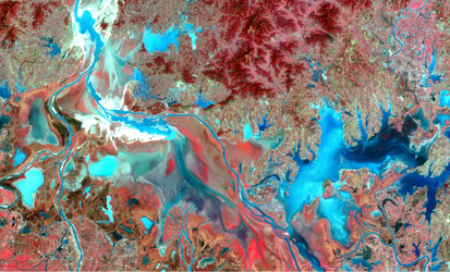
As ESA and China mark a decade of cooperation, imagery over China’s Poyang lake is testament to the new Sentinel satellite’s promise of continued radar data acquisition for a multitude of applications.
The Poyang lake in southern China’s Jiangxi province is the largest freshwater lake in the country.
This lake is an important habitat for migrating Siberian cranes – many of which spend the winter there. The basin is also one of China's most important rice-producing regions, although local inhabitants must contend with massive seasonal changes in water level.
In addition to seasonal changes, a team of scientists working under ESA’s Dragon programme have identified an overall decrease in water level in the lake over the last decade.
Led by Prof. Huang Shifeng from Beijing’s Institute of Water and Hydraulic Resources and Dr Hervé Yesou from SERTIT in France, the team used radar and optical imagery primarily from ESA’s Envisat satellite, supplemented with data from ESA Third Party and Chinese missions.
The Envisat mission ended in 2012, but the recently launched Sentinel-1A satellite continues the legacy by providing high-resolution radar data for inland water monitoring, among many other applications.
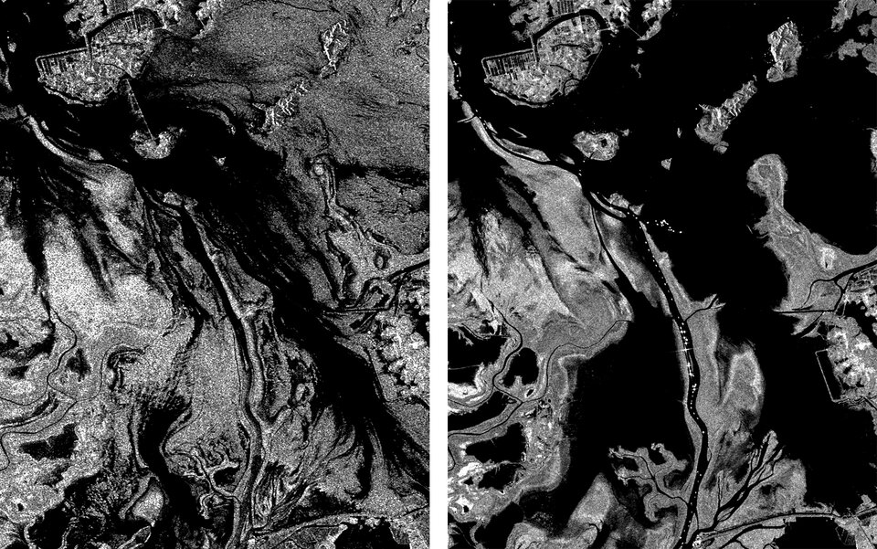
The scientists are using the data to improve our understanding of the lake’s water surface dynamics – information useful for flood mitigation, habitat mapping, ecological characterisation and measuring the water cycle’s impact on human health.
The project also concentrates on a unique synergistic exploitation of data from different types of space-based sensors – synthetic aperture radar, optical and altimeter – for water monitoring. As new radar data from Sentinel-1 become available, combining these new data with 20 years of measurements from previous satellite radar missions is key for mapping the long-term changes of this and other areas across the globe.
Poyang is just one of the many project areas of the collaborative Chinese-European Dragon Programme, which marks its ten-year anniversary this week.

As a joint undertaking between ESA and the National Remote Sensing Center of China (NRSCC), under the Ministry of Science and Technology (MOST) of China, the programme promotes the use of ESA, Third Party Mission and Chinese Earth observation satellite data within China for science and applications.
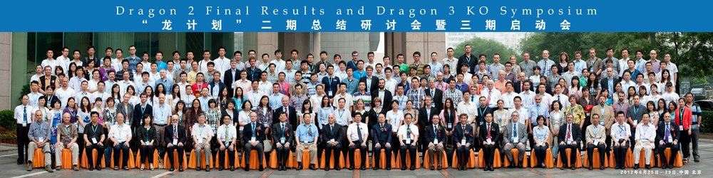
Over the past decade, the programme has significantly grown. The annual Dragon symposium held this week in Chengdu, China, was attended by MOST Vice Minister, Dr Cao Jianlin, and saw over 300 participants – double the number at the inaugural symposium in 2004. This programme has been recognised by both NRSCC and ESA as a model for successful scientific cooperation between Europe and China.
The programme’s scientific coordinators, Prof. Zengyuan Li from NRSCC and Yves-Louis Desnos from ESA, highlighted the achievements from 10 years of cooperation.
“The application fields of remote sensing have been developed in some new domains through Dragon’s joint researches, and more than 500 top-level scientific papers have been published,” said Prof. Li.

Mr Desnos stressed: “Over 750 PhD-level students have been trained under Dragon to scientifically exploit Earth observation data.
“Over 130 young scientists from Europe and China are participating in the research projects, bringing new ideas and preparing for the future.”
The symposium participants said they are looking forward to the availability of the first data from the Sentinels to further scientific research within the Dragon cooperation. ESA and NRSCC are discussing the next steps for the continuation and strengthening of the Dragon flagship cooperation beyond 2016.
The Sentinel satellites are being developed for Europe’s Copernicus environment monitoring programme. The first, Sentinel-1A, was launched in April from Europe’s Spaceport in French Guiana. The radar is still being calibrated, but early acquisitions provide an example of the kind of operational data the mission will provide.