Agency
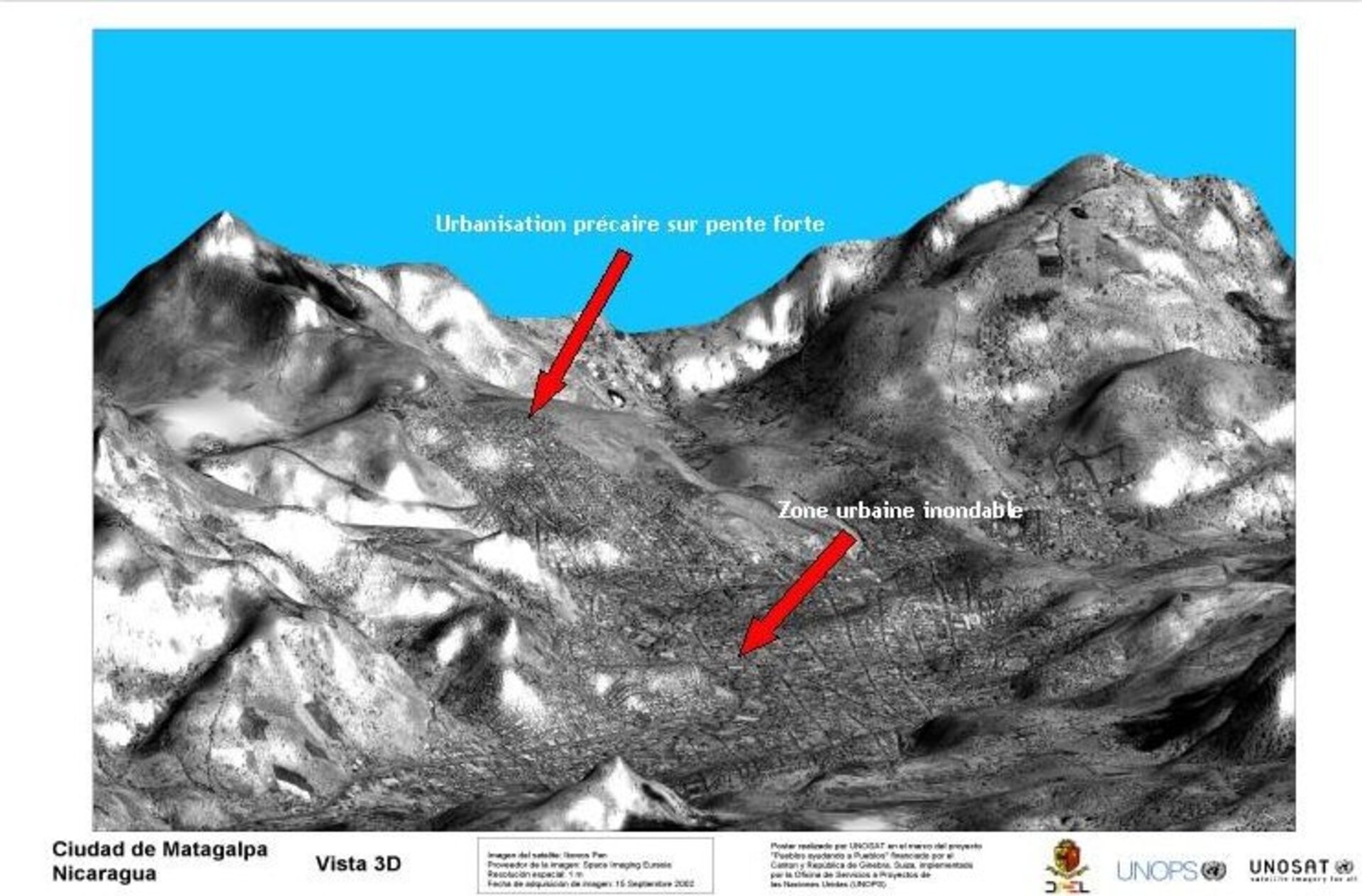
UNOSAT data highlights flood and landslide danger
This UNOSAT-provided three dimensional image of Matagalpa in Nicaragua identifies areas at high risk of flooding and landslides, for safer urban development planning. Matagalpa suffered badly during Hurricane Mitch back in 1998.