Applications
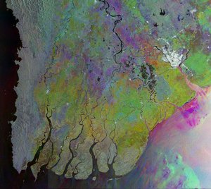
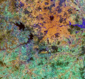
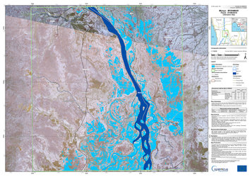
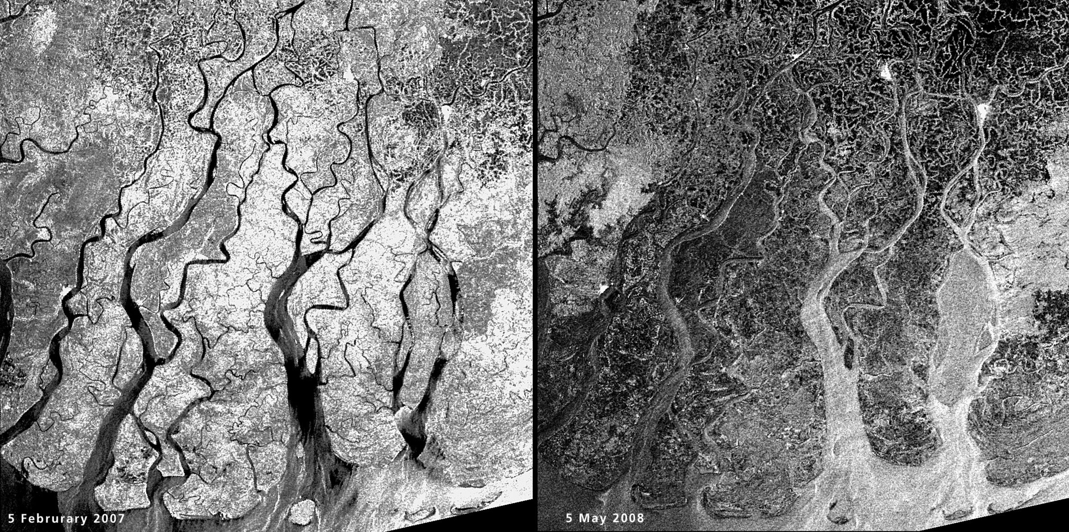
Flooding in the Irrawaddy delta, Myanmar
These Envisat radar images highlight the extent of flooding in the Irrawaddy delta caused by the cyclone Nargis that hit Myanmar on 3 May 2008, devastating the country. The left image, acquired on 5 February 2007, shows the situation approximately one year ago. The black and dark areas in the image on the right, acquired on 5 May 2008, indicate areas potentially still flooded two days after the event. Envisat’s Advanced Synthetic Aperture Radar (ASAR) data are especially well suited for delivering information on floods, which are usually accompanied by rain and therefore cloudy conditions. Radar sensors can peer through clouds, rain or local darkness and are especially sensitive to moisture on the ground.