Applications
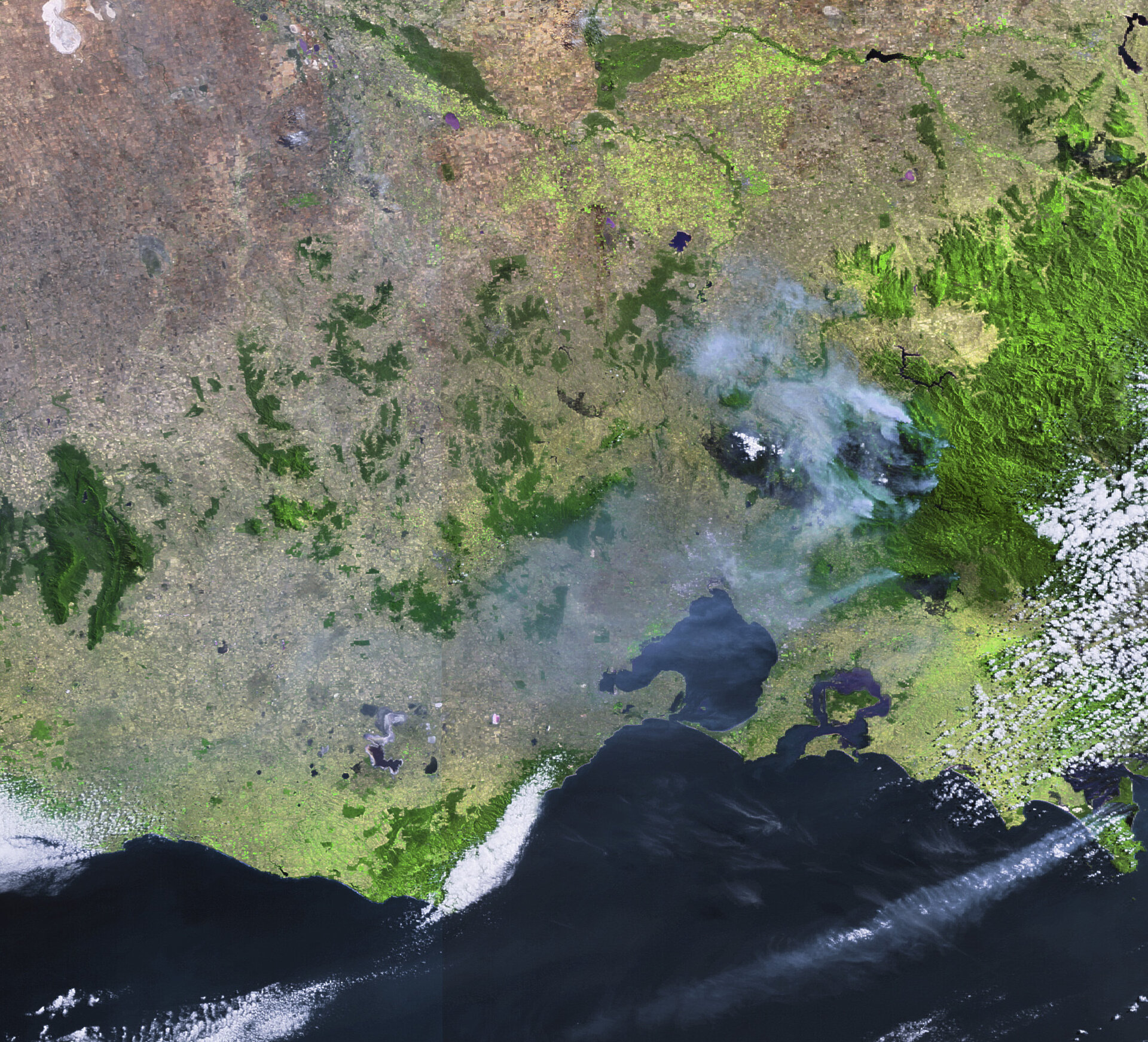
Australia’s deadliest wildfires captured by Envisat
This Envisat image taken on 16 February 2009 captures the devastation of Australia’s deadliest wildfires that have scorched more than 3 900 km² of the state of Victoria and claimed more than 200 lives. Satellites not only detect smoke billowing from major fires but also the burn scars left in their wake. In this image, burned areas from the Kinglake Complex, Bunyip and Wilsons Promontory National Park fires are all visible in black.