Agency
Crop status
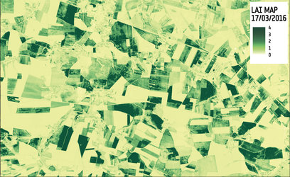
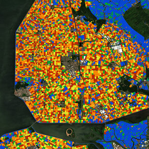
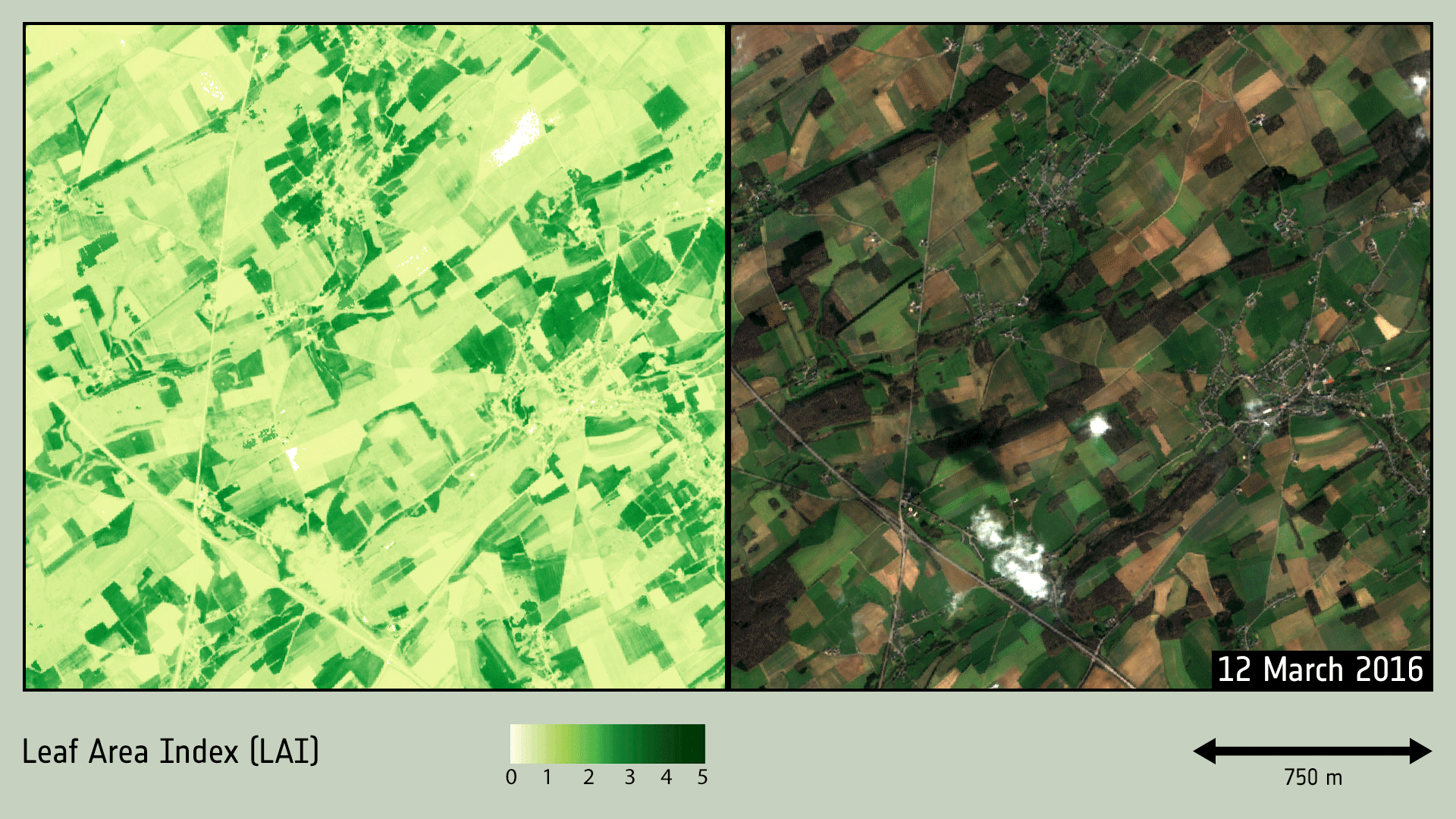
Mapping product indicating crop status. Satellite data can provide information about soil conditions and plant stress. This information is then exploited to optimise field management and, ultimately, plant growth.
Mapping product indicating crop status. Satellite data can provide information about soil conditions and plant stress. This information is then exploited to optimise field management and, ultimately, plant growth.