European Satellite Navigation
Satellite navigation has become part of our daily life. Beyond the transport sector where it enhances safety, efficiency and comfort, it is also used in very different areas such as agriculture, rescue operations networks management and banking.
In the early 1990s ESA initiated research and development programmes in cooperation with the European Commission and the Civil Aviation community, leading to:
EGNOS, the European Geostationary Navigation Overlay Service. Operational since 2011, EGNOS improves the performance of GPS and provides vertical guidance for aviation, for example in facilitating landing procedures in small airports.
Two test-satellites GIOVE-A and B. These have prepared the way for a full Galileo constellation, and demonstrated key technologies in a very specific orbit and environment.
The first four operational satellites for Galileo, launched in 2011 and 2012, for a complete In-Orbit Validation and Qualification of the Galileo design.
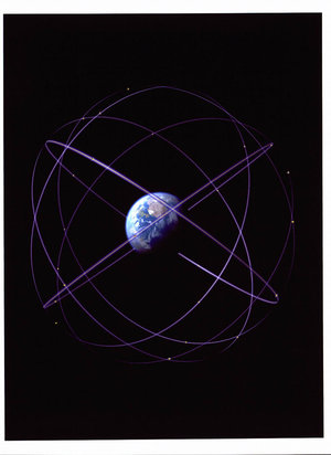
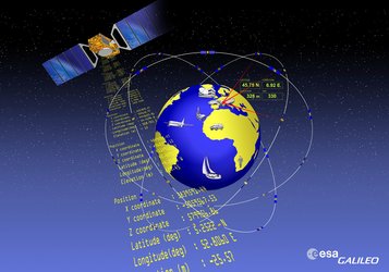
The fully deployed system will consist of 30 satellites circling Earth at an altitude of 23,000 km and will be operated by a worldwide network of ground stations.
Galileo will be Europe’sown global satellite navigation system, compatible and interoperable with the existing American GPS and Russian GLONASS military-controlled systems.