Applications
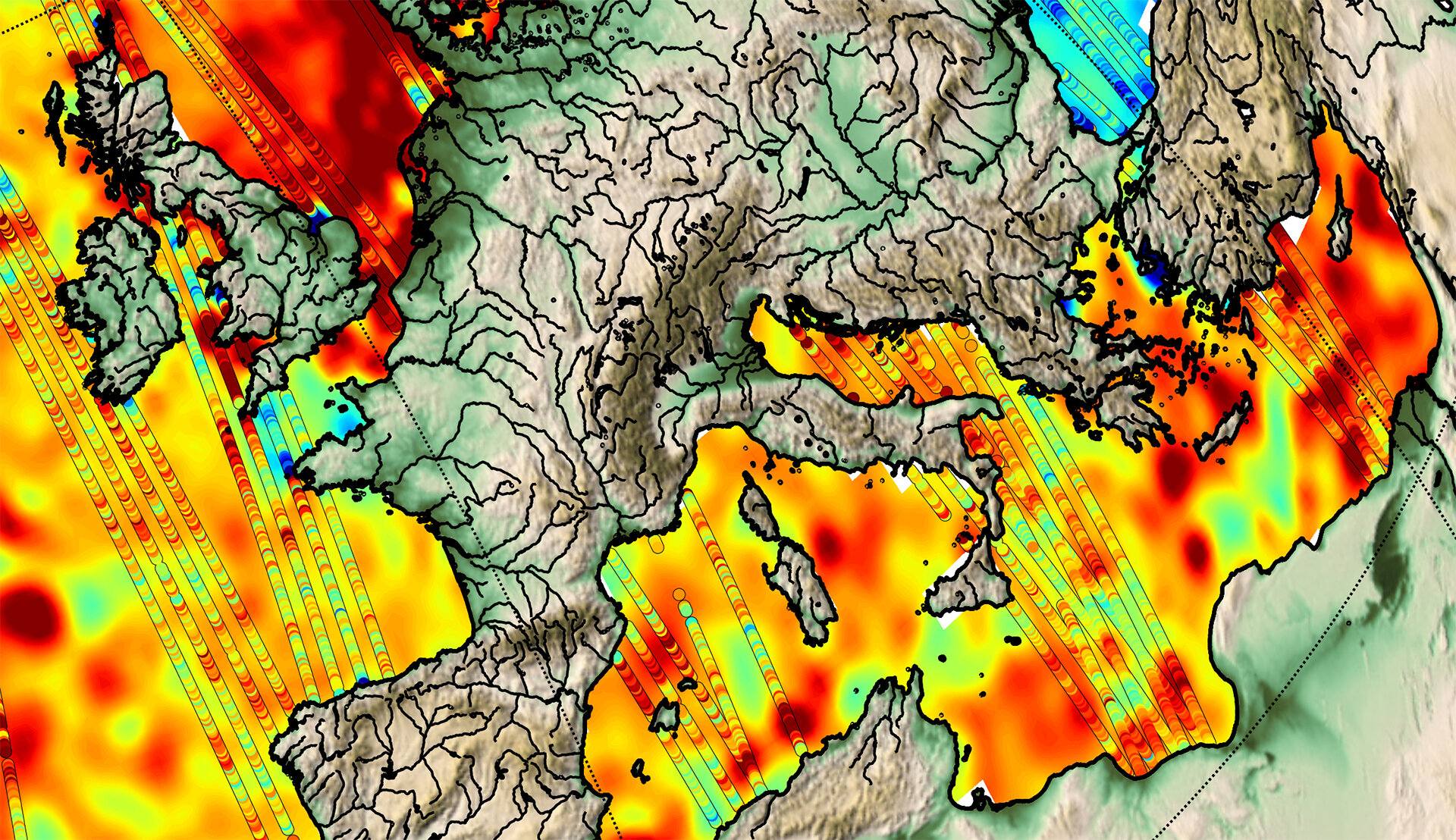
Sea-level detail from CryoSat
Detail of sea-surface topography: red represents higher sea levels while blue areas are lower. The ‘strips’ are the CryoSat satellite’s ground tracks. See larger map.
Detail of sea-surface topography: red represents higher sea levels while blue areas are lower. The ‘strips’ are the CryoSat satellite’s ground tracks. See larger map.