

Space technology helps find space, reduce pollution, and save money
Today, freight transport by lorries and containers is a highly automated and optimised business. However, even with the best planning possible, useful space is often left empty. Two German inventors have come up with an idea on how to use satellites to improve the allocation of lorry capacity.
At the 2008 European Satellite Navigation Competition, backed by ESA's Technology Transfer Programme, German T-Systems/DHL Innovation Center put up a prize for the best idea on how to utilise transport capacity better. They were looking for a solution to scrutinise vehicles' shipping space and identify and localise unused capacity automatically, which would then be filled by short-notice shipping orders.

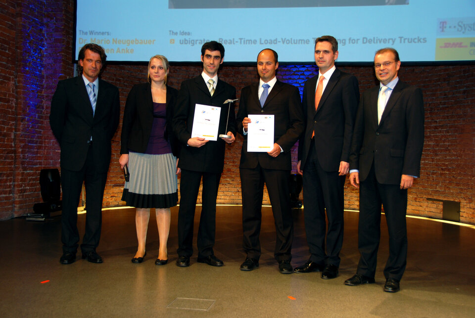
Dr Mario Neugebauer and Dr Jürgen Anke from German company 'ubigrate GmbH' came up with an intelligent solution to locate available load volumes in real time, and won the prize.
"Very often, companies do not know the exact load volume and available space in their trucks. They use packing plans to optimise the usage, but in reality it is difficult to follow the exact packing plans, and space is often not fully used. That is why it is important to be able to track the available load volume in real time, which is what we do with our solution," explained Anke.
The remarkable quality of the idea is that it creates win-win situation. Reducing human-emitted greenhouse gases will often lead to higher costs or services of lower quality. In this case, the opposite is true: ubigrate's solution will not only reduce the overall carbon dioxide emitted by the lorries, it will also result in a better service at a lower cost.
A better service with the help of satellites
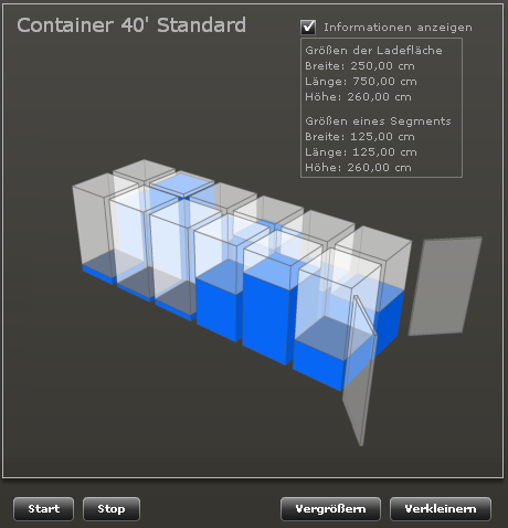
The 'Load-Volume Tracking' (LoVoTrack) system uses ultrasonic sensors, mobile communication and satellite navigation to obtain information on the load status of lorries and containers.
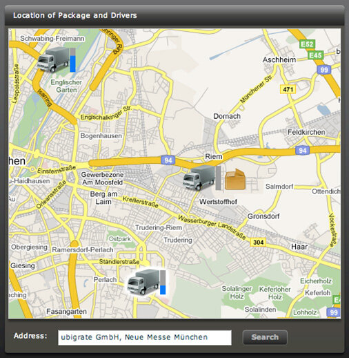
"We installed sensors on the ceiling of each container, which continuously monitor the available empty volume. This information, together with the precise satellite navigation data of where the truck is located, is transmitted via a common cellular phone network to a central server which follows the whole fleet of trucks of the transportation company. It is then easy to assign new packages to where volume is available," said Neugebauer.
In practice, this system can handle new requests for transporting parcels more quickly. Instead of inserting the pickup and transportation time in a packing plan, which is then integrated into a delivery schedule at the earliest a day later, the central server can identify the nearest lorry with available space in real time.
Neugebauer emphasised that "the best working solution also has the best ecological impact. By reducing the overall empty space inside a container, we increase the overall efficiency of transportation and are therefore able to reduce the amount of pollution per transported object, including carbon dioxide emissions."
The advantage of the ubigrate solution that made it win the final prize was that "it showed an innovative approach to measure the available free space, and an easy and robust way of device installation," and it "is very scalable and therefore can be used in different trailer and container scenarios," emphasised T-Systems/DHL Innovation Center's jury member Ralf Nejedl, Director of the Galileo Programme at T-Systems Enterprise Services GmbH.
At the Navigation World area of the Munich ICT 2008 Trade Fair, ubigrate presented an early prototype of the solution, which has since been developed collaboration with T-Systems/DHL Innovation Center.
The European Satellite Navigation Competition (ESNC)
The ESNC is an international innovation contest that rewards the best ideas in satellite navigation applications. The competition has been organised by Anwendungszentrum GmbH Oberpfaffenhofen since 2004, and is oriented towards companies, entrepreneurs, research institutes, universities and private individuals.
ESA’s Technology Transfer Programme Office (TTPO) has been a partner in the contest since 2005, and this year is awarding a €10 000 prize to the applicant with the best innovative business plan. The ESNC is intended to strengthen international collaboration, particularly in the development of applications and services made possible by Galileo, Europe’s satellite navigation system.
ESA’s Technology Transfer Programme Office (TTPO)
The main mission of the ESA TTPO is to facilitate the use of space technology and space systems for non-space applications, and to demonstrate the benefits of Europe’s space programme to European citizens. The TTPO is responsible for defining the overall approach and strategy for the transfer of space technologies, including the incubation of start-up companies and their funding. For more information please contact:
ESA’s Technology Transfer Programme Office
European Space Agency ESA - ESTEC
Keplerlaan 1, 2200 AG, Noordwijk ZH
The Netherlands
Phone: +31 (0) 71 565 6208
Fax: +31 (0) 71 565 6635
Email: ttp @ esa.int
Website: http://www.esa.int/ttp

