ESA satellites help Kenyan farmers access loans
Two thirds of the African population work in agriculture, yet just 1% of commercial loans go to the sector, and very few of these are allocated to smallholder farmers. Kenyan company FarmDrive is using data from ESA's Food Security Thematic Exploitation Platform (TEP) to help smallholder farmers access the funds they need.
Life as a smallholder farmer is tough; it is difficult to predict how well your crops will grow each year and investing in quality input materials is expensive. Life becomes even more difficult when you are denied loans or offered exorbitantly high interest rates because lenders are not able to assess the risks associated with lending you money. This leaves you unbanked and underserved, and leaves lenders with an enormous gap in their potential client base.
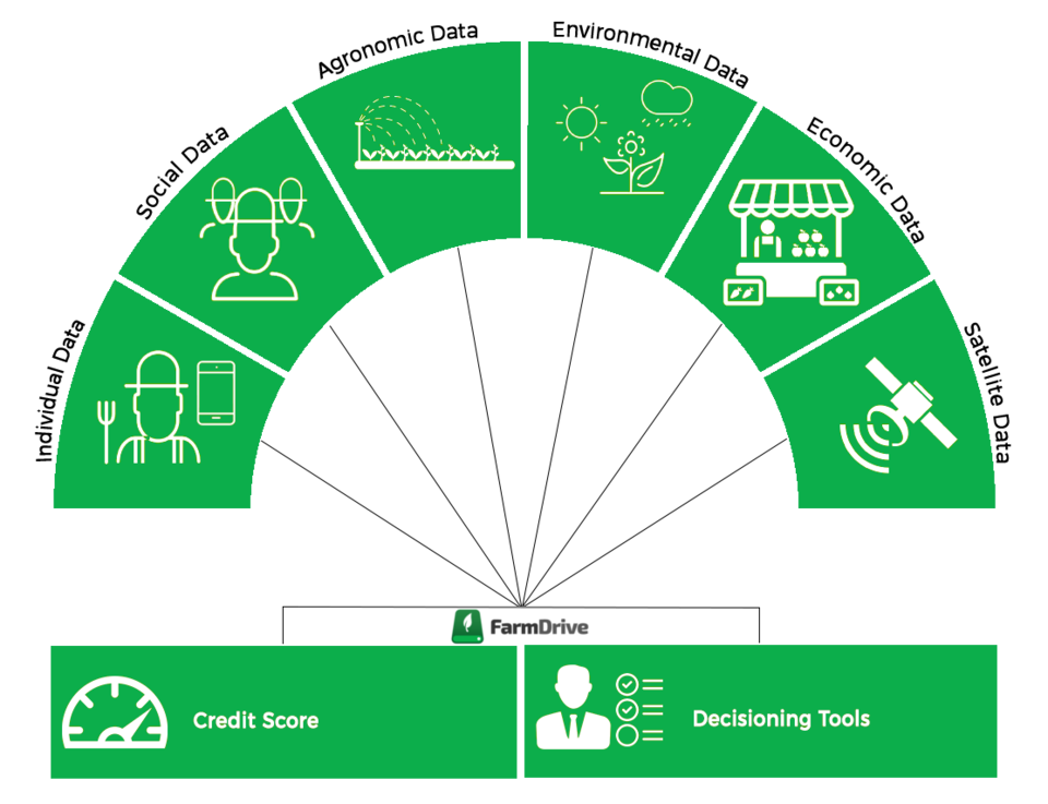
FarmDrive uses a variety of data, including on economics, agronomics and the environment, to build up credit profiles for farmers and enable them to access financial services. As part of the Food Security TEP, between 2018 and 2019 Vista Remote Sensing in Geosciences GmbH explored how Earth observation satellite data could support FarmDrive in its ambitions.
"Earth observation satellites can reduce the cost of collecting environmental data on wide geographic areas," explains Markus Muerth from Vista GmbH, which manages the Food Security TEP. “We used the TEP to deliver satellite data on crops and soil that we thought could be crucial for FarmDrive."
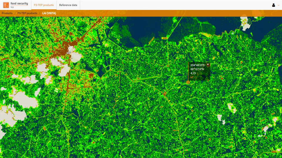
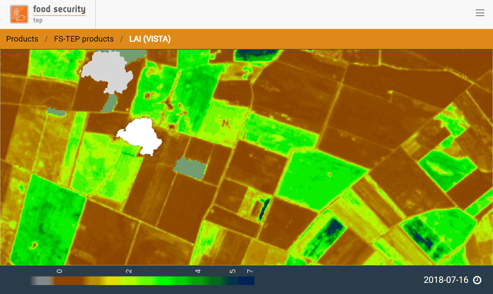
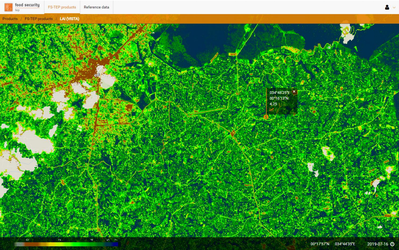
The data – which included information on soil moisture from ESA's SMOS satellite, information on leaf area index from the Copernicus Sentinel-2 mission and derived yield estimates for two different crops – were included in FarmDrive's predictive models for two pilot regions. This was a huge success; FarmDrive continues to use Earth observation data from the Food Security TEP in pre-commercial studies to assess the risk and performance of credits provided to smallholder farmers all over Kenya.
This community is one of many benefitting from the Food Security TEP, which has been freely and openly available since March 2018. From scientists to local and national administrators, from international agencies to agricultural players and many others, the platform provides Earth observation data – including from the Copernicus Sentinel-1 and -2 satellites – and derived information products and services for sustainable and efficient farming and aquaculture worldwide.
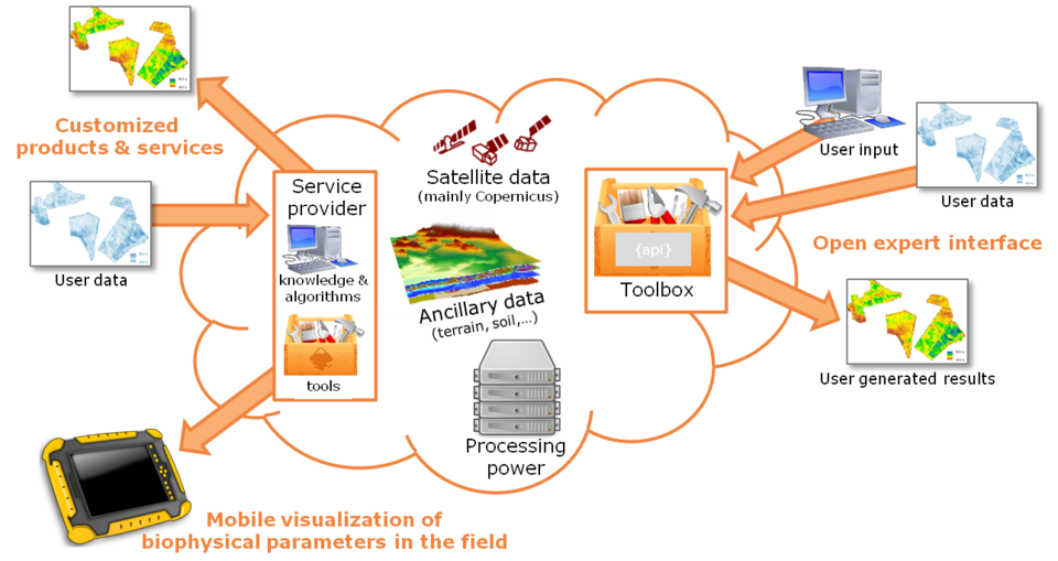
Food security is vital for supplying food sustainably to a growing population; it ensures that farming does not harm the environment in a way that ultimately decreases the available resources. The TEP supports this ambition by providing easy access to a continually evolving catalogue of data and processing tools to monitor and manage farms.
"The amount of available satellite and ancillary data is huge, and it's increasing every year, but for a long time people had to chase down the data they wanted from different websites and providers,” explains Espen Volden, who oversees the Food Security TEP from ESA’s side. "The Food Security TEP not only brings together all this data but also provides tools that help users explore and analyse them quickly and easily."
"We worked with a large group of expert users to define requirements for the platform, and continuously develop it in accordance with the needs of the community."