
Ground to Space Threat Simulator (GSTS)
| Programme: | TRP Workplan | Achieved TRL: | 3 |
| Reference: | T606-407ET | Closure: | 2016 |
| Contractor(s): | Qascom (IT), Spirent Communication (GB), RUAG (Sweden) | ||
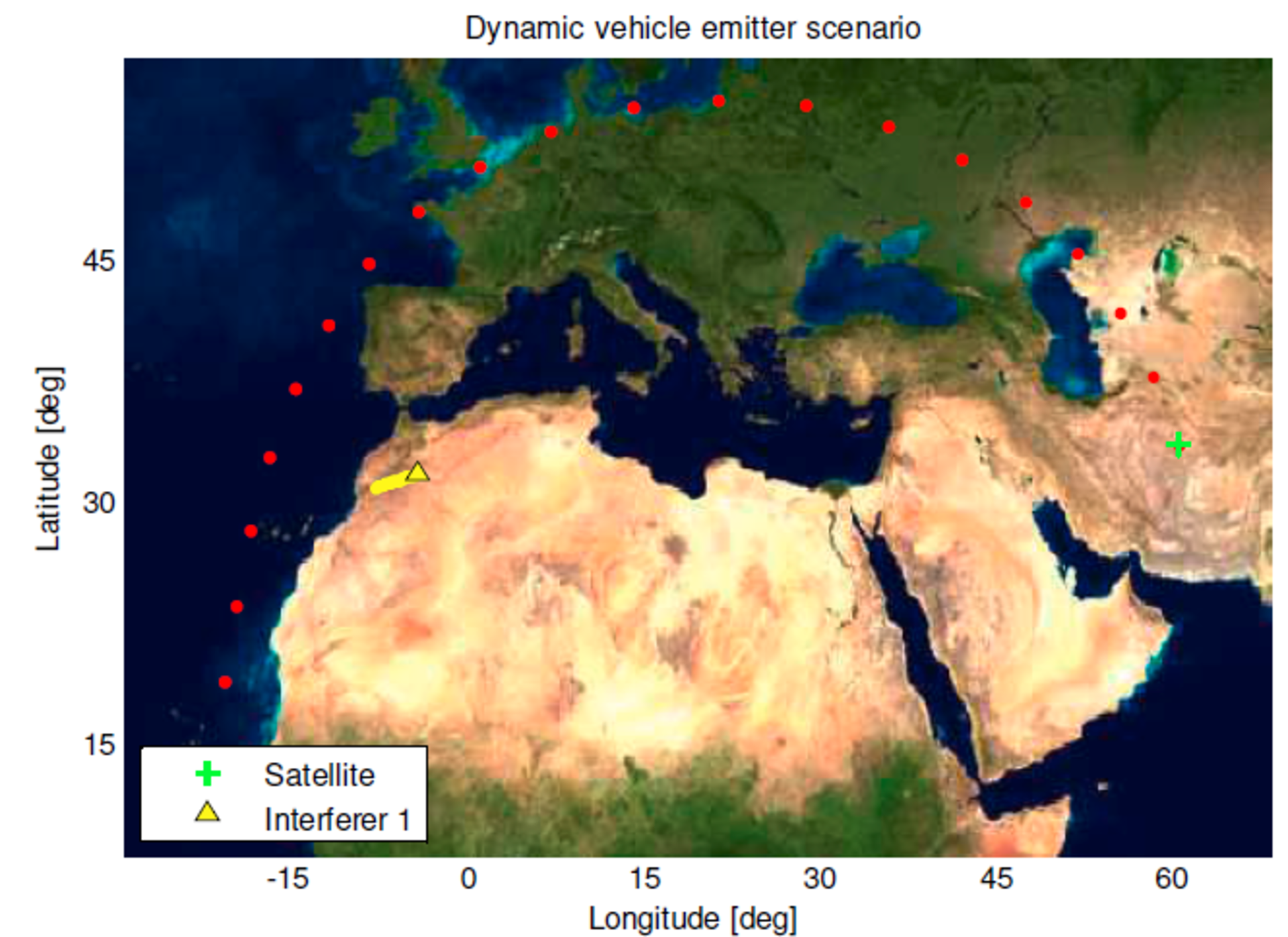
Beyond Detection and Mitigation, timely and accurate Interference Geolocation is essential to isolate and allow intervention for suppression the interfering source. However, Interference Geolocation Solution based on On-Ground and multi Satellite architecture are expensive and suffer for several limitations. On Board Geolocation offers the capability to monitor the RF interference “as seen” by the satellite and provide its Earth location.
Objectives
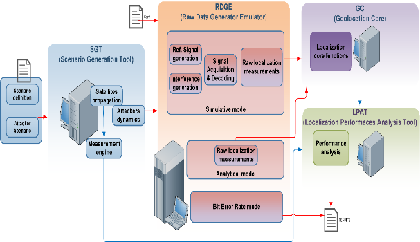
- Develop software simulator of satellite on-board technologies and algorithms for the detection and localization of on ground interference. It is intended to assess various architectures, based on synthetic raw measurements: Time, Frequency Difference of Arrival, received signal strength, Angle of Arrival (Music and ACM), and the evaluation of multiple localization techniques (Taylor Series, Extended Kalman filter and multiple hypothesis tracking). The simulator has a high degree of flexibility in terms of interferer signal type and dynamics, satellite orbits and modelling of the satellite receiver.
- Evaluate the performance geolocation and characterization techniques in realistic scenarios.
Achievements
Development of a testbed for assessment of satellite interference processing platforms including the capability of extracting location based features and geo-locating the interference sources.
Benefits
Demonstration of the feasibility of geo-locating static, dynamic and complex interference using on-board data processing from a single satellite (Low or medium Earth Orbit) with accuracy below 50 km.
Further activities
Interface of the Raw Data Generator and Geolocation Core with Hardware Testbed, design and Modelling of CAF MAP Techniques for Interference Monitoring.

