
Lidar-based relative navigation, guidance and control technologies
Mars Sample Return is one of the missions on which the Aurora exploration technology development effort is focussed. Requirements for this mission are more stringent that any mission to Mars before. Among all the challenging phases, accurate and soft landing along with rendezvous in Martian orbit are critical in such a mission.
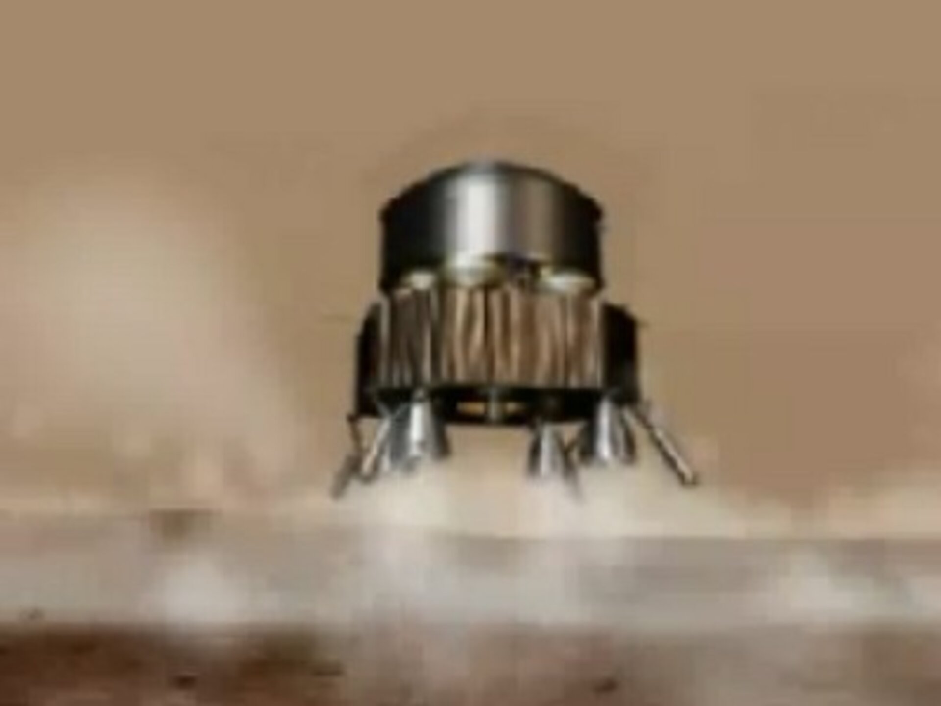
Landing on Mars has already been successfully performed relying on either airbag technology (Pathfinder, MER) or propulsive systems (Viking). Neither of these technologies is suitable to meet the MSR requirements, due either to the size of the MSR lander or the accuracy required in the descent. Indeed where hazard mapping or a landing accuracy with an order of magnitude of less than 10 km is required, an innovative technology is needed.
Basic needs for rendezvous in orbit are similar. It requires accuracy and ranging regardless of the baseline rendezvous technique, either capture or docking. For this phase, heritage from the Automated Transfer Vehicle (ATV) is helpful but not applicable as a whole because GPS cannot be used in Mars orbit.
Lidar technology is used more and more for ground applications and has been employed onboard demonstration missions. Space-based Lidar technology is designed to image a certain area (through laser scanning) and to measure relative distances and velocities with very high resolutions (typically less than one meter). Because the entry cannot be so accurate, the touch-down point ellipse remains in the order of magnitude of 10 km.
As soon as the propulsive descent starts, a few kilometres above the surface, Lidar can be used for hazard mapping and improving landing accuracy. It is necessary to implement autonomous navigation algorithms together with the Lidar sensor. The principle remains the same for rendezvous. The lidar, as an active system is made up of a laser that lights the target (ground or orbiter) and the feedback is the ranging, the relative velocity and imaging (landing only).
This activity aims to develop a simulation tool that is used to demonstrate the feasibility and to bracket the performances of this technology for both applications: soft landing and rendezvous. Also, real-time test bench definition is one of the main outputs. It was decided to split this activity into two main phases. The first results in the definition of simulation tools through design trade-offs and software definition. The second phase is devoted to software development, integration and validation to carry out a performance simulation campaign as well as test bench definition.
Lidar is an emerging technology which has been identified as one of the most sustainable technologies for exploration. As such, particular emphasis is placed on the development of this technology, with Mars Sample Return as the most likely near term exploration application.
| Start | Expected or actual duration | Status | Prime contractor |
|---|---|---|---|
| 2003 | 24 months | Completed | EADS Astrium/MDA |
Executive Summaries
Download the LIDAR-Based GN&C Executive Summary (PDF file - 1 580 KB) »»
Download the LiGNC Executive Summary (PDF file - 1 293 KB) »»