
Investigation of Earth Catastrophes From the International Space Station: Uragan Program
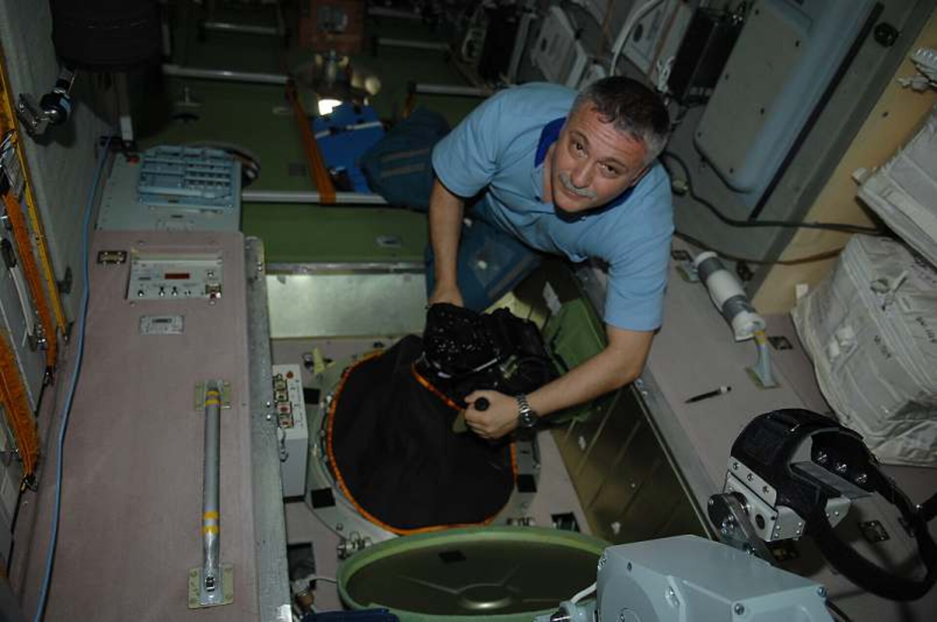
The Uragan program aboard the Russian segment of the International Space Station uses digital photography to study Earth’s natural resources by monitoring catastrophes, both natural and human made.
Uragan, which means “hurricane” in Russian, began during the first days of habitation on the station and continues to be an important Earth observation program, with the primary goal of defining requirements for a ground-space system for disaster warning and damage mitigation. The program is a logical continuation of the Earth Visual-Instrumental Observations Program (in other words, a crew Earth observation program) started in the Soviet Union/Russia in the early 1970s as part of the Salyut series of space stations and followed by the Mir orbiting complex.
In recent decades, humankind has faced various natural and human-made disasters—some with widespread damage. The Uragan program examines natural and human-made catastrophes, including earthquakes, volcanic eruptions, floods, fires, hurricanes, piping accidents and aviation accidents. Information on these types of catastrophes is beneficial to experts in various fields, governments and scientists developing models of catastrophic phenomena and many more. The space station is a convenient platform for Earth observation in that it provides a space for testing a variety of equipment, software and observation methods. Eventually, some of the items tested may be used on robotic spacecraft for remote observations.
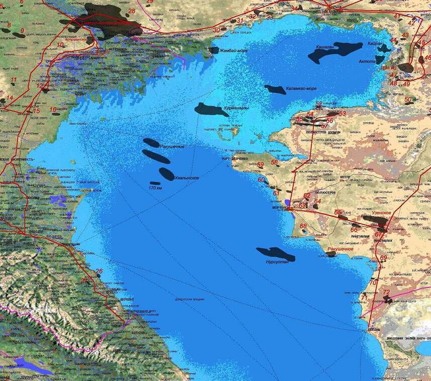
Practical needs and quick response are used as the basis for the Uragan program. Images taken from the station can be used by government agencies, scientists, and others to determine the effects of natural or human-made disasters. This program has photographed several disasters since its inception, including human-made oil pollution. In the Caspian Sea region, images taken by station crew members show how oil pollution has affected the coastal areas.
Through analysis of the images, three major areas or sources have been identified: the northeast coast in Kazakhstan, southeastern Turkmenistan, and the Absheron region of Azerbaijan. On the north¬east coast of the Caspian Sea in Kazakhstan, the large oil deposits formed water-oil lakes ranging in size from several yards or meters up to 7.5 miles (12 kilometers) across. Portions of these lakes are surrounded by ground walls to prevent flooding and contamination of the surrounding areas. The Caspian Sea level continuously fluctuates, and waves up to 9 feet (3 meters) high can be caused by strong winds. Because of the probability of floods on the coast, the potential for failure of these lake walls and corresponding oil flow into Caspian Sea waters is rather high.
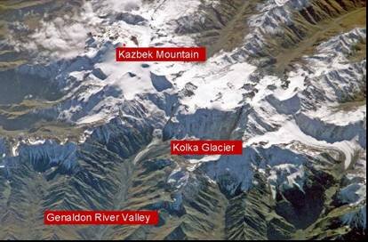
Besides human-made disasters, natural disasters are also monitored. In 2002, crew photography documented important information about a glacier-related disaster in the Caucasus Mountains. On Sept. 20, a small glacier called Kolka in North Ossetia, Russia, unexpectedly released a great amount of ice mixed with water and stones. This mass quickly traveled down the valley causing widespread destruction, loss of life and blocking a hollow in front of Rocky Ridge.
A cosmonaut’s photograph taken one month earlier on Aug. 13, 2002, showed the north part of Kazbek Mountain with the small Kolka glacier clearly in view in the upper part of the Genaldon River valley. The glacier was completely covered by stones, giving it a dark appearance. Upper reaches of the Genaldon River before and after the catastrophe were observed using the cosmonaut photographs. This glacial event was unusual, as almost the entire glacier quickly left its bed and streamed down the valley. Scientists around the world observed this rare occurrence. Crew photography taken after the disaster showed a deep, empty hollow that had been full of ice.
The mass media published many differing opinions about the catastrophe, however only the precise detailed surveys from space allowed for a thorough analysis and final determination of the reasons for the disaster. Analysis of the images by experts from the Institute of Geography, Russian Academy of Sciences, discovered clear signs of initial phase of avalanche masses motion. The specific color of ice-soil mixture and changes of structure of the glacier cover indicated melting of the inner layers of the glacier which gives lubrication for the avalanche flume. Such well planned monitoring improves the ability to predict such disasters in advance.
Other important results obtained within the framework of the Uragan program include observations of floods, forest fires, glacial hazards, reservoirs, seaports, icebergs, and other objects and phenomena. Further development of the program is related to the use of additional equipment for observations in the microwave, infrared and ultraviolet ranges, together with development of mathematical models for investigation of catastrophic phenomena. This program continues to capture images of disasters and through analysis, benefiting all humankind.
Igor V. Sorokin
S.P. Korolev Rocket and Space Corporation Energia
