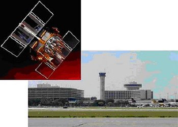
• → European Space Agency

      • Space for Europe
      • Space News
      • Space in Images
      • Space in Videos
    • About Us

      • Welcome to ESA
      • DG's News and Views
      • For Member State Delegations
      • Business with ESA
      • ESA Exhibitions
      • ESA Publications
      • Careers at ESA
    • Our Activities

      • Space News
      • Observing the Earth
      • Human Spaceflight
      • Launchers
      • Navigation
      • Space Science
      • Space Engineering
      • Operations
      • Technology
      • Telecommunications & Integrated Applications
    • For Public

    • For Media

      • Media
      • ESA TV
      • Videos for professionals
      • Photos
    • For Educators

    • For Kids

    • ESA

    • Navigation

    • EGNOS

    • Galileo

    • Applications

    • Galileo’s clocks
    • Europe's satellite navigation services
    • Galileo partners
    • Satellite anatomy
    • Galileo on the ground
    • Next steps
    • Resources
    • Development Facilities
    • Navigation applications helpdesk (email)
    • Multimedia
    • Image gallery
    • Media Centre
    • Screensavers & Wallpapers
    • Video gallery
    • RSS feeds
    • Press Releases

    ESA > Our Activities > Navigation > Navigation Applications

    Aviation

    Improving aviation safety with EGNOS
    Improving aviation safety with EGNOS

    When planning aircraft routes and landing schedules at busy airports, it is essential to ensure that aircraft are always a safe distance from each other. "The trouble is you don’t always know where the planes are, so you have to leave a very large safety margin," says Hans Fromm, former Deputy Head of the Navigation Department at the European Space Agency (ESA). "But if you could be confident of knowing precisely where the planes are, you could reduce the margins safely and increase capacity," he adds. EGNOS and Galileo, the satellite navigation system under development in Europe, will provide a guaranteed service with sufficient accuracy to allow airlines and pilots to know their position reliably and precisely enough to make substantial efficiency savings.

    Last update: 6 June 2007

    Rate this

    Views

    Share

    • Currently 0 out of 5 Stars.
    • 1
    • 2
    • 3
    • 4
    • 5
    Rating: 0/5 (0 votes cast)

    Thank you for rating!

    You have already rated this page, you can only rate it once!

    Your rating has been changed, thanks for rating!

    8
    Tweet
    • Aviation projects
      • EGNOS TRAN - Aviation
        • GNSS for Airport Movements Monitoring and Alerting - GAMMA
          • Management and Supervision System for Special Aircraft Operations (MASSAO)

    Connect with us

    • RSS
    • Youtube
    • Twitter
    • Flickr
    • G+
    • Facebook
    • Livestream
    • Subscribe
    • App Store
    • LATEST ARTICLES
    • · Rare merger reveals secrets of gal…
    • · Watching for hazards: ESA opens as…
    • · ESA astronaut Timothy Peake set fo…
    • · Space drives e-mobility
    • · Proba-V opens its eyes
    • FAQ

    • Jobs at ESA

    • Site Map

    • Contacts

    • Terms and conditions