New tools aid volcanic ash monitoring
While satellites are providing an ideal way of monitoring the cloud of volcanic ash sweeping across much of Europe recently, a ground-based network of lidar instruments has also been providing a valuable source of information to help meteorologists assess this unprecedented event.
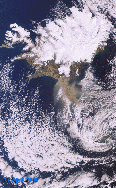
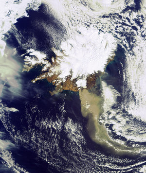
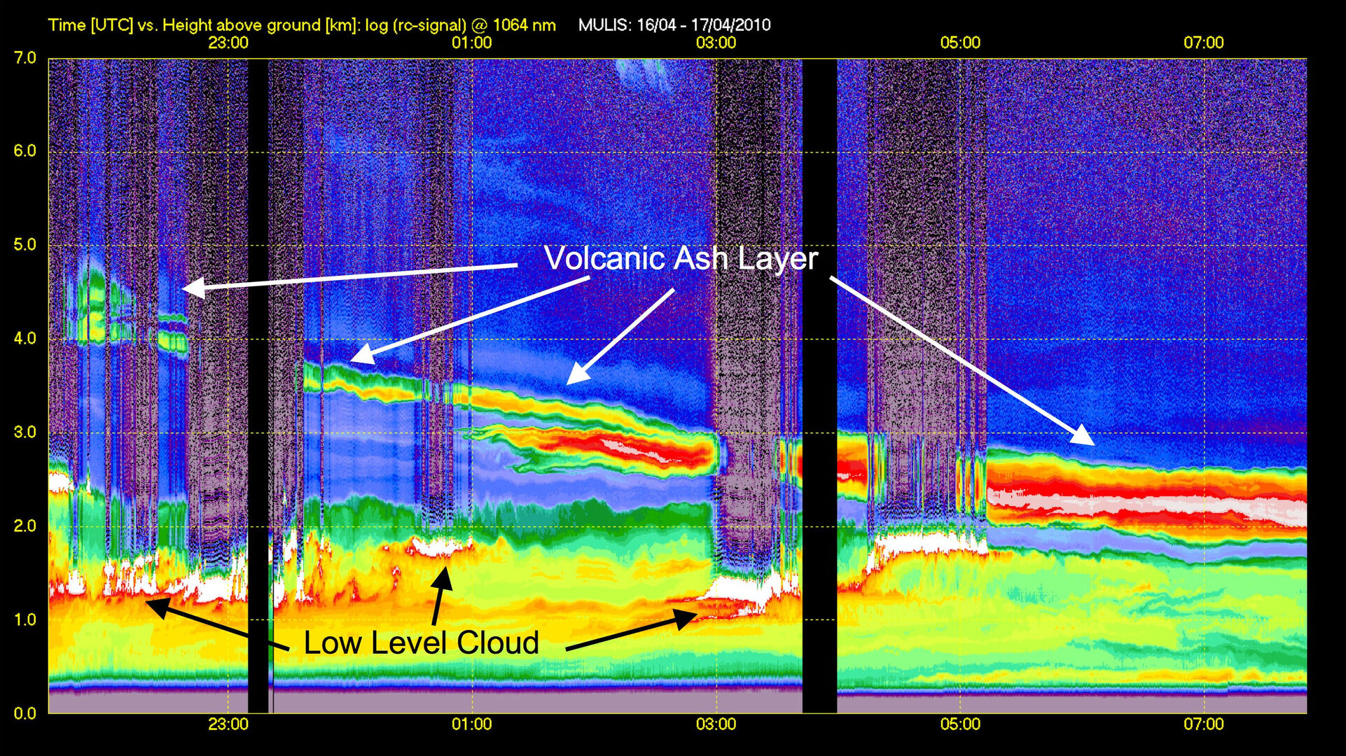
The Earlinet network of lidar stations has been closely monitoring the cloud of volcanic ash from the Eyjafjallajoekull volcano in Iceland since it started erupting on 15 April. The network, which comprises 26 different stations across Europe, uses lidar, short for 'light detection and ranging', instruments that shoot powerful bursts of light from a laser into the sky to acquire information on the physical properties of the atmosphere.
As the light travels through the atmosphere, it interacts with molecules of gas, droplets of water and particles of dust or ash. Since some of the light is 'backscattered' to the instrument on the ground, it is possible to work out the distance of the 'scatterers' by differencing the time between sending and receiving the light. This method offers an excellent opportunity to monitor particles of airborne ash from the ground.

ESA's General Studies Programme is currently funding Earlinet to establish a database of atmospheric profiles that show the presence of clouds and aerosols to support two of the Agency's Earth Explorer missions currently in preparation. The two missions, ADM-Aeolus and EarthCARE, will both carry lidar instruments to advance our understanding of the atmosphere from space.
ADM-Aeolus will be the first space mission to directly measure wind profiles on a global scale and EarthCARE will acquire vertical profiles of clouds and aerosols to improve our understanding of the role they play in climate regulation.
With air traffic paralysed in the last days as the huge plume of volcanic ash drifted across much of European, the Earlinet network was able to make a significant contribution to the monitoring the situation by validating meteorological model simulations that were subsequently being provided to the Volcanic Ash Advisory Centres.

The data collected by Earlinet comes in form of profiles, which clearly showed depth and density of the cloud of volcanic ash. Data from NASA's Calipso mission, the only Earth observation mission currently in orbit that carries a lidar, also contributes to these datasets.
In addition, measurements taken from the DLR German Aerospace Center's Dassault Falcon 20E research aircraft, which carries a downward looking lidar, were also incorporated into the network's data.
The cloud of volcanic ash created an unprecedented situation with European air traffic being grounded for almost a week – a situation that required a collaborative approach between various institutes and agencies to provide accurate information to the decision makers. Moreover, the opportunities that the ground-based lidar network offers are expected to be exploited further in the future.
For further information please contact:
Paul Ingmann
ESA Earth Observation Mission Science Division
Tel: +31 71 565 4459
Email: paul.ingmann @ esa.int
Andrés Gálvez
ESA General Studies Programme Manager
Tel: +33 1 5369 7623
Email: andres.galvez @ esa.int