"A multipurpose tool with high potential": EO Director Volker Liebig discusses GMES
Volker Liebig is the European Space Agency’s new Director for Earth Observation Programmes. On 1 October 2004, he also became Head of ESA’s Space Research Institute (ESRIN) in Frascati, Italy. With Earth and Space Week beginning in Brussels, the Director shares his outlook on one major Earth Observation initiative.
Born in 1956 in Lübbecke, Germany, Volker Liebig studied at the University of Munich, completing a thesis on geomagnetism in polar regions. As part of his research, he took part in an expedition to Antarctica.
He has also worked in the space industry, at Kayser Threde in Munich, and took over the Earth Observation (EO) division of the former German space agency DARA, which has since merged with the German Aerospace Centre (DLR). From 2000-2004, Dr Liebig was DLR Programme Director.

'Global Monitoring for Environment and Security' (GMES) is a joint venture of ESA and the European Commission. What is the specific role of ESA in this programme?
"GMES will deliver independent European monitoring capabilities from space for environment and security. It will also incorporate data from airborne and in situ instruments. ESA is developing and implementing the space component with the corresponding ground segment.
"This is the model of co-operation set out in the Framework Agreement between ESA and the EU, and in the new EU Treaty. In addition to its function vis-a-vis its own Member States, ESA is the implementing agency for the European Union when it comes to space projects."
Does this mean that the GMES programme will become the main activity of your Directorate?
"ESA’s Earth Programme will have three main activities. One is the continuation of the very successful EOEP, the Earth Observation Envelope Programme. In the context of the Earth science mission, specific technologies are being developed which will be key to future applications and the continuity of the Explorer missions, the backbone of our ‘Living Planet Strategy’. Every methodology starts with science. We plan to implement and launch an Explorer mission every two years, addressing issues selected by the scientific community. The related science and technologies will in many cases be the basis for future operational missions.
"Bringing these technologies and the associated science methodologies to maturity is our second objective. This will translate into operational missions like GMES. This explains the importance of our EOEP. Of course, GMES will become the second and biggest element of our programmes. In preparation for GMES, we are already working on initial operational services to support the implementation of European policies.
"The third element of our programme is co-operation with Europe’s meteorological satellite organisation (Eumetsat) for which ESA develops satellites such as Meteosat Second Generation and Metop. This long-standing co-operative relationship has been very successful for meteorology and is a good model for the implementation of GMES."
Will GMES missions run in parallel with the Earth Explorer and Earth Watch missions of the Living Planet programme? What is the status of these missions?
"When we drafted the Living Planet strategy, we added the category of Earth Watch missions, covering operational and commercial satellites. The Meteosat and Metop spacecraft of Eumetsat are in fact Earth Watch missions. We have other elements in prospect: the Spanish Fuegosat system for fire detection and the TerraSAR venture of InfoTerra. We are also working on the ground segment for TerraSAR. Both missions have the potential to be part of GMES in the future.
"GMES will not only consist of missions developed by ESA but will also encompass missions from Member States or industry. ESA will not duplicate existing work, but will try to close data gaps and deliver monitoring services that have been identified in co-operation with the Commission."
Will GMES include national missions?
“ESA is proposing to bridge the gaps in operational remote sensing capabilities using the Sentinel satellites. The Sentinels will not replace existing sensors nor will they duplicate the work of satellites planned as national initiatives. The Sentinels are complementary. National programmes should and will be part of GMES, or will at least contribute to it.
"The definition of the Sentinels, which we worked on with the Commission, is based on the requirements anticipated for the future in Europe. Thus, user requirements have been transferred to system requirements. We anticipate four or five families of Sentinel satellites. All Sentinels will fill identifiable gaps in Europe's operational remote sensing infrastructure.
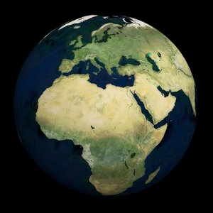
"The basic idea of GMES is to give Europe independence in its own data sources in Europe. Today we rely a lot on international data, especially from the USA. As with the GALILEO navigation system, if Europe has its own capabilities we can also offer these services internationally and better negotiate our participation in international initiatives. GMES will be the European contribution to the Global Earth Observation System of Systems (GEOSS), aiming to establish a global environmental monitoring system."
How and when will we see the first Sentinel programme?
"The first Sentinel will be launched, in 2008-2009 at the earliest."
Will GMES be operational in 2008?
"This depends, in part, on the availability of funding. A set of initial GMES services could be operational by 2008, based on existing elements of the Space component."
What will 'Oxygen' mean for GMES?
"Oxygen is the name of our initiative to harmonize the ground segment for earth observations in Europe. The idea is that we change the previous system where every mission had its own dedicated ground segment, to something that can be available for all missions and has only one user interface. Common standards will be established for all space missions. This will represent a great advantage for the user community, which is not necessarily familiar with space data.
"Users want a service that facilitates the link with the appropriate data sources and access to the information they need. This will also include the interfaces with the systems of in situ observations as the final services are built on data sources from satellites and from ground measurements. The challenge is to bring all the information together in order to generate useful products."
When GMES becomes operational will a new GMES authority or operating company be established?
"What I like to use as a model is meteorology. The distribution of weather data is a success story and is a reference model for GMES operations. The example of Eumetsat, the operational entity for meteorological satellites in Europe, shows the efficient distribution of roles between an operator and a developing and implementing agency, which is ESA. Eumetsat could play the role of an operator for two application areas monitoring of the atmosphere and oceanography. We have a gap in Europe when we consider land applications.
"In the USA, there are two operating entities: the US Geological Survey for the civilian side, NIMA for the security side. Something like this is missing in Europe. In the context of GMES, the Commission could establishment a new operational agency for land applications. Time is passing. It took some ten years to have Eumetsat as an operational agency for meteorological satellites after the first Meteosat launch. For GMES land applications and security aspects, this should take place earlier. ESA is not aiming to be the GMES operator. We are willing to do it for a short interim period, if necessary, but we need one or more operational agencies in addition for land applications."
What is the budget for the GMES programme?
"The final report of the GMES initial period refers to a budget of about €2.7 billion, for the space component, with its ground infrastructure, until 2013. The estimate for the service element is €150 million per year. The figures from the other side of the Atlantic are higher: the USA is spending about seven times more on earth sciences and they have begun to study a GMES-like system.
"In Europe we expect about one third of the budget to come from ESA Member States, two-thirds from the European Commission. In 2005 we will know better what will be available for 2007. So far, for the European Commission, the GMES budget comes mainly from DG Research, but it could change."
Is GEOSS, to be discussed in Brussels in February 2005, the USA’s reaction to Europe’s GMES initiative?
"GEOSS is an intergovernmental activity leading to the global establishment of environmental monitoring systems. We have needed this for many years. Europe will provide GMES, but we want our own and independent global monitoring capability in order to be in a position to decide ourselves about the implementation of policies for environment, e.g. regarding the Protocols of Montreal and Kyoto. "Europe will deliver its capability to the global community via GEOSS. It is the same for the USA. Both American and European systems will have global capabilities, but they will be harmonized through GEOSS. It looks a little like the duality with European Galileo and American GPS. Both sides of the Atlantic have accepted now that they will work closely together with their own systems for global operations. Galileo and GPS III generation will share the same civil signal structures for the combined use of navigation channels, for the benefit of the users, who can use the two independent systems. Similarly, through GEOSS, the users will be able to use GMES and the equivalent in the USA."

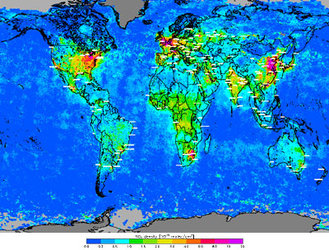
What can GMES do for Africa?
"There are a lot of possibilities for co-operation. Worldwide, many user communities look with great interest at the data and products delivered by GMES, especially for Africa where there is a real gap in environmental data. The overwhelming response from African users to ESA’s TIGER water initiative, where we received 95 project proposals on the first call, shows the high demand in Africa. GMES will be a great help, and is an ideal instrument for international co-operation."
How do you see the future of GMES?
"The GMES initiative has been discussed and approved at two Ministerial Conferences. We already plan to spend 80 million euro from ESA in the next two and half years on preparatory work, including the GMES service elements, the socio-economic assessment study and the Sentinel studies. ESA is preparing everything for the Ministerial Council in Berlin at the end of 2005. After Galileo, GMES is the most advanced programme in Europe jointly initiated and carried out by the European Union and ESA.”
The most challenging task for GMES?
"Funding will be a challenge, as money is short in all Member States, but I am optimistic, seeing the demand in Europe. Reaching the wide user community is also a challenge for implementation, from atmospheric environmentalists to security officers, through volcanoes specialists, natural hazards managers, dangerous construction planners. GMES is a multipurpose tool with high potential. The challenge is to implement this system so as to meet the needs of the majority in an efficient way."
This article first appeared on the European Commission EUROPA Earth & Space Week website.