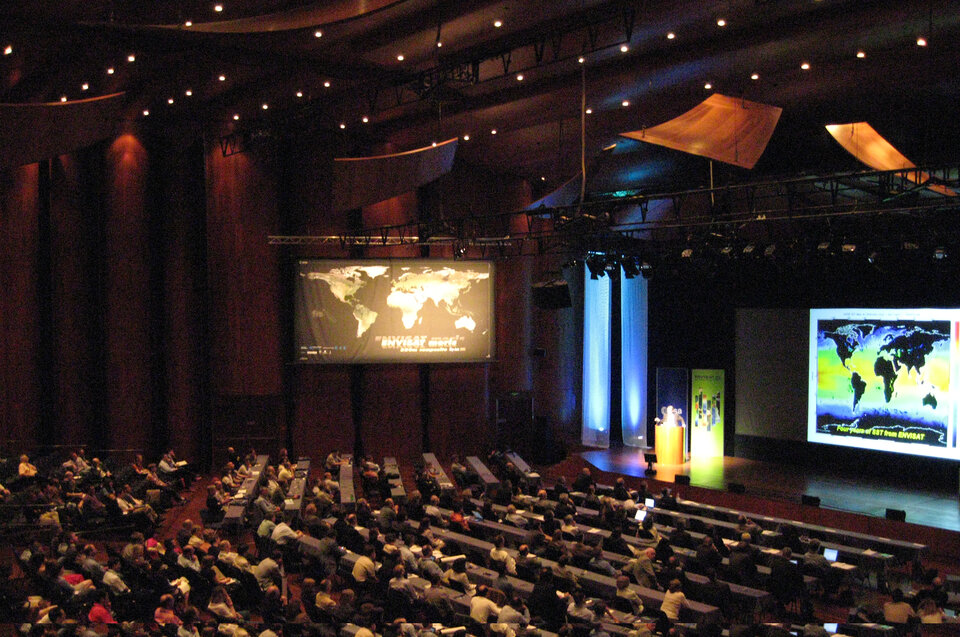
Envisat Symposium 2007 kicks off in Switzerland
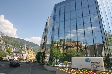
More than 900 scientists from around the world have gathered in Montreux, Switzerland, for a five-day symposium to discuss, present and review their findings on the state of our world’s land, oceans, ice and atmosphere using data from ESA Earth observation satellites, in particular Envisat – the largest environmental satellite ever built.
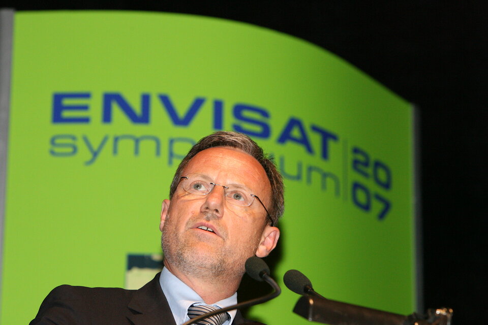
The largest ESA scientific symposium of the year was formally opened today by ESA Director of Earth Observation (EO) programmes Dr Volker Liebig who stressed the importance of the programme saying over 1200 scientific projects are managed with ESA’s Envisat and EO data and 27 000 radar scenes were distributed to users last year.
He addressed climate change, the greatest environmental challenge facing the world today, and highlighted the role satellites have played in better understanding the parameters involved in it. Noting its relevance for decision makers, politicians and economists, he applauded the scientists present at the symposium for their contribution to the issue.
According to Liebig, ESA plans to launch 17 missions in the coming years to guarantee continuity of relevant data for scientific use and applications.
Director of the Swiss Federal Office of Topography Jean-Philippe Amstein and Director Daniel Fürst of the Swiss Space Office welcomed the participants to Switzerland and underscored the role of ESA.
“Switzerland does not have a space programme,” Fürst said, “so ESA is our space agency and our gateway to Earth observation from space.”
Following the symposium’s opening, five researchers gave an overview of the most significant results of the Envisat and ERS missions.
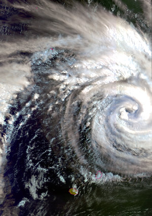
Dr Johnny Johannessen of Norway’s Nansen Environmental and Remote Sensing Centre (NERSC) began with advances in oceanography. “Through the availability of satellite data from ERS-1in 1991 up until now, we have gained an understanding of the ocean and its interaction with the entire Earth system that we would not have otherwise been able to do.”
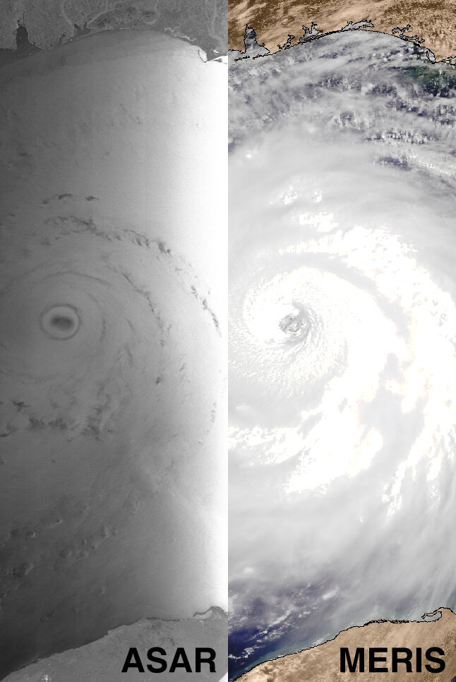
Johannessen explained that since the time series of satellite data is getting longer, oceanographers and scientists are now in the situation to investigate the effects of climate change, such as sea level rise, global warming and reduced sea-ice cover, and to follow the build up of hurricanes and typhoons and see how they propagate.
He highlighted the need to combine satellite observations with models and to merge them with in situ data. “With the models, we can project the predictions into the future. We are there today, and it is without doubt thanks to satellite data,” he said.
Johannessen warned that this predictive ability would be lost in the future if the provision of satellite data does not continue with the same magnitude combined with the exploration of new sensors.
Data from satellites have ushered in a new area of exploration to polar regions.
Dr Eric Rignot of NASA’s Jet Propulsion Laboratory (JPL) reviewed cryospheric achievements with the ERS and Envisat missions and highlighted the most important scientific discoveries in sea-ice monitoring and land-ice mapping, such as the derivation of sea-ice thickness in the Arctic and the estimates of the mass balance of the large ice sheets in Greenland and Antarctica for the first time using radar altimetry.
“Data from satellites have ushered in a new area of exploration to polar regions. We started from scratch and in just a few years have learned a tremendous amount, which is extremely important because this is a timely study in the context of climate change,” he said.
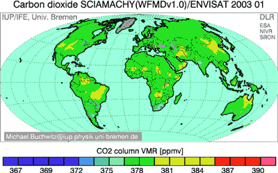
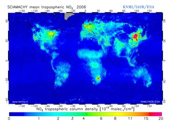
Prof. John Burrows of Bremen University in Germany spoke of advances in Atmospheric science: “A combination of GOME on ERS-2 and Envisat’s GOMOS, MIPAS and SCIAMACHY instruments are providing a quantum leap forward in Earth observation.
“The quality and quantity of data is such that we are able for the first time to look at processes and changes in the atmosphere, which is necessary both for understanding atmospheric physics and chemistry and for policy making. We are on the verge of a new era where the quality of satellite data is sufficient that we can both monitor important international protocols like the Montreal Protocol, controlling ozone depleting substances, and Kyoto Protocol, observing greenhouse gases, the precursors of climate and temperature changes.”
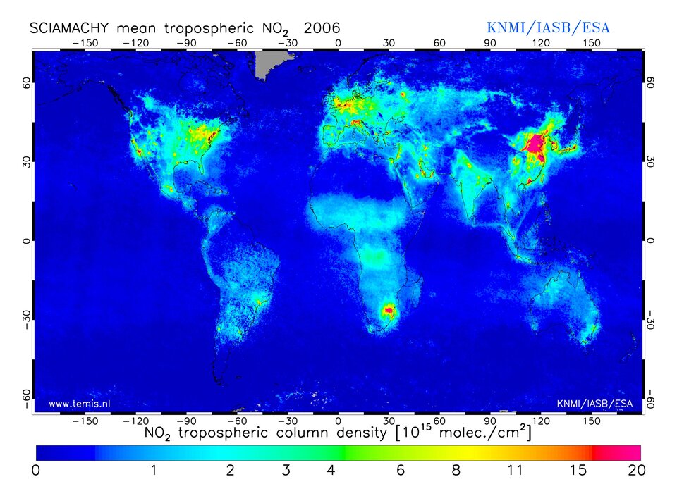
He explained scientists are at the brink of addressing, on a global scale, pollution issues from stratospheric ozone depletions, such as the ozone hole, through to air pollution and climate change gases.
“The important issue is that the atmosphere has a short-time scale, so changes in it are early warning signals of long-term changes, making it essential that we understand both the chemistry of these issues and provide that societal input to policy-makers,” he continued. “The changing atmosphere and the anthropogenic input into it are now much more than a single science issue, and we need to understand these issues and processes in order to provide good information.”
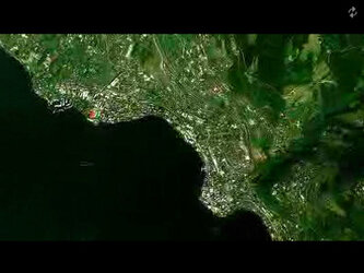
Dr Alan Belward of the European Commissions’ Joint Research Centre (JCR) in Italy addressed advances in vegetation mapping, saying the best advances are new quantitative measures of the land surface process which have allowed scientists to move past traditional cartography methods.
“We have now got science quality biophysical variables, so we have actual quantitative measures of change in the land surface that we can now relate to climate models, carbon models and a lot of new uses such as ecosystem health,” he said.
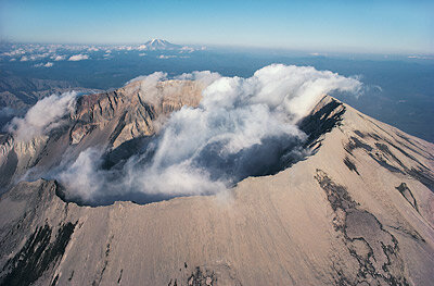
Advances in tectonics and volcanology were highlighted by Prof. Barry Parsons of Oxford University. Parsons spoke of the role a technique called Synthetic Aperture Radar (SAR) Interferometry, or InSAR for short, has played in measuring surface deformation. Using InSAR, scientists are able to measure surface deformations before and after earthquakes and to detect surface deformations in volcanoes.
According to Parsons, SAR has advanced the fields of tectonics and volcanology by allowing scientists to monitor the changes anywhere in the world at any time.
During the course of the week, participants will see eight hundred presentations, selected by peer review, of ongoing research project activities using data from Envisat, ERS and Third Party Missions by scientists travelling from more than 50 countries.
Themes of the symposium include the atmosphere, climate, oceanography, cryosphere, land and hazards. Within these themes, almost all fields of Earth science will be addressed, such as landslides, ocean colour, sea surface temperature, sea ice, volcanoes, earthquakes, floods, fires, winds and waves and oil spills, among others.
The conference will also include a special session dedicated to the joint ESA/European Commission Global Monitoring for Environment and Security (GMES) programme, including the GMES space component, Sentinel missions and contributions from national missions.
On Tuesday, there will be a session dedicated to the use of Earth observation satellites in support of International Environmental Conventions in close collaboration with UN agencies, the World Climate Research Programme (WCRP) and the International Geosphere-Biosphere Programme (IGBP).