Providing GMES services at the ends of the Earth – interview with Dr Charles Randell
Receiving strong backing from ESA member states at this week's Ministerial Conference in Berlin, Global Monitoring for Environment and Security (GMES) is a joint initiative between ESA and the European Commission to combine ground- and space-based observations to develop an integrated environmental monitoring capability to benefit European citizens.
Broadening interest in GMES is highlighted by a conference taking place in Warsaw, Poland on 12-14 December, which has been organised by the non-governmental organisation Eurisy, dedicated to promoting the use of space technology. The conference title is 'Integration of the New European Union (EU) countries into the GMES Programme', and it will focus on how these states may best participate in future GMES development and applications.
As the conference will hear, initial GMES services are already operational, addressing a range of sectors from atmospheric chemistry monitoring to geological hazard assessment. They are being provided through an ESA activity known as the GMES Services Element (GSE). And with GMES a global endeavour, the particular needs of the high latitudes have not been neglected.

Prominent within GSE is the Polar View initiative, which is delivering Earth Observation-based products and services to users across the Polar regions. In an interview originally carried out by SciencePoles, the scientific website of the International Polar Foundation, Dr Charles Randell, the Canadian Vice-President of the global C-CORE corporation discusses the development of Polar View so far.
What is Polar View? What are its objectives?
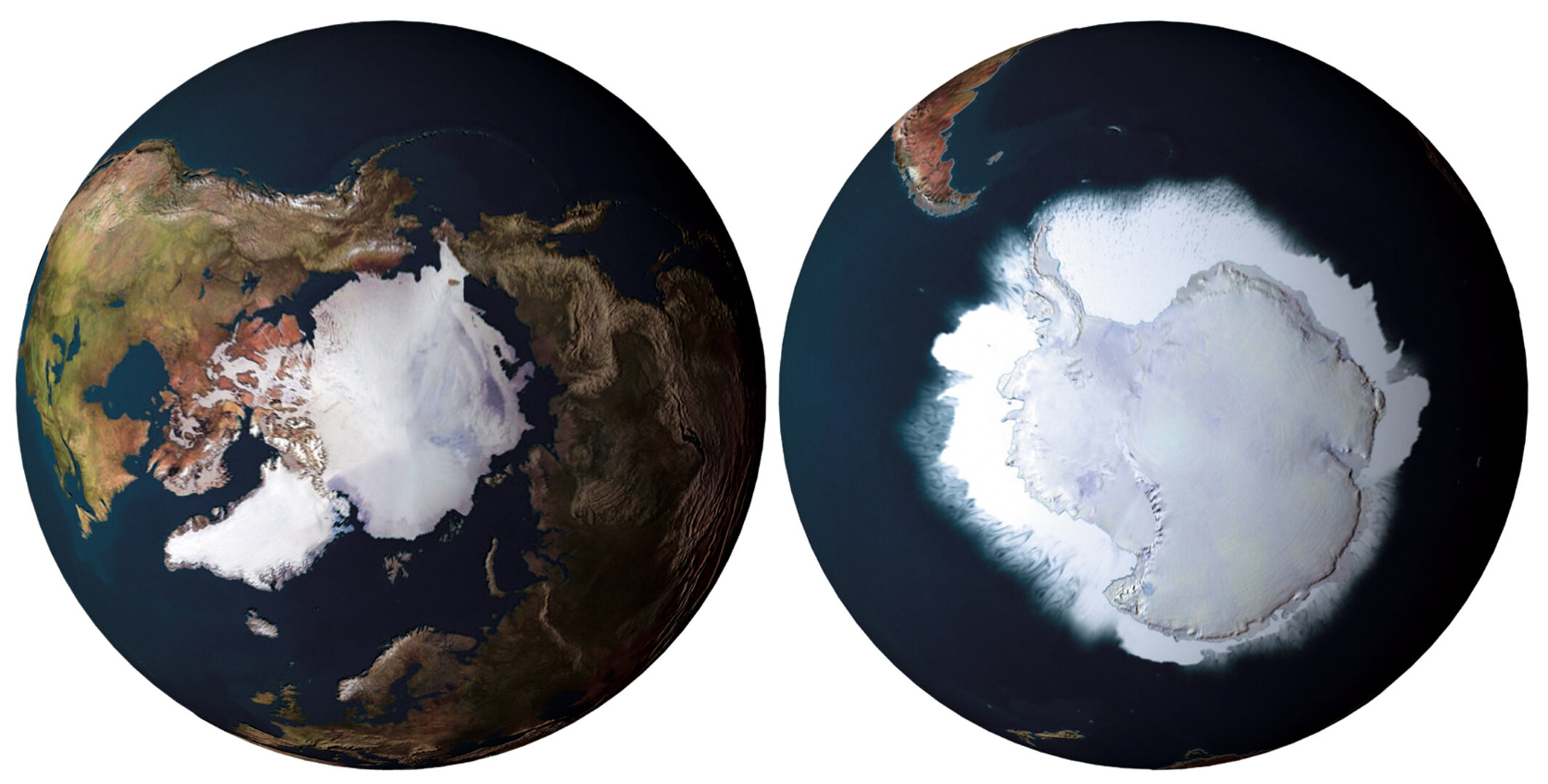
Polar View is an Earth Observation (or satellite remote-sensing) programme, focused on both the Arctic and the Antarctic. Polar View is supported by ESA and promotes the utilization of satellites for public good and supporting public policy. The Polar View Team consists of companies, government agencies and research institutes across Europe and Canada.

Each organization brings diverse, complementary skills and experience to the Polar View programme and is committed to establishing a dedicated service for addressing polar issues using Earth Observation technologies. The reason Canadians are able to participate on a European Space Agency programme is that Canada is an associate member of the ESA and financially supports a number of ESA programmes.
How is Polar View different from its predecessor, Northern View? What services does it provide which didn't exist before?
Polar View is a much larger programme with participation from 10 countries and with an initial contract for three years to 2008. Northern View was a 20 month programme really building the foundations for Polar View.
The goal of the original Northern View activity was to become a one-stop-shop for geospacial, or large area information about what is happening in the North. Things like snow melt and snow extent, ice issues, glacier issues, Northern infrastructure, and what's happening in terms of climate change. Because it was a much smaller entity than Polar View, the emphasis of Northern View was very much on operational services: using existing technology and getting the information out there to the world - to those who could use it.
With Northern View, we were doing a lot of marketing, but also trying to demonstrate to ESA that there was a very real need for geospacial monitoring in the North, and that the benefits outweighed the costs. The fact that we then moved from Northern View to Polar View proves that we were successful in doing that.
Who are your users/clients? Are they mostly government or private?
Primarily government or other public agencies. We also collaborate with the national ice centres in generating and providing information beyond their typical mandate of producing ice charts for navigation. Many of the ice centres would like to provide more detailed and specific ice information to particular communities and other specialty products. Polar View helps them with that.
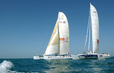
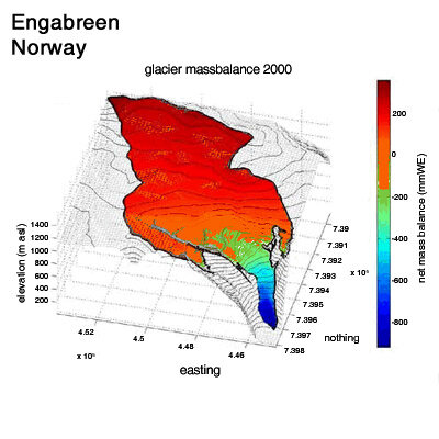
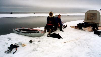
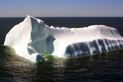
But we also provide information for certain private clients and commercial interests such as iceberg information to yacht races around the Antarctic, or to hunters and trappers who work in the North and who need to go to the edge of the ice for fishing and hunting. Polar View provides them daily updates of where the ice edge is and the current state of land fast versus moving ice. Also to water utilities which need information on glaciers and what is happening to them in a seasonal context in order to optimize power generation or reduce flood risk.
How is the service sold? What are the costs involved?
We are contracted by ESA to provide these services initially free of charge if that's what it takes to get users to appreciate the benefit of satellite-based monitoring services. But the ultimate goal is to become sustainable, so in the long run someone other than ESA will have to pay for it. Sustainability is foremost in our work.
We have quantified very well what it costs us to provide these services or information products, but ESA's approach was that if we are going to be doing this for public agencies, they don't have a lot of disposal income, so we need to give them time to get the budgets to pay for the information. We have allowed a maximum of three years for them to be able to do that. At anytime, if we do not see a realistic chance for sustainability of a service we need to seriously consider keeping it part of the Polar View portfolio. We have dropped some services because of this. We have also brought on new ones.
So what is the budget of Polar View?
The value of the contract with ESA is approximately €8 million for three years. The actual Polar View program of activity is at least 50% more than that.
Does this include the European Commission? Do you receive any funding from the Sixth Framework Programme (FP6)? What about the Seventh Framework Programme FP7?
No, but what we have done is to incorporate some of the technologies which were developed with the help of FP6, and we are looking at FP7.
Who are your competitors in the US and internationally? How do you position yourself against them?
We're not trying to replace national agencies or the science community. What we're doing is complementary to their activities and we work with them. There are organizations that have been providing services at a low level to some of the clients that we are also providing information to, and generally what we have done in these cases is to integrate them into the team. Polar View is exclusive in that the Team is at the top of their game and very expert in extracting information from satellite data. We demand no less than this. But it is an open membership. People can leave and people can join Polar View.
You speak of Polar View as "a team". How is it structured? How many people are involved?
It is very much a team, but in terms of people involved, there are two different groups. There are the users, spread out among 40 different groups, and then there are the 30 Polar View sub-contractors themselves. Because it is so large, spanning ten countries, and because it is important to have regional representation, we've organized the network into four regional nodes: the North American node, the rather large Euro-Russia node, the Baltic Sea node, and the Antarctic node.
Each node is like a miniature consortium in itself, but they remain very tightly networked with individual node managers and standardized platforms. They are each responsible for service provision and marketing within their regions. Over the top of this we have circumpolar and other international activitiers.
Who is in charge of your Antarctic node?
The node manager for the Antarctic is the British Antarctic Survey. We have service providers from the UK, Norway, Italy and Canada.
How many satellites are involved in Polar-View?
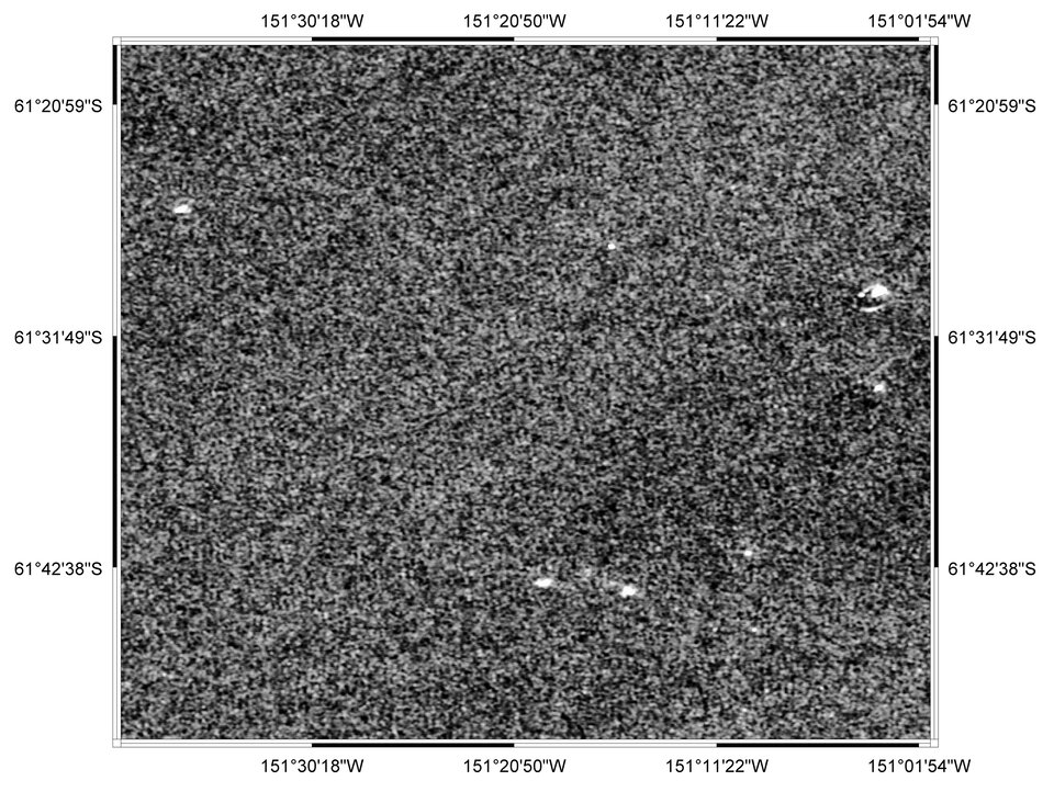
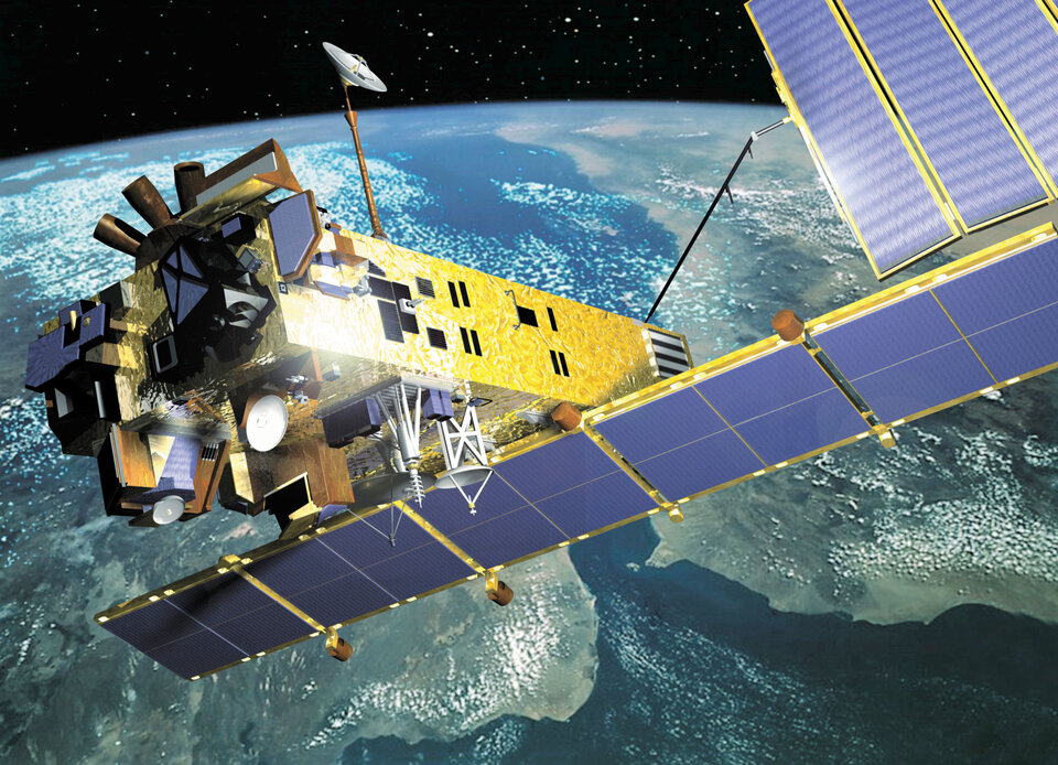
There are two primary ones we use called Synthetic Aperture Radar (SAR) satellites: Envisat and Radarsat. We also use about another six satellites.
What will be the impact of the recent CryoSat failure on Polar View?
Of course we were very disappointed, but because Polar View services are in fact operational services which rely on satellites that have already been up there for a few years, the immediate impact of the CryoSat failure for us is fairly minimal. However, we were certainly looking forward to using it and there were enhancements to our existing services that we would have been able to provide had it been successful. So we are hoping that there will be another CryoSat before too long.

Finally, will the International Polar Year (IPY) have an impact on your work?
We certainly hope so. Polar View submitted a proposal to the IPY International Programme Office to provide geospacial information for IPY missions both in the Arctic and the Antarctic. Since then the national ice centres (collectively, the International Ice Charter Working Group) have approached us to become the common portal of IPY relevant ice information, and we are currently working on the details of how this cooperation will take shape.