
Sentinel satellites reveal east–west shift in Italian quake
New information on the effects of the 30 October earthquake that struck central Italy continues to emerge as scientists analyse radar scans from satellites.
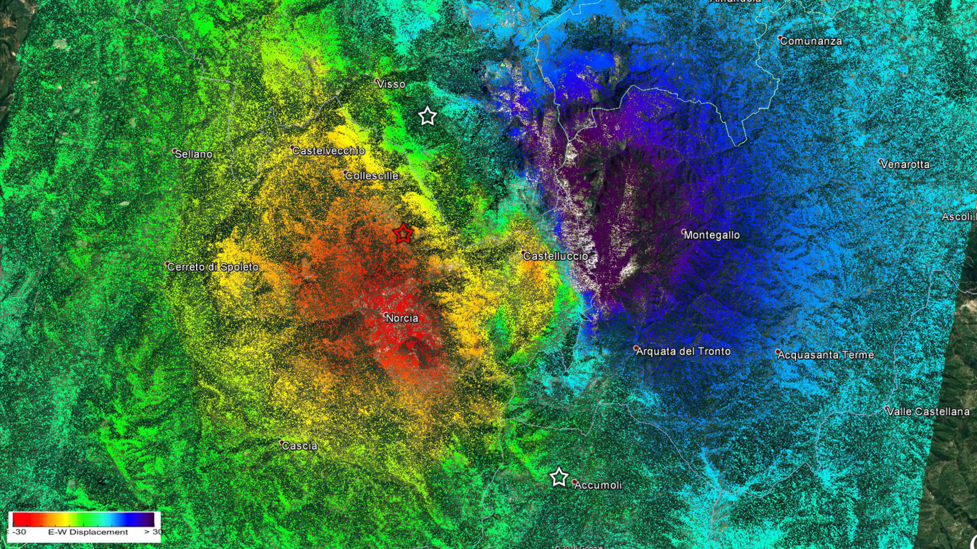
Using radar imagery from the Copernicus Sentinel-1 satellites, Italian experts have identified significant east–west displacements of the ground in the area struck by the earthquake.
An eastwards shift of about 40 cm was mapped in the vicinity of Montegallo, while a westwards shift of about 30 cm is centred in the area of Norcia.
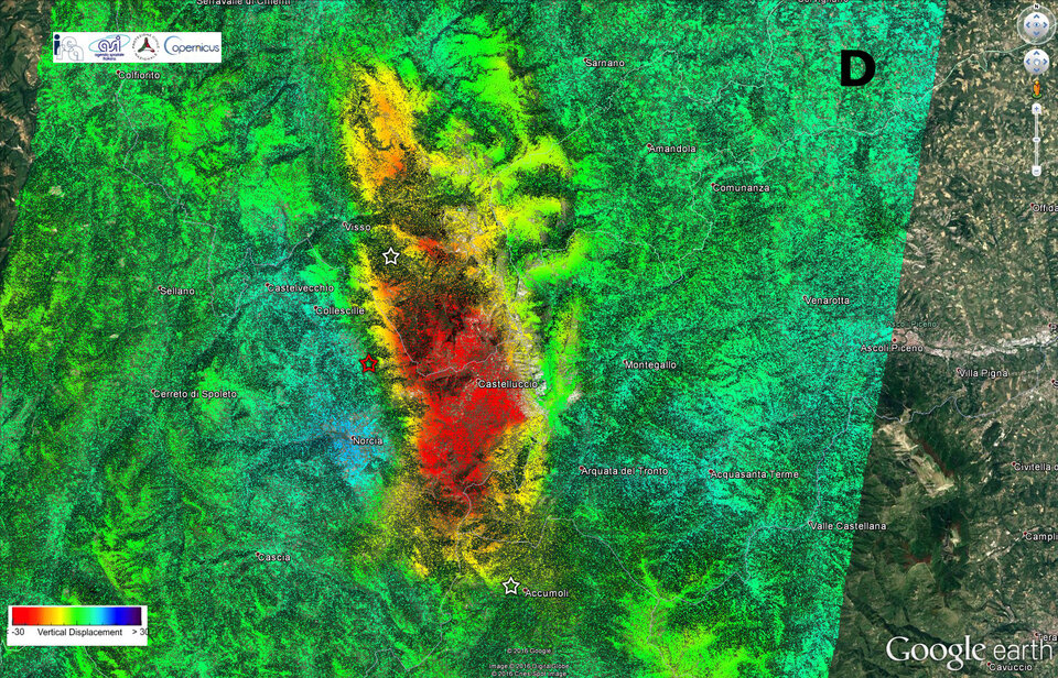
Vertical displacement is also evident, with the ground sinking 60 cm around Castelluccio but rising by about 12 cm around Norcia.
The team of scientists from the Institute for Electromagnetic Sensing of the Environment of the National Research Council and the National Institute of Geophysics and Volcanology combined radar scans taken before and after the event to map centimetre-scale changes.
The team has benefited from the two Sentinel-1 satellites of Europe’s Copernicus programme. While Copernicus is led by the European Commission, ESA is in charge of developing the satellites and operates Sentinel-1.
“These impressive scientific results could be obtained very rapidly thanks to the operations concept of the Sentinel-1 mission: large scale and frequent mapping, in particular of Europe and worldwide tectonic areas, tight satellite orbit control, systematic processing of all acquired data, and open and free access of the products within few hours from observation,” said Pierre Potin, Sentinel-1 mission manager at ESA.
“In this specific case, the east–west and vertical ground displacements could be derived in less than three days after the earthquake, making use of both Sentinel-1A and Sentinel-1B and in different viewing geometries.”
Sentinel-1 is not the only satellite providing information on this recent quake: scientists are also relying on the Italian space agency’s Cosmo-SkyMed satellites, as well as satellite images from other space agencies.
The Italian peninsula is prone to earthquakes because of the continuing collision of the African and Eurasian tectonic plates. Under the Apennine mountain chain, the regional collision is causing the African slab to flex and dip under the Tyrrhenian Sea, while at the same time retreating northeastwards.


