
Traditional Inuit ice treks guided from space
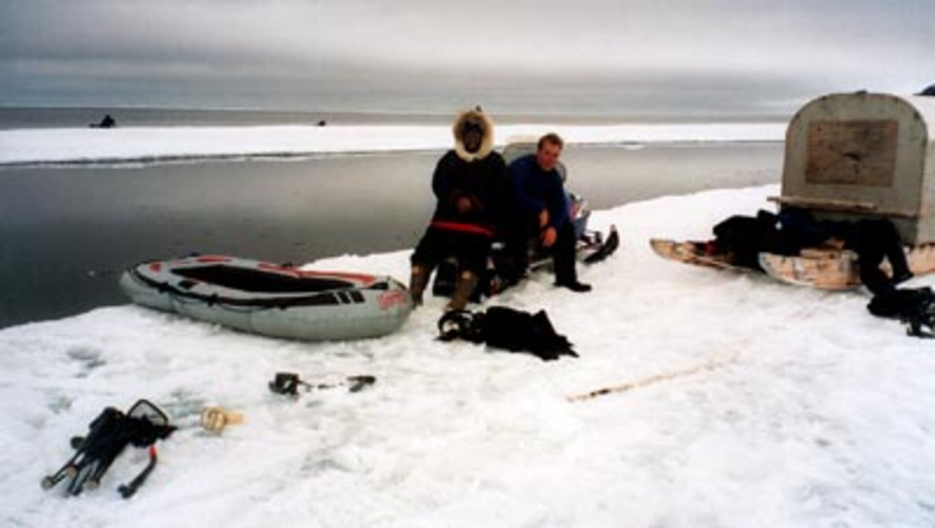
Each Arctic spring the waters at the ice edge become rich with life, and for thousands of years the Inuit of northern Canada have been going there for fishing and game. Today's Inuit have space-age tools assisting them with these traditional activities: satellites that precisely map ice type and extent.
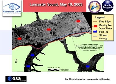
The ESA-backed Northern View Floe Edge Information Service provides regularly updated ice maps of inlets around Lancaster Sound, part of Baffin Bay within Canada's Nunavut Territory. Users can access maps from the Floe Edge service directly via a dedicated website, or else consult printouts posted for the public by the local Parks Canada Office.
"The maps are easy to interpret, and extremely useful," said David Qamaniq of the town of Pond Inlet in Lancaster Sound. "Ice edge conditions can change extremely rapidly, but the maps give an indication which areas are stable."
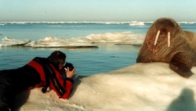
Inhabitants of this region depend directly on fish and game from the ice edge for sustenance, and journeying there has a strong cultural significance as well. The biological diversity encouraged by plankton-rich waters at the ice edge also attracts a growing number of tourists.
"On our trip last year to the Admiral Inlet, the Inuit guides were using the Floe Edge maps, so that was how I learned of the service," explained Thomas Lennartz of Toronto-based tour company Arctic Kingdom. "During the winter we use it to get an idea of what the upcoming season of trips to the ice edge will be like.
"The location of the ice floe determines what wildlife we will see at the ice edge: a floe that spans Lancaster Sound in May indicates the likely presence of hundreds of Beluga and Narwhal whales as they migrate north for summer. The distance of the ice edge from town also impacts our logistical and operational planning – it may take either hours or days to reach, so we need to anticipate our fuel requirements and likely route."
The satellite maps show users where the ever-moving floe edge is currently located, and enabling users to bypass ice ridges, moving ice or stretches of open water. The radar-based satellite images can differentiate between stable 'land-fast' ice and ice that is moving or prone to fracture.
"During the winter season the ice edge moves further and further from the community," said Qamaniq. "We still carry out some trips so we do need to know how far the floe edge is. Then we really start going back to the floe edge from March up until the middle of July."
The satellite-based service supplements traditional methods of safely navigating the icescape, which seem to have become less reliable in recent years, possibly due to global warming. Back in June 1997 some 15 people from Pond Inlet became stranded on a detached 60 square metre ice floe and it was three days before they could be rescued.
"The safety aspect is a crucial part of the service, as during the busiest times each spring a large part of the population can be out on ice," explained John Bennett of Noetix, the company operating the Floe Edge service. "We use Synthetic Aperture Radar data from Envisat and Radarsat to provide a near-real time service."
As well as detecting ice thickness and age, radar has the additional advantage of seeing through cloud and darkness, so usable imagery can be acquired whenever an overpass takes place.

"If a satellite image is taken at midnight we aim to have it available by midday the same day," added Bennett. "The images are sent to us for interpretation as soon as they are acquired by the Canadian Ice Service."
Floe Edge is part of a broader portfolio of Earth Observation-based services provided to northern populations by the Northern View initiative, part of the Global Monitoring for Environment and Security (GMES) programme supported jointly by ESA and the European Commission.


