Four Future Campaigns further the Earth Explorers programme
LaRA, ESAG, SIFLEX and WALEX are four new Campaigns, which are due to be implemented before June 2002 in support of ESA’s Living Planet Earth Explorers programme.
Laser and Radar Altimeter Campaign (LaRA)
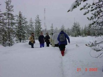
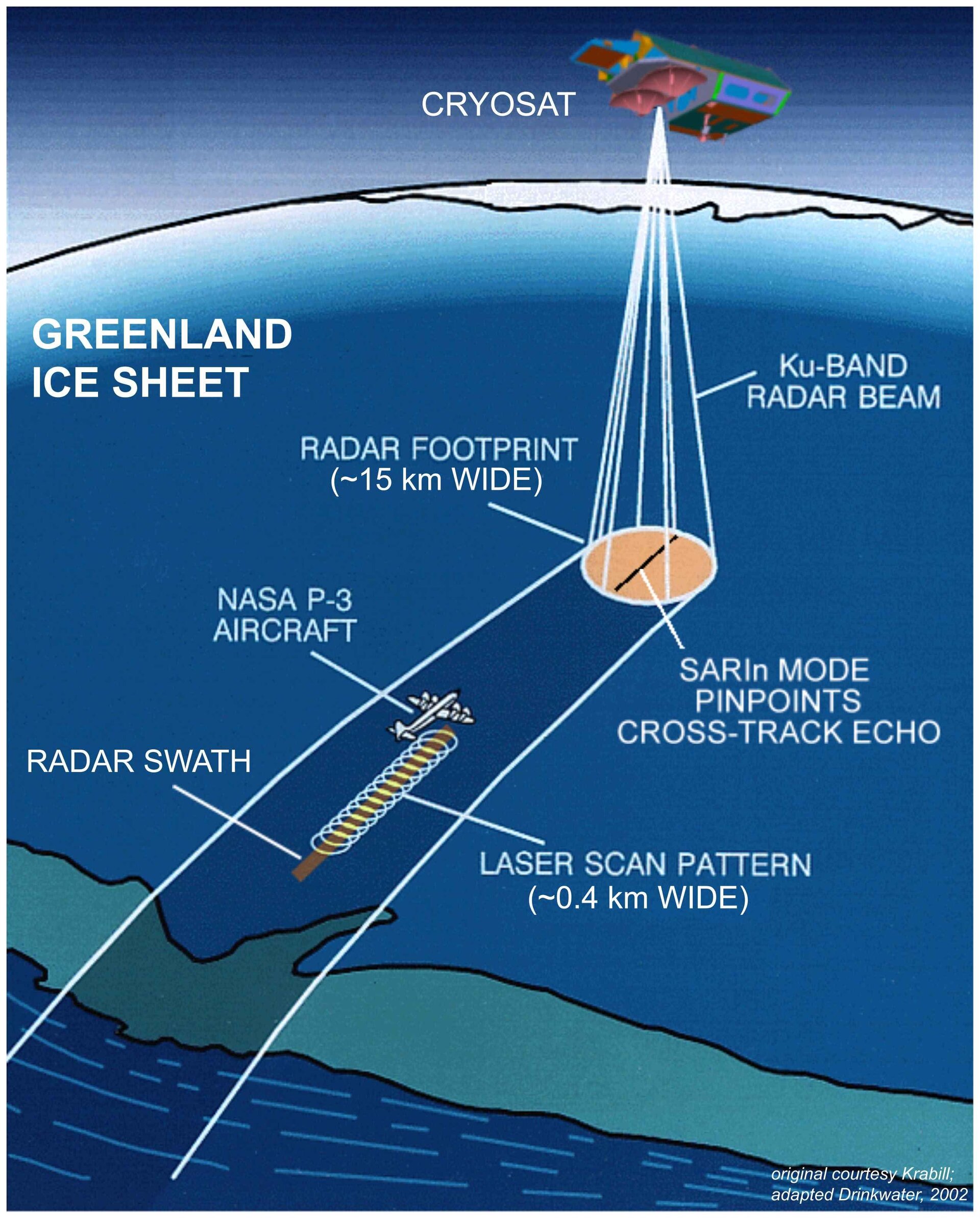
The Laser and Radar Altimeter campaign (LaRA) is planned to fly in the spring of 2002 over Greenland. This exercise is designed to understand how to use airborne instrumentation for the purpose of validating CryoSat measurements, as well as for the cross-comparison of data from ESA’s Cryosat mission and NASA’s IceSat mission. The LaRA campaign involves making simultaneous, overlapping airborne measurements over the ice sheet surface using the John Hopkins Applied Physics Laboratory delay Doppler radar altimeter and the Airborne Terrain Mapper scanning laser altimeter.
European Survey of Arctic Gravity Campaign (ESAG)

Due to fly in May 2002, the purpose of the European Survey of Arctic Gravity campaign (ESAG) is to collect high accuracy airborne gravity measurements in a region between Greenland and Spitsbergen. In addition to validating existing older marine gravity data, ESAG will provide support for ESA’s GOCE mission (Gravity Field and steady state Ocean Circulation Explorer) at locations not accessible to satellite data acquisition due to the Polar Gap problem. The gravity measurements are to be made by an operational airborne gravity system developed by KMS (National Survey and Cadastre of Denmark) in cooperation with the University of Bergen. The aircraft also carries a laser scanner for the determination of sea-ice surface height profiles relative to the open sea in support of ESA’s Cryosat mission.
Solar Induced Fluorescence Experiment Campaign (SIFLEX)

The purpose of the Solar Induced Fluorescence Experiment (SIFLEX) campaign is to observe the solar induced fluorescence signal over a northern boreal coniferous forest site in order to verify that the signal is suitable for observation from space.
The SIFLEX campaign is to be carried out at Sodankylä in Finland and the experiment will cover the main period of spring recovery of photochemical activity of Scots pine trees. In order to estimate climate change effects on terrestrial ecosystems the study of boreal regions is important; firstly, because boreal forests are extensive with large carbon storage above and below ground and secondly, because climate simulations predict substantial warming in the high northern latitudes. The objective of the SIFLEX campaign is to collect and provide direct and accurate observations of carbon dioxide, latent heat and sensible heat fluxes using micrometeorological methods. In addition, data on dark-adapted fluorescence and directional spectral radiances will be obtained. A fluorescence sensor will be installed in a new tower at the site and measurements of the site will be taken remotely from varying heights and angles. Irradiance and spectral reflectance measurements will be made at the same time and cover the same footprint and operate at the same viewing angle. The data taken in the field is hoped to confirm the feasibility of space-borne missions intended to remotely sense the carbon dioxide exchange of forested areas and the atmosphere.
WAter Vapour Lidar EXperiment (WALEX)
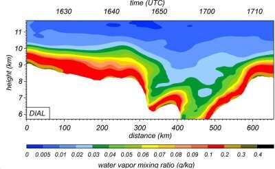
The Water Vapour Lidar Experiment (WALEX) campaign is designed to provide representative lidar measurements of water vapour and aerosol/cloud properties in different climatic zones. The campaign is to take place in May and June 2002 when long-range 2-d airborne lidar measurements of water vapour and particles will be collected along a flight section across the northern Atlantic from Southern Germany to Oklahoma. Water vapour profiles in the 920-950 nm spectral region along with backscatter and depolarisation profiles at visible (532 nm) and infrared (1064 nm) wavelengths will be collected along the flight sections. This campaign supports the Earth Explorers Core Mission contender WALES (Water vApour Lidar Experiment in Space), which has recently entered Phase A (feasibility study).