From Pytheas to CryoSat: a brief history of Europe's polar explorers
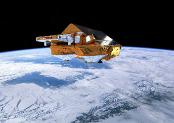
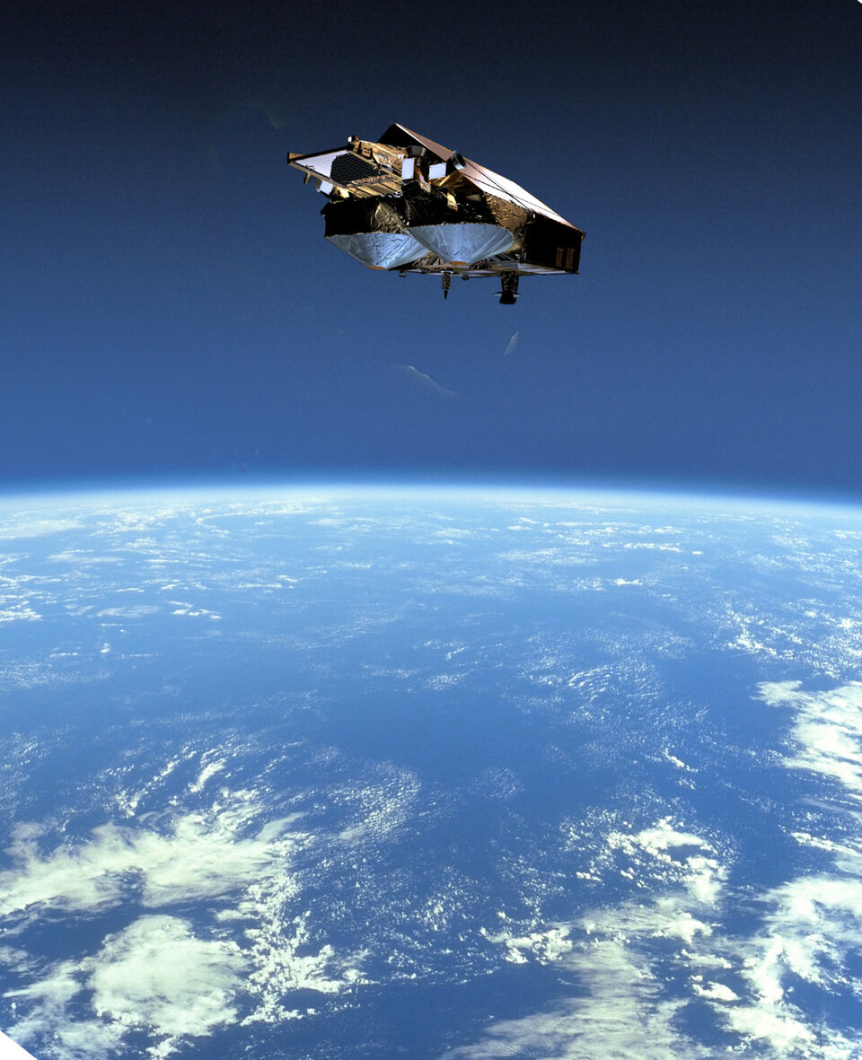
Currently undergoing final preparations for launch from northern Russia, ESA's CryoSat will chart ice thickness across the Arctic and Antarctic with unprecedented accuracy. This ice-dedicated satellite is a first for our continent, but also follows in a long tradition of European polar exploration.
Driven by a wide variety of motives, Europeans have been utilising the best available technology to chart the frozen ends of the Earth for thousands of years.
The first humans are believed to have entered the Arctic during and after the last Ice Age, probably to follow herds of reindeer. Prehistoric Sámi (Lapp) people left rock carvings across the sites they inhabited.
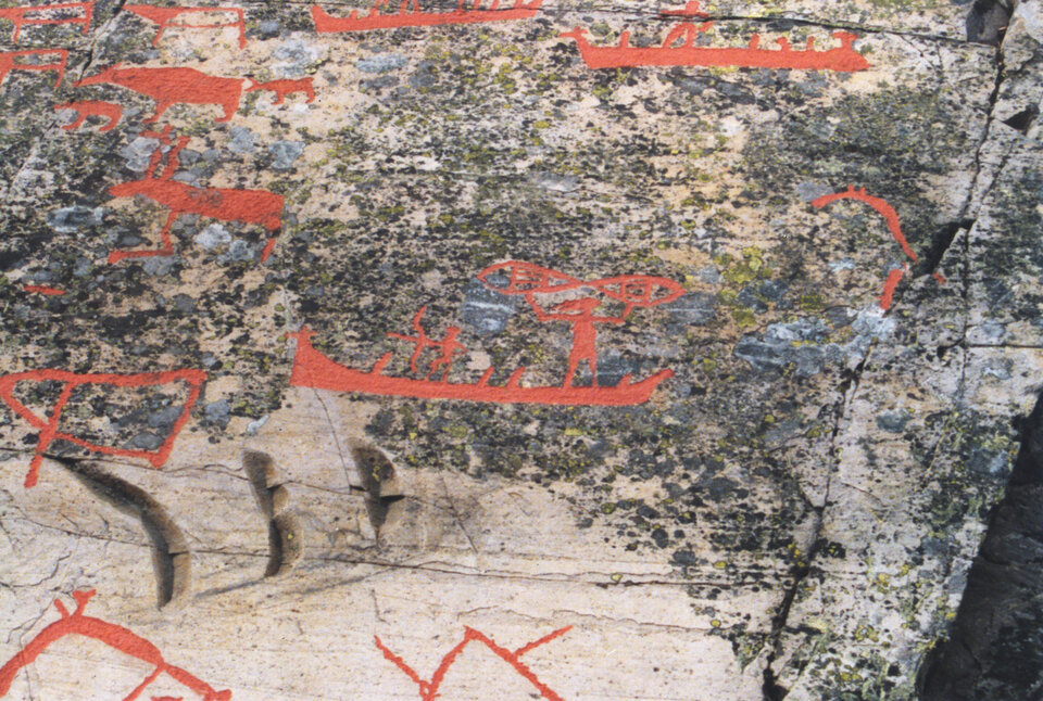
Elaborate carvings dating back more than 6000 years have been found in Alta fjord in the extreme north of Norway. They include depictions of reindeer, bears, fish and birds along with weapons, boats and scenes of hunting and fishing. The carvings were continued for almost 3000 years.
Another 4500-year-old carving on the island of Rodoy in Arctic Norway shows a horned hunter either paddling a canoe or more probably skiing. It is certain that skis were employed back then – although used more to stay on top of the snow than for speed. One ski found in a peat bog in Sweden has been dated back to 5000 years (just five hundred years younger than the first known wheel).
Another technological innovation made possible the first trip to the Arctic for which a written record survives. In 330 BC the Greek navigator Pytheas set off to the far north from the colony of Massalia, located in present-day Marseilles – about 400 kilometres away from where CryoSat's main SIRAL instrument was built in Toulouse. Pytheas was equipped with a navigational instrument called a 'gnomon', a sundial capable of measuring latitude. With it he was able to sail out of sight of land, travelling first to Britain to obtain a cargo of tin, then venturing further north to explore the limits of the known world.
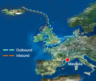
No copy survives of the chronicle Pytheas himself wrote of his travels, entitled 'On the Ocean'. However fragments have survived in quotes from later Greek writers. Having heard from the inhabitants of Scotland of lands to the north where the Sun never set during some times of year, he sailed six days northward.
Pytheas reached an island he called Thule – generally identified as Iceland – before encountering impassable water and slush ice that 'binds all together, and can be travelled neither on foot nor by boat', nowadays thought to be slushy 'pancake' ice at the edge of Arctic pack ice. He turned back and returned to Massalia, only to have his story disbelieved by most of those that heard it. Today his descriptions and recorded positions are known to fit the historical and geographical facts.
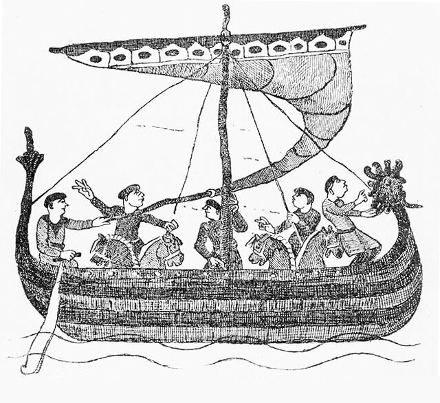
Norsemen settled Iceland around 850 AD, expanding into Greenland inside the Arctic Circle in the following century. Gunnbjorn Ulfsson first sighted Greenland in about 932, but it was eventually scouted, then settled, by Eric the Red, who led 14 ships of colonists there in 985.
It was Eric who misleadingly named this largely-ice-covered Arctic island 'Greenland' to attract people to stay. The settlements he founded thrived for hundred of years but eventually fell victims to variation in climate - vanishing during the 'little Ice Age' of the 15th century.
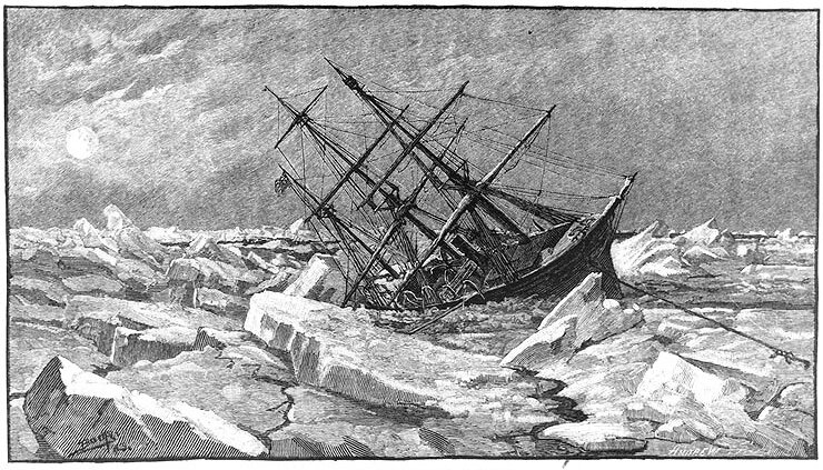
Renaissance-era improvements in ship design spurred on the next phase of Arctic exploration. Maritime trade with the 'Indies' in eastern Asia became a source of great wealth in Europe but required long journeys through dangerous waters.
In 1497 Italian-born sailor Giovanni Cabato (known as John Cabot in his adopted England) proposed the existence of a 'Northwest Passage' to the Indies through the waters of northern Canada. For more than 400 years expeditions searched for this elusive waterway – some never returning - and in the process the icebound Arctic seas and islands were gradually charted.
Discovering Antarctica

Surrounded by stormy ocean at the southern extremity of the world, the Antarctic continent remained untouched by humanity up until the 19th century. Nevertheless it appeared on many ancient maps, with the Greeks being the first to propose a southern continent was required to balance out the land of the northern hemisphere. Meanwhile medieval Maori legends tell of a Polynesian war canoe that headed south to an ice-bound ocean.
In 1773 British Royal Navy Captain James Cook led the first ships around Antarctica but, like Pytheas before him, found the way forward blocked by thick pack ice. Based on the frozen environment around him Cook saw little worth in carrying on: "Should anyone possess the resolution and fortitude to elucidate this point by pushing yet further south than I have done, I shall not envy him the fame of his discovery, but I make bold to declare that the world will derive no benefit from it".
Cook's own log books contradicted him – his detailed descriptions of the enormous number of seals in the Southern Ocean lured many hunters there. In the century to follow, millions of Antarctic seals were killed for their fur while whales were hunted for their oil.
Russian explorer Fabian Gottlieb von Bellinghausen became the first person to sight the Antarctic continent itself in 1820. The following year American sealer John Davis is claimed to have first set foot there, although the mainland status of his hour-long berth is disputed. Also in 1821 a group of British sealers were stranded on King George Island off the Antarctic Peninsula, and became the first people to endure the harsh Antarctic winter.
In 1823 sealer James Weddell took advantage of mild weather to push some 344 kilometres further south than Cook – but failed to find any land, or his sought-after seal colonies. However, the Weddell Sea today bears his name and the latitude he reached was unsurpassed for another 80 years.
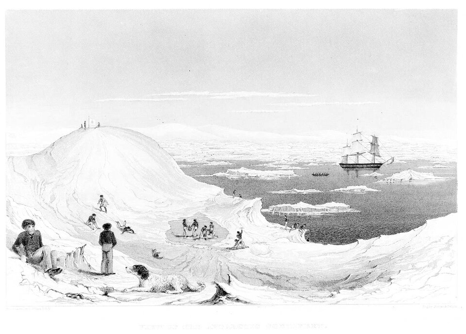
Frenchman Jules Sébastien-César Dumont d'Urville made the first undisputed landing on the mainland in 1840. Later that decade 1840s British Royal Navy Captain James Clark Ross charted a large stretch of the Antarctic coastline, naming volcanic Mount Erebus, the tallest mountain in the continent, after one of his two ships. Another discovery was a tall barrier of ice today called the Ross Ice Shelf.
As sailing ships gave way to steam, Antarctic navigation became easier, and whalers in particular pushed aggressively south, filling various gaps on coastal charts. The focus of scientific interest shifted to the Antarctic interior, and national rivalry to be first to the South Pole.
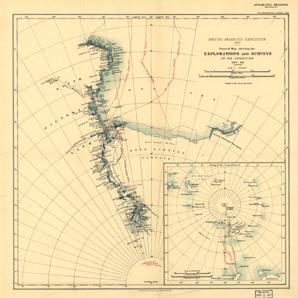
In 1901 expedition three Britons – Robert Falcon Scott, Ernest Shackleton and Edward Wilson - made it to 82º south before having to turn back, suffering from snowblindness and scurvy with at least one sledge dog dropping dead every day. Ironically, until CryoSat, this latitude has also marked the southern limit of recent polar-orbiting satellite radar altimetry observations.
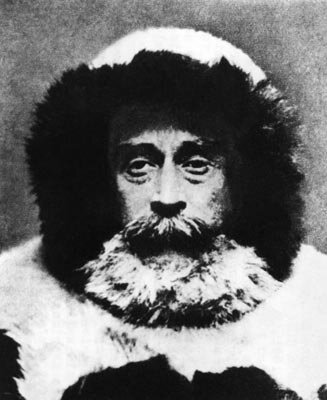
Shackleton came much closer during a second attempt at the Pole in 1909, but had to turn back 156 kilometres from his target. Norwegian explorer Roald Amundsen was finally the first person to reach the South Pole in 1911, some 35 days in advance of a fatal UK attempt led by Scott.
The Poles today: a source of science
Meanwhile in the Arctic the North Pole had been reached by the United States' Admiral Robert Peary in 1909, and Amundsen had achieved another first three years earlier by leading the first ship through the famed Northwest Passage – but it had taken him three years to do it, and along a route far too shallow for trading ships.
The first successful ship journey through the Northwest Passage in a single season did not take place until 1944, achieved by Canadian seaman Henry Larsen (several Antarctic ice shelves being named after him today).
Even then, the Northwest Passage turned out to be impractical for routine use, but thinning summer ice cover due to climate change may change this situation in future. For example, when Larsen's perilous journey was recreated in 1999 the crew encountered no dangerous floating ice whatsoever.
While the 'heroic age' of polar exploration was driven by the hope of geographical discoveries and national territorial gains, today scientific discovery is the goal – the Antarctic Treaty of 1959 sets aside the entire southern continent for scientific use, establishing Antarctica as a vast, pristine laboratory.
The 1957-8 International Geophysical Year (IGY) laid the groundwork for this historic agreement, which persists to this day. Modelled on two previous International Polar Years in 1882-3 and 1932-3 it coordinated scientific activities across the globe, but with a special emphasis on Antarctica. Some 10 000 scientists from 67 nations participated, and many South Polar bases and monitoring stations were first established.
The Scientific Committee on Antarctic Research (SCAR) develops and coordinates international scientific research in terms of Antarctica. Rather than looking for trade routes or physical resources, today's polar explorers seek ways to better understand the past, present and future nature of the entire Earth system.
The ice sheets of Greenland and Antarctica represent valuable evidence of past climate change events during the last few hundred thousand years. Gas bubbles found at different layers represent direct samplings of the 'paleo-atmosphere', while evidence of changes in snow accumulation, dust and sea salt represent a means to assess shifts in temperature and local sea-ice conditions during that time.
Intriguingly, scientists have also been employing the logbooks of past Arctic expeditions to search as far back as possible for past Arctic sea ice changes. For the last 17 years the Norwegian Polar Institute and the Norwegian Meteorological Institute have been making historical maps of Arctic sea ice for the last 500 years, in order to look for signs of global warming.
Today Arctic and Antarctic sea ice is routinely monitored by satellite – although CryoSat will be the first radar altimeter optimised for sea ice. Climate modelling suggests the frozen ends of the Earth will exhibit the greatest sensitivity to climate change, and represent the best means to estimate its future extent.
Continuous space-based monitoring of the Polar Regions is therefore a vital scientific input, and the International Global Earth Observing Strategy (IGOS) – a process to harmonise space- and Earth-based observation systems - includes a dedicated Cryosphere theme.
CryoSat is about to start delivering a dynamic picture of shifts across both Polar Regions, its radar altimeter returning a detailed record of changes in the thickness of marine ice cover and land ice sheets over a continuous three-year period, with an accuracy of one centimetre. CryoSat will better ESA’s previous missions by flying within two degrees of the South Pole, thereby providing the most comprehensive dataset on polar ice mass variations to-date.