
ESA awards contract to EADS Astrium (UK) to build Aeolus – the first satellite to measure the Earth’s wind from space
Last week an important milestone was reached in the development of ESA’s Aeolus mission as the contract to build the satellite was officially awarded to EADS Astrium (UK).
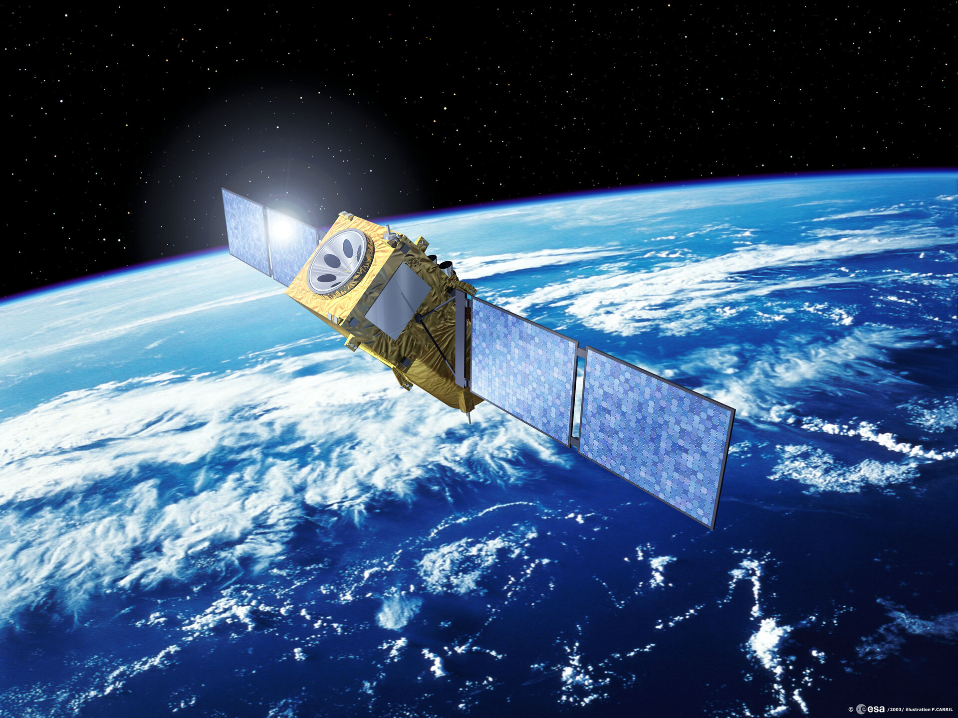
Due for launch in October 2007, Aeolus is ESA’s second Earth Explorer Core Mission within its Living Planet Programme. This mission is designed to make direct measurements of global three-dimensional wind-fields in order to significantly improve weather forecasting and climate research. The aim of the mission is to provide global observations of wind profiles with a vertical resolution that will satisfy the requirements of the World Meteorological Organisation (WMO). Named after Aeolus, who in mythology was appointed ‘the keeper of the winds’ by the Greek Gods, the Aeolus satellite will be the first ever mission to directly observe the Earth’s wind patterns from space.
The contract to build the satellite was signed on 22 October 2003 in London, and gives EADS Astrium (UK) the responsibility for the overall system design. EADS Astruim (UK) will be supported by up to 50 space companies in 12 European countries for the supply of the various equipments and services.
When launched, the satellite will be placed in a Sun-synchronous orbit at an altitude of
400 km and will always be in the dawn or dusk position. This unique orbit means that Aeolus will be able to provide accurate wind profiles for the entire planet, including remote areas lacking any ground-based weather station. The expected lifetime of this mission is
3 years. “Aeolus will be the first wind-lidar in space”, said Peter Dubock, ESA’s Aeolus Project Manager. “It will measure wind profiles on a global scale. In fact, the World Meteorological Organisation has given the need for these measurements top priority.”
Aeolus will carry just one large instrument – the Atmospheric Laser Doppler Lidar Instrument (ALADIN). This is a direct detection lidar operating in the ultra-violet spectral region (355 nm). It emits a short but powerful laser pulse towards the atmosphere, from which a small portion is scattered back by the air molecules and by cloud and aerosol particles. The telescope in ALADIN collects the backscattered light and directs it to an optical receiver, which measures the Doppler shift of the received light. Wind profiles will then be derived showing the relative strength and direction of winds at different altitudes. Peter Dubock said, “Wind-lidar missions have been studied for about 20 years now, but the laser technology required was not ready. Finally, Europe has developed the sophisticated technology, and thus we can go ahead with the full-scale satellite programme. There are still challenges to meet, but we are confident that they will be mastered successfully by our space industry.”
Aeolus is planned as a pre-operational spacecraft to demonstrate the use of global wind profiles for weather prediction and other areas of atmospheric science. It is expected that a series of Aeolus-type spacecraft will follow for the use in operational weather forecasting.

