
Earth from Space: Équateur
An area in the northwest of the Democratic Republic of Congo is pictured in this image taken by the French SPOT-4 satellite.
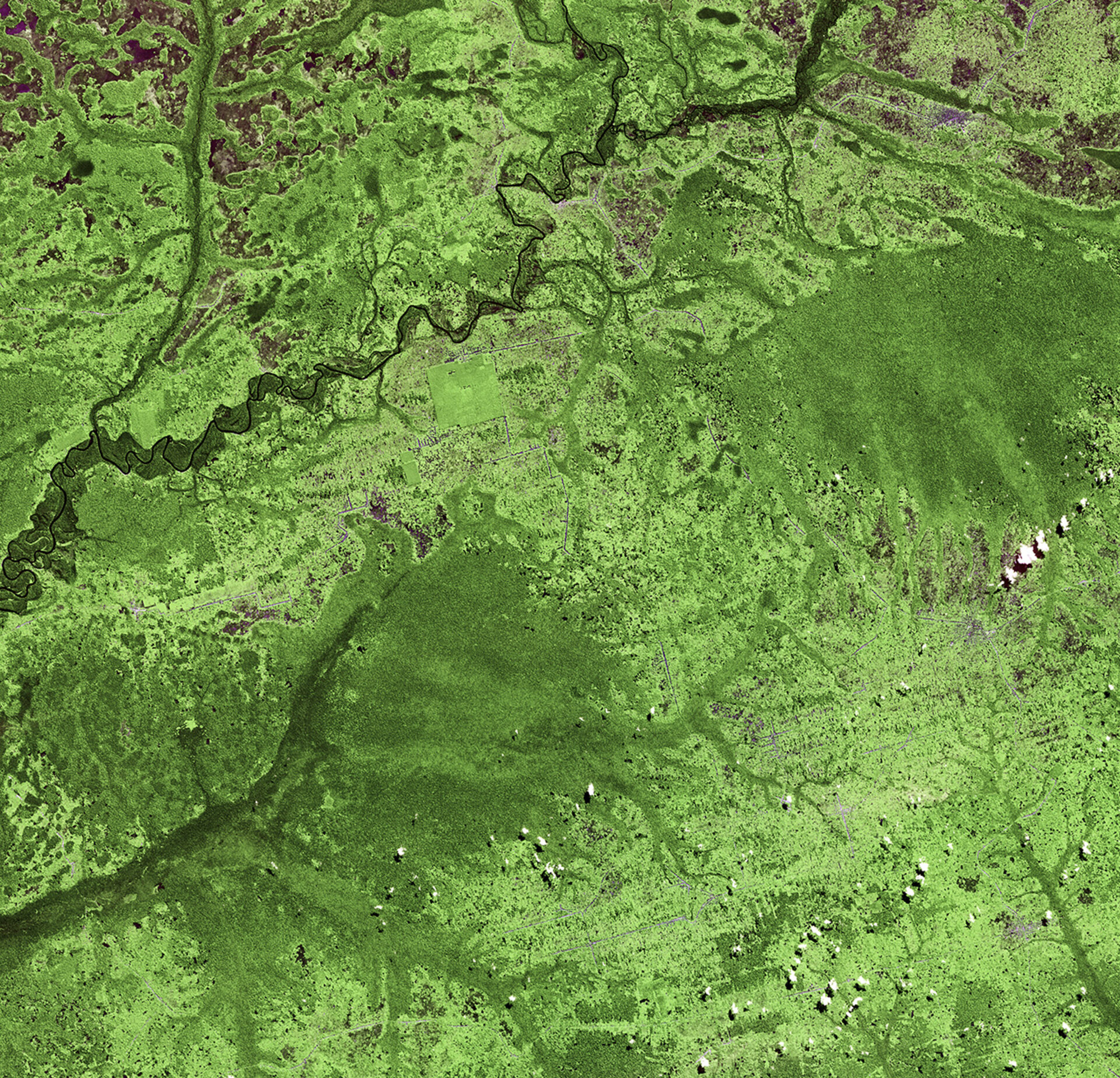
The DR Congo has the largest extent of tropical rainforest in Africa, but its precious ecosystem is constantly threatened by deforestation.
The main causes of deforestation in the country include the development of roads, the collection of firewood and charcoal, clear-cutting for agriculture and logging.
The area pictured is centred about three degrees north of the equator, in a province appropriately named Équateur for this reason.
Most of the lighter green areas are deforested, while the darker green are areas of dense – and possibly natural – vegetation.
The lines cutting through the image are roads, many with structures built along them. Clusters of purple dots are larger settlements.
A river snakes through the upper part of the image and below it there appears to be a square in light green. Judging by the precision of the outline, we can deduce that this is a patch of land that was either intentionally spared from deforestation or has been reforested.
With their unique view from space, observation satellites are instrumental in documenting the scale of deforestation, particularly in remote areas, and can assist authorities in forest management.
SPOT-4 acquired this image on 26 June 2011. The satellite is supported by ESA as a Third Party Mission, which means ESA utilises its multi-mission European ground infrastructure and expertise to acquire, process and distribute data from the satellite to its wide user community.
This image is featured on the Earth from Space video programme.


