
Earth from Space: New Caledonia
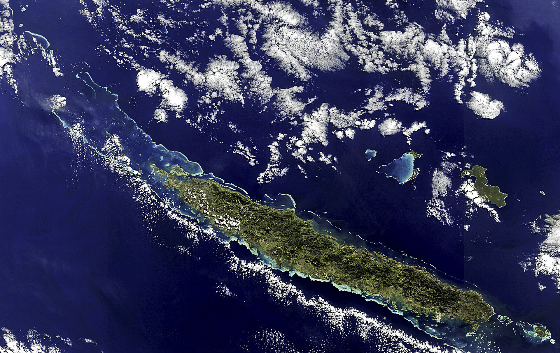
The New Caledonia archipelago, 1210 km east of Australia, is captured in this Envisat image.
Caledonia was the Roman name for today’s northern Scotland. When British explorer James Cook saw the archipelago’s main island in the 1770s, he named it ‘New Caledonia’ because of the similarities he noticed between the Scottish highlands and the island’s terrain.
The name was later applied to the surrounding islands as well.
Today, New Caledonia is a self-governing French territory, but an independence referendum is expected in the coming years.
The main island, Grande Terre, dominates the image, stretching 350 km long from northwest to southeast. A mountain range runs the length of the island – its highest point reaching over 1620 m – and divides the land’s lush east from the savannahs in the west.
A coral reef surrounds the main island and stretches into the Coral Sea to the northwest. The reef provides an important nesting site for green sea turtles and is home to endangered dugongs.
New Caledonia is a biodiversity hot spot, because the central mountain range provides a variety of niches, landforms and micro-climates.
The territory has about 25% of the world’s nickel resources. Although the recent global economic recession greatly affected this industry, the recovery of prices has brightened the future for New Caledonia’s economy.
This image was acquired by Envisat’s MERIS instrument on 5 July 2011 and it is featured on the Earth from Space video programme.

