
Earth from Space: New Zealand's wind tunnel
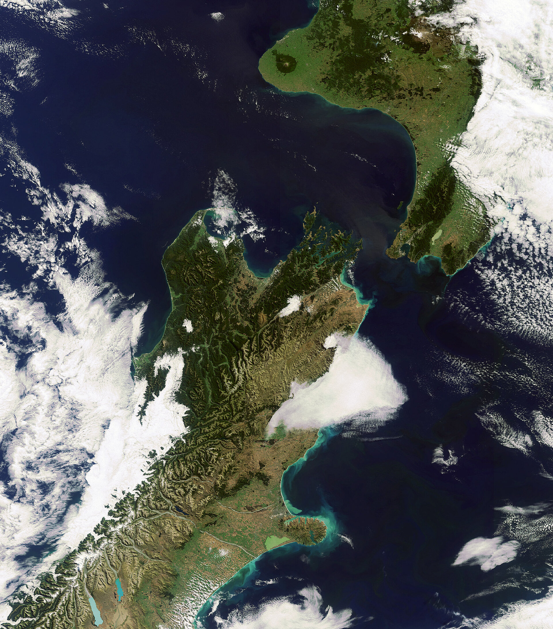
This Envisat image captures New Zealand's North and South Islands, separated by the Cook Strait. Named after James Cook, who in 1770 was the first European to sail through it, the Cook Strait connects the Tasman Sea to the west with the South Pacific Ocean to the east.
At its narrowest, it is just 23 km wide – so on a clear day it is possible to see across the strait. However, the Cook Strait is also renowned for being one of the roughest and most unpredictable stretches of water in the world.
As a result of New Zealand's latitude, the country lies in the path of the westerly wind belt known as the Roaring Forties. Since the strait is the only gap between the mountainous two islands, it acts as a huge wind tunnel, whipping up treacherous seas.
In addition, the tidal flow through Cook Strait is unusual. The tide is out of phase, which means when it is high tide on one side it is low on the other, resulting in strong currents in the middle.
New Zealand comprises many islands, though the North and South Islands are the largest landmasses. The image shows that the northerly part of the South Island is, in fact, further north that the south of the North Island. The South Island is the larger of these two landmasses and along its length gives rise to the Southern Alps, where the highest peak, Mount Cook, reaches 3754 metres. The North Island is less mountainous but more volcanic.
Notable for its geographic isolation in the southwest Pacific Ocean, New Zealand is home to many endemic plant and animal species, although the country has suffered a high rate of extinction due human activity. However, New Zealand is now a world-leader in island restoration programmes, reintroducing native species and establishing wildlife reserves on several smaller islands where pests such as rodents have been eradicated.
This image was acquired on 8 March 2010 by Envisat's Medium Resolution Imaging Spectrometer (MERIS) while working in Full Resolution Mode to provide a spatial resolution of 300 metres.

