
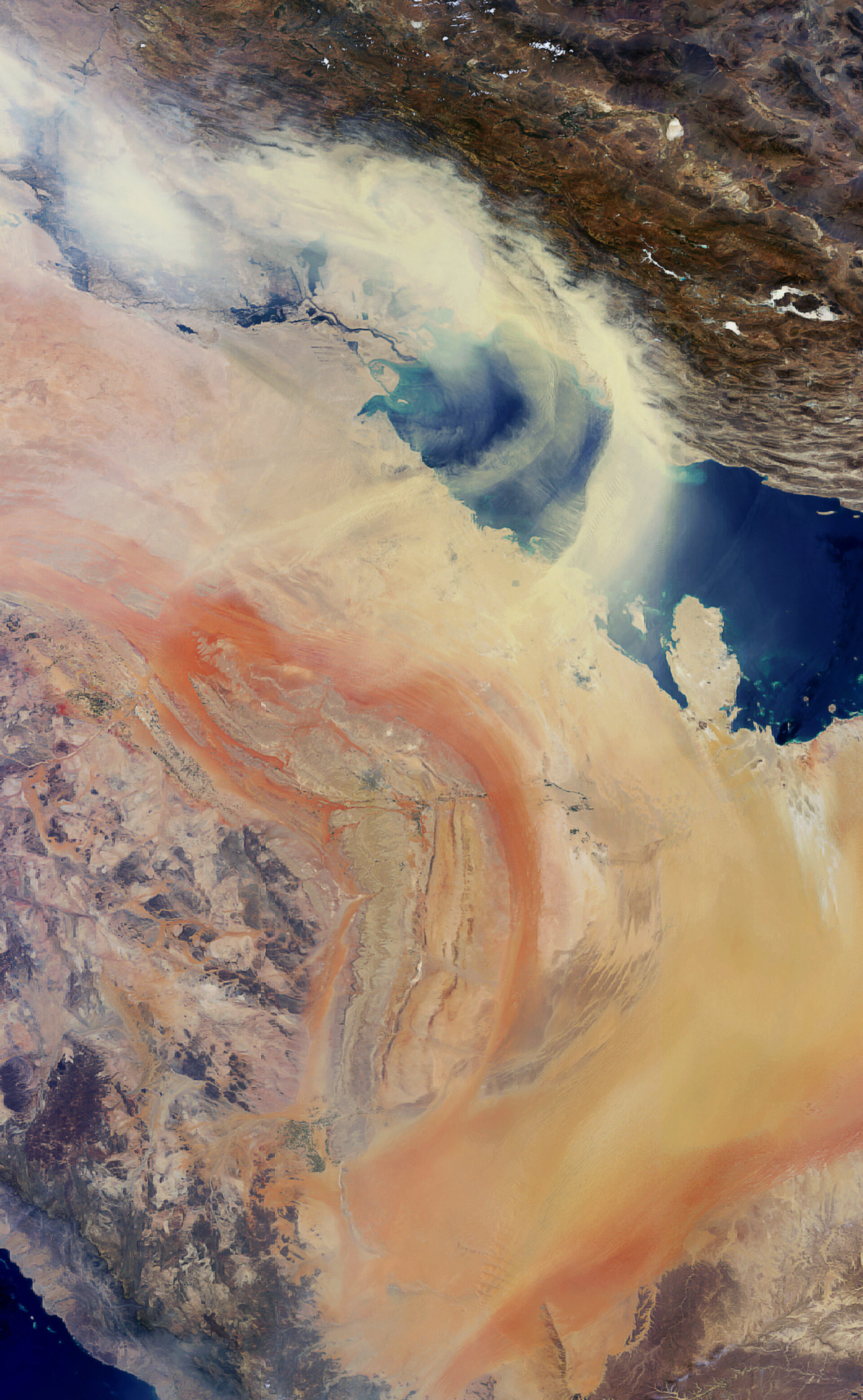
Earth from Space: Persian Gulf sandstorm
Envisat captures sand and dust blowing northeast from the Arabian Peninsula across the Persian Gulf toward Iran (visible at image top).
Some of the world's largest sandy desert areas, including the Rub’ al Khali and An-Nafud, are located in the Arabian Peninsula.
Sand and dust storms are usually the result of atmospheric convection currents, which form when warm, lighter air rises and cold, heavier air sinks.
Dust storms in northeastern Iraq, the Persian Gulf and the southern Arabian Peninsula are more frequent in summer because a strong northwesterly wind, called the shamal, blows over the floodplain of Iraq’s Tigris and Euphrates Rivers for up to three months, transporting the sand and dust.
In mid-June, a shamal caused a massive dust storm that stretched from Iraq to India to the Arabian Peninsula, where it hovered for days due to low wind speeds.
Other countries visible in the image include Iraq (where the Tigris and Euphrates Rivers merge at top left), Kuwait (top left of Persian Gulf), Saudi Arabia (bottom stretching along the peninsula) and Qatar (centre right, jutting out into the Persian Gulf).
This image was acquired on 1 July 2008 by Envisat’s Medium Resolution Imaging Spectrometer (MERIS) instrument while working in Full Resolution mode to provide a spatial resolution of 1.2 km.

