
Earth from Space: Ports of Barcelona
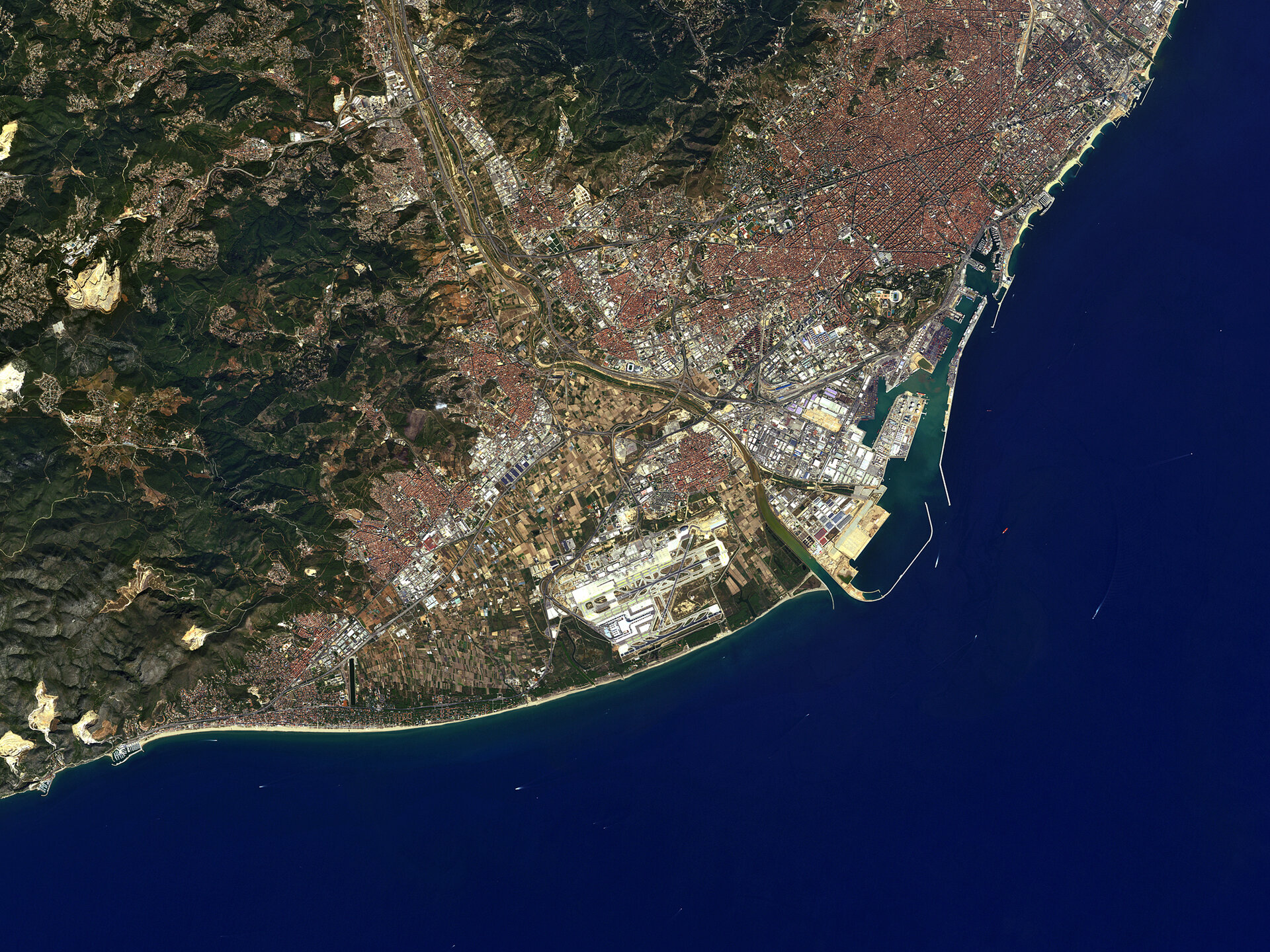
On the north east coast of the Iberian Peninsula, the Spanish city of Barcelona is pictured in this image from Japan’s ALOS satellite.
Near the top right corner, the circular Plaça de les Glòries Catalanes was meant to be the city centre in the original urban plan. The avenue, Avinguda Diagonal, cuts through this square and the city.
The Collserola mountain range rises above Barcelona to the north. Here, over 80 sq km of preserved parkland is home to varied wildlife such as wild boar, badger, rabbit, woodpeckers, rat-catching eagles, green tree frogs and turtles.
Dominating the left side of the image are the Garraf Massif mountains, their cliffs reaching the Mediterranean coast. Rock quarries and rubbish dumps are degrading the land here, and some of these degraded areas can be seen in the lower left corner as large yellow patches.
Along the coast, we can see the Barcelona’s port – one of Europe’s top ten largest container ports.
Barcelona-El Prat airport is about 10 km southwest of the city centre, across the Llobregat River. In 2012, the airport saw over 35 million passengers.
On either side of the airport we can see the darker areas of the Llobregat delta. The delta is a significant area for aquatic birds because it is on the birds’ migratory route from Northern Europe to Africa. As for flora, more than 22 different species of orchids have been found here.
ALOS captured this image on 13 September 2010 with its Advanced Visible and Near Infrared Radiometer, which is designed to chart land cover and vegetation in visible and near-infrared spectral bands, with a resolution of 10 m.
This image is featured on the Earth from Space video programme.

